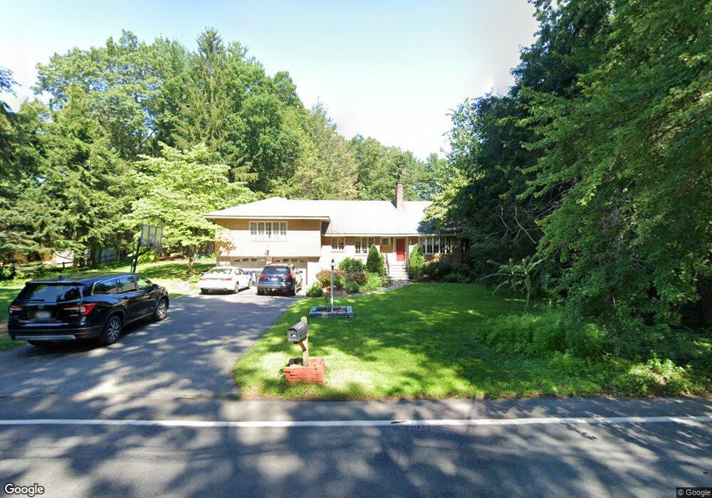
56 Park St Wilmington, MA 01887
Estimated Value: $742,000 - $882,000
3
Beds
2
Baths
1,821
Sq Ft
$454/Sq Ft
Est. Value
About This Home
This home is located at 56 Park St, Wilmington, MA 01887 and is currently estimated at $826,531, approximately $453 per square foot. 56 Park St is a home located in Middlesex County with nearby schools including Wilmington Middle School, Wilmington High School, and N Reading Knowledge Beginnings.
Ownership History
Date
Name
Owned For
Owner Type
Purchase Details
Closed on
Feb 6, 2001
Sold by
Radochia Paul A and Radochia Sandra R
Bought by
Callahan Brian and Callahan Jacqueline
Current Estimated Value
Purchase Details
Closed on
Jul 15, 1988
Sold by
Radochia Harold A
Bought by
Radochia Paula A
Create a Home Valuation Report for This Property
The Home Valuation Report is an in-depth analysis detailing your home's value as well as a comparison with similar homes in the area
Home Values in the Area
Average Home Value in this Area
Purchase History
| Date | Buyer | Sale Price | Title Company |
|---|---|---|---|
| Callahan Brian | $339,900 | -- | |
| Radochia Paula A | $220,000 | -- |
Source: Public Records
Mortgage History
| Date | Status | Borrower | Loan Amount |
|---|---|---|---|
| Open | Radochia Paula A | $203,000 | |
| Closed | Radochia Paula A | $268,000 |
Source: Public Records
Tax History Compared to Growth
Tax History
| Year | Tax Paid | Tax Assessment Tax Assessment Total Assessment is a certain percentage of the fair market value that is determined by local assessors to be the total taxable value of land and additions on the property. | Land | Improvement |
|---|---|---|---|---|
| 2025 | $8,806 | $769,100 | $324,900 | $444,200 |
| 2024 | $8,641 | $756,000 | $324,900 | $431,100 |
| 2023 | $8,028 | $672,400 | $295,500 | $376,900 |
| 2022 | $7,731 | $593,300 | $246,300 | $347,000 |
| 2021 | $7,979 | $576,500 | $224,100 | $352,400 |
| 2020 | $7,646 | $563,000 | $224,100 | $338,900 |
| 2019 | $6,927 | $503,800 | $213,300 | $290,500 |
| 2018 | $6,976 | $484,100 | $203,100 | $281,000 |
| 2017 | $6,660 | $460,900 | $203,100 | $257,800 |
| 2016 | $6,493 | $443,800 | $193,400 | $250,400 |
| 2015 | $6,001 | $417,600 | $193,400 | $224,200 |
| 2014 | $5,814 | $408,300 | $184,400 | $223,900 |
Source: Public Records
Map
Nearby Homes
- 3 Gordon Rd
- 12 Lockwood Rd
- 220 Martins Landing Unit 309
- 260 Martins Landing Unit 508
- 260 Martins Landing Unit 103
- 200 Martins Landing Unit 102
- 300 Martins Landing Unit 107
- 320 Martins Landing Unit 311
- 320 Martins Landing Unit 108
- 320 Martins Landing Unit 109
- 320 Martins Landing Unit 110
- 320 Martins Landing Unit 303
- 320 Martins Landing Unit 102
- 320 Martins Landing Unit 103
- 320 Martins Landing Unit 2410
- 320 Martins Landing Unit 403
- 320 Martins Landing Unit 107
- 320 Martins Landing Unit 210
- 320 Martins Landing Unit 2201
- 320 Martins Landing Unit 112