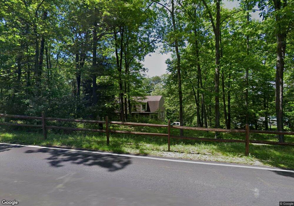
56 Possaghi Rd Newton, NJ 07860
Estimated Value: $435,000 - $487,000
--
Bed
--
Bath
1,344
Sq Ft
$344/Sq Ft
Est. Value
About This Home
This home is located at 56 Possaghi Rd, Newton, NJ 07860 and is currently estimated at $462,448, approximately $344 per square foot. 56 Possaghi Rd is a home located in Sussex County with nearby schools including Marian E. McKeown School and Kittatinny Regional High School.
Ownership History
Date
Name
Owned For
Owner Type
Purchase Details
Closed on
Oct 24, 2016
Sold by
Hendershot Deborah L
Bought by
Hendershot Deborah L
Current Estimated Value
Purchase Details
Closed on
Oct 21, 2016
Sold by
Leed Capital Llc
Bought by
Hendershot Deborah L
Purchase Details
Closed on
Jan 28, 1999
Sold by
Bova Alice
Bought by
Hendershot William and Hendershot Deborah
Home Financials for this Owner
Home Financials are based on the most recent Mortgage that was taken out on this home.
Original Mortgage
$124,000
Interest Rate
6.74%
Create a Home Valuation Report for This Property
The Home Valuation Report is an in-depth analysis detailing your home's value as well as a comparison with similar homes in the area
Home Values in the Area
Average Home Value in this Area
Purchase History
| Date | Buyer | Sale Price | Title Company |
|---|---|---|---|
| Hendershot Deborah L | -- | None Available | |
| Hendershot Deborah L | $12,000 | Multiple | |
| Hendershot William | $155,000 | -- |
Source: Public Records
Mortgage History
| Date | Status | Borrower | Loan Amount |
|---|---|---|---|
| Previous Owner | Hendershot William | $124,000 |
Source: Public Records
Tax History Compared to Growth
Tax History
| Year | Tax Paid | Tax Assessment Tax Assessment Total Assessment is a certain percentage of the fair market value that is determined by local assessors to be the total taxable value of land and additions on the property. | Land | Improvement |
|---|---|---|---|---|
| 2025 | $9,911 | $296,900 | $102,700 | $194,200 |
| 2024 | $9,385 | $296,900 | $102,700 | $194,200 |
| 2023 | $9,385 | $296,900 | $102,700 | $194,200 |
| 2022 | $9,156 | $296,900 | $102,700 | $194,200 |
| 2021 | $8,898 | $296,900 | $102,700 | $194,200 |
| 2020 | $8,865 | $296,900 | $102,700 | $194,200 |
| 2019 | $8,785 | $296,900 | $102,700 | $194,200 |
| 2018 | $8,616 | $296,900 | $102,700 | $194,200 |
| 2017 | $8,441 | $296,900 | $102,700 | $194,200 |
| 2016 | $7,590 | $275,000 | $80,800 | $194,200 |
| 2015 | $7,120 | $275,000 | $80,800 | $194,200 |
| 2014 | $7,037 | $275,000 | $80,800 | $194,200 |
Source: Public Records
Map
Nearby Homes
- 90 Kemah Mecca Lake Rd
- 31 Kent Rd
- 17 Eastbrook Ln
- 8 Possaghi Rd
- 21 Lake Rd
- 908 Willow Dr
- 903 Aspen Ct
- 000 Pepperidge Dr
- 921 Tulip Trail
- 4 Grove St
- 121 W Shore Dr
- 68 W Shore Dr
- 0 Mount Benevolence Rd
- 221 Fairview Ave
- 25 County Road 521
- 17 17 West Owassa Tnpk
- 86 County Road 521
- 1071 County Road 521
- 903 Twin Oaks Rd
- 40 Martin Ln