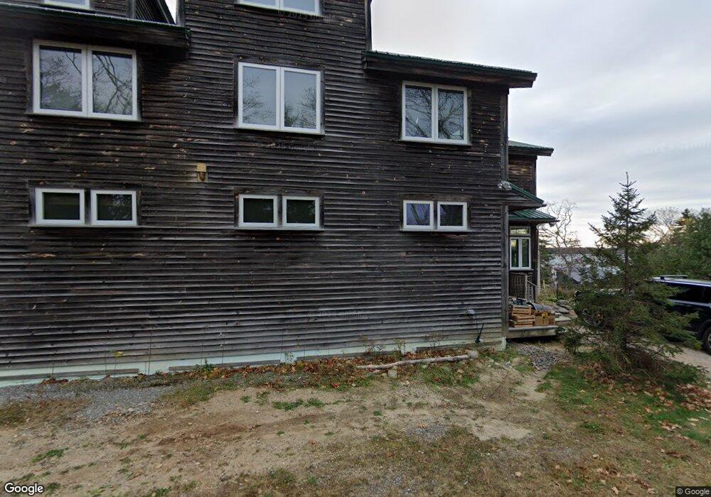
56 Pound View Rd Harpswell, ME 04079
Harpswell Neck NeighborhoodEstimated Value: $730,000 - $1,409,000
3
Beds
3
Baths
1,068
Sq Ft
$942/Sq Ft
Est. Value
About This Home
This home is located at 56 Pound View Rd, Harpswell, ME 04079 and is currently estimated at $1,006,180, approximately $942 per square foot. 56 Pound View Rd is a home with nearby schools including Mt Ararat High School.
Ownership History
Date
Name
Owned For
Owner Type
Purchase Details
Closed on
Nov 29, 2007
Sold by
Ciccarone Erik T and Ciccarone Rachel M
Bought by
Ciccarone Props Llc
Current Estimated Value
Home Financials for this Owner
Home Financials are based on the most recent Mortgage that was taken out on this home.
Original Mortgage
$417,000
Outstanding Balance
$264,520
Interest Rate
6.43%
Mortgage Type
Unknown
Estimated Equity
$741,660
Create a Home Valuation Report for This Property
The Home Valuation Report is an in-depth analysis detailing your home's value as well as a comparison with similar homes in the area
Home Values in the Area
Average Home Value in this Area
Purchase History
| Date | Buyer | Sale Price | Title Company |
|---|---|---|---|
| Ciccarone Props Llc | -- | -- |
Source: Public Records
Mortgage History
| Date | Status | Borrower | Loan Amount |
|---|---|---|---|
| Open | Ciccarone Props Llc | $417,000 | |
| Closed | Ciccarone Props Llc | $150,000 |
Source: Public Records
Tax History
| Year | Tax Paid | Tax Assessment Tax Assessment Total Assessment is a certain percentage of the fair market value that is determined by local assessors to be the total taxable value of land and additions on the property. | Land | Improvement |
|---|---|---|---|---|
| 2024 | $3,875 | $609,200 | $463,800 | $145,400 |
| 2023 | $3,716 | $609,200 | $463,800 | $145,400 |
| 2022 | $3,594 | $609,200 | $463,800 | $145,400 |
| 2021 | $3,597 | $532,100 | $388,600 | $143,500 |
| 2020 | $3,586 | $532,100 | $388,600 | $143,500 |
| 2019 | $3,565 | $532,100 | $388,600 | $143,500 |
| 2018 | $3,448 | $532,100 | $388,600 | $143,500 |
| 2017 | $3,437 | $532,100 | $388,600 | $143,500 |
| 2016 | $3,405 | $532,100 | $388,600 | $143,500 |
| 2015 | $3,320 | $532,100 | $388,600 | $143,500 |
| 2013 | $3,076 | $532,100 | $388,600 | $143,500 |
Source: Public Records
Map
Nearby Homes
- 1 Mallard Pond Rd
- Lot 2A Allen Point Rd
- Lot 2B Allen Point Rd
- 21 Spring Hill Rd
- 0 Bayview Rd Unit 2 1632776
- 1450 Harpswell Neck Rd
- 87 Lowells Cove Rd
- 10 Irene Ave
- lot C Long Point Rd
- 30 Driftwood Tide Ln
- 83 Central Ave
- 46 Blackstone Club Rd
- Map 80 Lot 18-0 White Island
- 58 Maquoit Dr
- 270 Harpswell Neck Rd
- 205 W Cundys Point
- 242 Long Reach Ln
- 5 Arrowhead Ridge Rd
- 0 Gundalo Gap Rd Unit 1638108
- 34 Newfield Rd