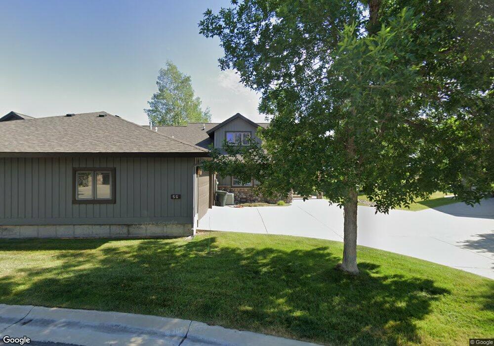
56 River Rock Rd Sheridan, WY 82801
Estimated Value: $382,000 - $641,000
--
Bed
3
Baths
2,274
Sq Ft
$246/Sq Ft
Est. Value
About This Home
This home is located at 56 River Rock Rd, Sheridan, WY 82801 and is currently estimated at $559,085, approximately $245 per square foot. 56 River Rock Rd is a home.
Ownership History
Date
Name
Owned For
Owner Type
Purchase Details
Closed on
Jan 22, 2007
Sold by
Robinson Warren L and Robinson Joan C
Bought by
Latini David Joseph
Current Estimated Value
Purchase Details
Closed on
Nov 21, 2005
Sold by
Bison Corp
Bought by
Robinson Warren L and Robinson Joan C
Home Financials for this Owner
Home Financials are based on the most recent Mortgage that was taken out on this home.
Original Mortgage
$300,000
Interest Rate
6.12%
Mortgage Type
New Conventional
Create a Home Valuation Report for This Property
The Home Valuation Report is an in-depth analysis detailing your home's value as well as a comparison with similar homes in the area
Home Values in the Area
Average Home Value in this Area
Purchase History
| Date | Buyer | Sale Price | Title Company |
|---|---|---|---|
| Latini David Joseph | -- | None Available | |
| Robinson Warren L | -- | None Available |
Source: Public Records
Mortgage History
| Date | Status | Borrower | Loan Amount |
|---|---|---|---|
| Previous Owner | Robinson Warren L | $300,000 |
Source: Public Records
Tax History Compared to Growth
Tax History
| Year | Tax Paid | Tax Assessment Tax Assessment Total Assessment is a certain percentage of the fair market value that is determined by local assessors to be the total taxable value of land and additions on the property. | Land | Improvement |
|---|---|---|---|---|
| 2025 | $3,293 | $37,004 | $7,268 | $29,736 |
| 2024 | $3,293 | $48,784 | $9,500 | $39,284 |
| 2023 | $3,134 | $46,436 | $8,550 | $37,886 |
| 2022 | $2,594 | $38,435 | $6,840 | $31,595 |
| 2021 | $2,243 | $33,227 | $6,650 | $26,577 |
| 2020 | $2,226 | $32,983 | $6,650 | $26,333 |
| 2019 | $2,110 | $31,266 | $6,318 | $24,948 |
| 2018 | $2,057 | $30,472 | $6,175 | $24,297 |
| 2017 | $1,999 | $28,977 | $4,750 | $24,227 |
| 2015 | $1,980 | $28,447 | $4,750 | $23,697 |
| 2014 | $2,053 | $29,496 | $4,275 | $25,221 |
| 2013 | -- | $28,056 | $3,800 | $24,256 |
Source: Public Records
Map
Nearby Homes
- 8 Buckskin Dr
- 21 Wishbone Way
- Tbd Wagon Wheel Court Lot F11
- Tbd Wagon Wheel Ct Lot F10 & F11
- TBD Wagon Wheel Ct Unit F10
- TBD Wagon Wheel Ct Unit F11
- TBD Wagon Wheel Ct Unit Lot 1
- TBD Wagon Wheel Ct Unit Lot 2
- 3 Thunderbird Dr
- 5 Oakmont Ct
- 1 Deer Haven Dr
- 21 Eagle Ridge Dr
- TBD Powder Horn Rd
- TBD Powder Horn Rd Unit MNR 24 Lot 1
- 91 Wyoming 335
- TBD Eagle Ridge Dr Unit H-7
- 96 Canvasback Rd
- 70 Cantle Ct
- 90 Cantle Ct
- 106 Cayuse Ct
- 58 River Rock Rd
- 54 River Rock Rd
- 52 River Rock Rd
- 59 River Rock Rd
- 62 River Rock Rd
- 50 River Rock Rd
- TBD Green Meadows Dr Unit Lot A11
- TBD Green Meadows Dr Unit A-4
- TBD Green Meadows Dr Unit B-4
- 45 River Rock Rd
- 48 River Rock Rd
- 20 Green Meadows Dr
- 66 River Rock Rd
- 65 River Rock Rd
- 0 Green Meadows Dr Unit Block A Lot 9
- 0 Green Meadows Dr Unit Lot 2 17-551
- 0 Green Meadows Dr
- 18 Green Meadows Dr
- 68 River Rock Rd
- 37 River Rock Rd