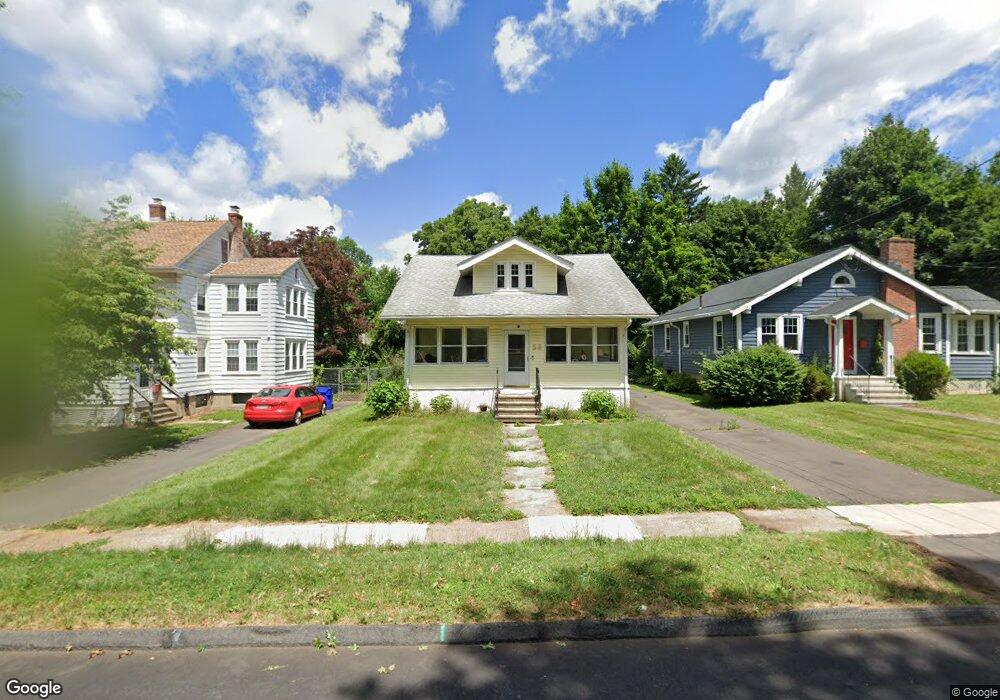
56 Robbins Dr Wethersfield, CT 06109
Estimated Value: $330,751 - $367,000
5
Beds
1
Bath
1,346
Sq Ft
$261/Sq Ft
Est. Value
About This Home
This home is located at 56 Robbins Dr, Wethersfield, CT 06109 and is currently estimated at $351,188, approximately $260 per square foot. 56 Robbins Dr is a home located in Hartford County with nearby schools including Charles Wright School, Silas Deane Middle School, and Wethersfield High School.
Create a Home Valuation Report for This Property
The Home Valuation Report is an in-depth analysis detailing your home's value as well as a comparison with similar homes in the area
Home Values in the Area
Average Home Value in this Area
Tax History
| Year | Tax Paid | Tax Assessment Tax Assessment Total Assessment is a certain percentage of the fair market value that is determined by local assessors to be the total taxable value of land and additions on the property. | Land | Improvement |
|---|---|---|---|---|
| 2025 | $7,584 | $183,990 | $91,920 | $92,070 |
| 2024 | $5,804 | $134,290 | $64,440 | $69,850 |
| 2023 | $5,611 | $134,290 | $64,440 | $69,850 |
| 2022 | $5,517 | $134,290 | $64,440 | $69,850 |
| 2021 | $5,462 | $134,290 | $64,440 | $69,850 |
| 2020 | $5,464 | $134,290 | $64,440 | $69,850 |
| 2019 | $5,471 | $134,290 | $64,440 | $69,850 |
| 2018 | $5,599 | $137,300 | $62,900 | $74,400 |
| 2017 | $5,460 | $137,300 | $62,900 | $74,400 |
| 2016 | $5,292 | $137,300 | $62,900 | $74,400 |
| 2015 | $5,243 | $137,300 | $62,900 | $74,400 |
| 2014 | $5,044 | $137,300 | $62,900 | $74,400 |
Source: Public Records
Map
Nearby Homes
- 192 Wolcott Hill Rd
- 18 Avalon Place
- 87 Somerset St
- 1 Fernwood St
- 91 Somerset St
- 317 Garden St Unit 319
- 116 Wells Farm Dr
- 1 Bristol St
- 19 Albert Ave
- 48 Ridge Crest Cir
- 90 Goodwin Park Rd
- 35 Stillwold Dr
- 249 Ridge Rd
- 295 Ridge Rd Unit 8
- 704 Franklin Ave
- 108 Chamberlain Rd
- 1310 Berlin Turnpike Unit 223
- 137 Dale Rd
- 28 Bolton St
- 493 Main St
Your Personal Tour Guide
Ask me questions while you tour the home.