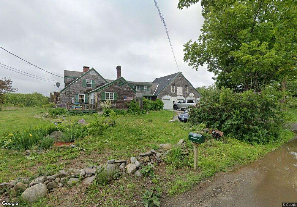
56 Stephenson Ln Belfast, ME 04915
Estimated Value: $394,000 - $1,004,000
4
Beds
3
Baths
3,334
Sq Ft
$190/Sq Ft
Est. Value
About This Home
This home is located at 56 Stephenson Ln, Belfast, ME 04915 and is currently estimated at $635,085, approximately $190 per square foot. 56 Stephenson Ln is a home located in Waldo County with nearby schools including Cornerspring Children's House and The School At Sweetser - Belfast.
Ownership History
Date
Name
Owned For
Owner Type
Purchase Details
Closed on
Oct 23, 2025
Sold by
Dellamattera Julie N
Bought by
House Yvonne B and House Arthur T
Current Estimated Value
Purchase Details
Closed on
Oct 28, 2023
Sold by
House Yvonne
Bought by
House Yvonne
Purchase Details
Closed on
Feb 16, 2005
Sold by
Mullen Brenda L and Mullen John P
Bought by
Dellamattera Lawrence K and Dellamattara Julie N
Home Financials for this Owner
Home Financials are based on the most recent Mortgage that was taken out on this home.
Original Mortgage
$300,000
Interest Rate
5%
Mortgage Type
Stand Alone Second
Create a Home Valuation Report for This Property
The Home Valuation Report is an in-depth analysis detailing your home's value as well as a comparison with similar homes in the area
Home Values in the Area
Average Home Value in this Area
Purchase History
| Date | Buyer | Sale Price | Title Company |
|---|---|---|---|
| House Yvonne B | $355,000 | -- | |
| House Yvonne | -- | None Available | |
| Dellamattera Lawrence K | -- | -- | |
| Dellamattera Lawrence K | -- | -- |
Source: Public Records
Mortgage History
| Date | Status | Borrower | Loan Amount |
|---|---|---|---|
| Previous Owner | Dellamattera Lawrence K | $300,000 |
Source: Public Records
Tax History Compared to Growth
Tax History
| Year | Tax Paid | Tax Assessment Tax Assessment Total Assessment is a certain percentage of the fair market value that is determined by local assessors to be the total taxable value of land and additions on the property. | Land | Improvement |
|---|---|---|---|---|
| 2024 | $6,123 | $397,600 | $84,200 | $313,400 |
| 2023 | $5,936 | $295,300 | $53,200 | $242,100 |
| 2022 | $6,142 | $287,000 | $53,200 | $233,800 |
| 2021 | $6,314 | $287,000 | $53,200 | $233,800 |
| 2020 | $6,918 | $296,900 | $49,600 | $247,300 |
| 2019 | $6,717 | $293,300 | $49,600 | $243,700 |
| 2018 | $6,658 | $293,300 | $49,600 | $243,700 |
| 2017 | $6,423 | $293,300 | $49,600 | $243,700 |
| 2016 | $6,586 | $287,600 | $48,200 | $239,400 |
| 2015 | $6,442 | $287,600 | $48,200 | $239,400 |
| 2014 | $6,227 | $287,600 | $48,200 | $239,400 |
| 2013 | $5,982 | $287,600 | $48,200 | $239,400 |
Source: Public Records
Map
Nearby Homes
- 15 Evergreen Ridge Rd
- 0 Stephenson Ln Unit 833368
- 0 Stephenson Ln Unit 318002
- 0 Stephenson Ln Unit 262706
- 0 Stephenson Ln Unit 1147164
- 0 Stephenson Ln Unit 1535381
- Lot35 Stephenson
- Lot 35 Stephenson Ln
- 26 Old Searsport Ave
- 00 Stephenson Ln
- 30 Old Searsport Ave
- 38 Old Searsport Ave
- 18 Old Searsport Ave
- 23 Old Searsport Ave
- 94 Searsport Ave
- 42 Old Searsport Ave
- 96 Searsport Ave
- 100 Searsport Ave
- 48 Old Searsport Ave