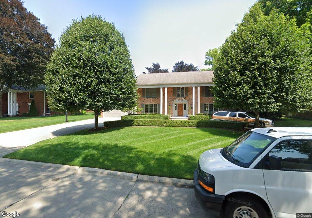
56 Stonehurst Rd Grosse Pointe Shores, MI 48236
Estimated Value: $938,423 - $1,131,000
--
Bed
2
Baths
4,556
Sq Ft
$226/Sq Ft
Est. Value
About This Home
This home is located at 56 Stonehurst Rd, Grosse Pointe Shores, MI 48236 and is currently estimated at $1,029,606, approximately $225 per square foot. 56 Stonehurst Rd is a home with nearby schools including John Monteith Elementary School, Parcells Middle School, and Grosse Pointe North High School.
Ownership History
Date
Name
Owned For
Owner Type
Purchase Details
Closed on
Jul 24, 2003
Sold by
Bracken Patrick B and Bracken Patricia A
Bought by
Lesha Steven A
Current Estimated Value
Purchase Details
Closed on
Nov 10, 1994
Sold by
Ryan Delbert L
Bought by
Patrick B Bracken and Conlan Patricia A
Home Financials for this Owner
Home Financials are based on the most recent Mortgage that was taken out on this home.
Original Mortgage
$100,000
Interest Rate
8.91%
Mortgage Type
New Conventional
Create a Home Valuation Report for This Property
The Home Valuation Report is an in-depth analysis detailing your home's value as well as a comparison with similar homes in the area
Home Values in the Area
Average Home Value in this Area
Purchase History
| Date | Buyer | Sale Price | Title Company |
|---|---|---|---|
| Lesha Steven A | -- | Lawyers Title Insurance Co | |
| Patrick B Bracken | -- | -- |
Source: Public Records
Mortgage History
| Date | Status | Borrower | Loan Amount |
|---|---|---|---|
| Previous Owner | Patrick B Bracken | $100,000 |
Source: Public Records
Tax History Compared to Growth
Tax History
| Year | Tax Paid | Tax Assessment Tax Assessment Total Assessment is a certain percentage of the fair market value that is determined by local assessors to be the total taxable value of land and additions on the property. | Land | Improvement |
|---|---|---|---|---|
| 2025 | $12,680 | $486,600 | $0 | $0 |
| 2024 | $12,680 | $463,800 | $0 | $0 |
| 2023 | $12,680 | $411,300 | $0 | $0 |
| 2022 | $12,680 | $399,800 | $0 | $0 |
| 2021 | $12,680 | $387,600 | $0 | $0 |
| 2019 | $12,909 | $329,700 | $0 | $0 |
| 2018 | $8,202 | $303,300 | $0 | $0 |
| 2017 | $8,351 | $293,300 | $0 | $0 |
| 2016 | $12,411 | $260,700 | $0 | $0 |
| 2015 | $22,575 | $240,300 | $0 | $0 |
| 2013 | $21,870 | $218,720 | $0 | $0 |
| 2011 | -- | $248,550 | $0 | $0 |
Source: Public Records
Map
Nearby Homes
- 535 Ballantyne Rd
- 745- 749 Lake Shore Rd
- 59 Fordcroft St
- 720 Fairford Rd
- 475 Lake Shore Rd
- 565 Lochmoor Blvd
- 587 Lochmoor Blvd
- 11 Windemere Place Unit 29
- 809 Fairford Rd
- 499 Sunningdale Dr
- 54 Belle Meade St
- 622 Sunningdale Dr
- 528 Hidden Ln
- 745 Lake Shore Rd
- 749 Lake Shore Rd
- 963 Lochmoor Blvd
- 81 Moross Rd
- 340 Kercheval Ave
- 65 Vernier Rd
- 343 Beaupre Ave
- 60 Stonehurst Rd
- 50 Stonehurst Rd
- 55 Fairford Rd
- 59 Stonehurst Rd
- 51 Fairford Rd
- 53 Stonehurst Rd
- 61 Fairford Rd
- 65 Stonehurst Rd
- 66 Stonehurst Rd
- 46 Stonehurst Rd
- 43 Fairford Rd
- 47 Stonehurst Rd
- 65 Fairford Rd
- 71 Stonehurst Rd
- 74 Stonehurst Rd
- 68 N Deeplands Rd
- 41 Stonehurst Rd
- 60 N Deeplands Rd
- 52 Fairford Rd
- 40 Stonehurst Rd