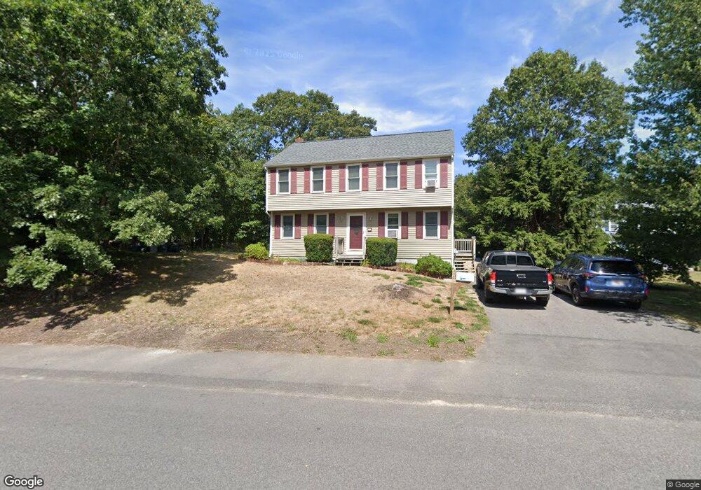
56 Taft Rd Weymouth, MA 02188
Weymouth Landing NeighborhoodEstimated Value: $728,000 - $779,096
4
Beds
2
Baths
1,700
Sq Ft
$447/Sq Ft
Est. Value
About This Home
This home is located at 56 Taft Rd, Weymouth, MA 02188 and is currently estimated at $759,524, approximately $446 per square foot. 56 Taft Rd is a home located in Norfolk County with nearby schools including Abigail Adams Middle School, Academy Avenue Elementary School, and Weymouth Middle School Chapman.
Create a Home Valuation Report for This Property
The Home Valuation Report is an in-depth analysis detailing your home's value as well as a comparison with similar homes in the area
Home Values in the Area
Average Home Value in this Area
Tax History Compared to Growth
Tax History
| Year | Tax Paid | Tax Assessment Tax Assessment Total Assessment is a certain percentage of the fair market value that is determined by local assessors to be the total taxable value of land and additions on the property. | Land | Improvement |
|---|---|---|---|---|
| 2025 | $7,170 | $709,900 | $268,700 | $441,200 |
| 2024 | $6,945 | $676,200 | $255,900 | $420,300 |
| 2023 | $6,562 | $627,900 | $237,000 | $390,900 |
| 2022 | $6,434 | $561,400 | $219,400 | $342,000 |
| 2021 | $5,909 | $503,300 | $219,400 | $283,900 |
| 2020 | $5,627 | $472,100 | $219,400 | $252,700 |
| 2019 | $5,529 | $456,200 | $211,000 | $245,200 |
| 2018 | $5,458 | $436,600 | $209,300 | $227,300 |
| 2017 | $5,330 | $416,100 | $199,400 | $216,700 |
| 2016 | $5,080 | $396,900 | $191,700 | $205,200 |
| 2015 | $4,883 | $378,500 | $191,700 | $186,800 |
| 2014 | $4,678 | $351,700 | $178,400 | $173,300 |
Source: Public Records
Map
Nearby Homes
- 93 Wilson Ave
- 4 Sutton St
- 38 Idlewell St
- 669 Commercial St
- 114 Gilbert Rd
- 20 Richards Rd
- 70 Biscayne Ave
- 727 Commercial St
- 286 Broad St
- 35 Seminole Ave
- 294 Commercial St
- 29-31 Broad Street Place
- 28 Webb St
- 50 Center St
- 9 Vine St Unit 1
- 19 Vine St Unit 3
- 114 Broad St Unit D
- 114 Broad St Unit C
- 33 Argyle Rd
- 51 Beals St Unit 53