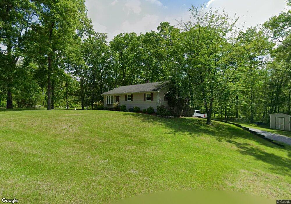
56 W Owassa Turnpike Newton, NJ 07860
Estimated Value: $329,030 - $376,000
--
Bed
--
Bath
1,092
Sq Ft
$319/Sq Ft
Est. Value
About This Home
This home is located at 56 W Owassa Turnpike, Newton, NJ 07860 and is currently estimated at $348,008, approximately $318 per square foot. 56 W Owassa Turnpike is a home located in Sussex County with nearby schools including Frankford Township School and High Point Regional High School.
Ownership History
Date
Name
Owned For
Owner Type
Purchase Details
Closed on
Sep 20, 2023
Sold by
Zawislak Scott A
Bought by
Zawislak Living Trust and Zawislak
Current Estimated Value
Purchase Details
Closed on
Sep 10, 1999
Sold by
Meyer Susan
Bought by
Zawislak Scott
Purchase Details
Closed on
Aug 23, 1994
Sold by
Logsdon Ernest L and Logsdon Christine L
Bought by
Zawislak Scott and Meyer Susan
Create a Home Valuation Report for This Property
The Home Valuation Report is an in-depth analysis detailing your home's value as well as a comparison with similar homes in the area
Home Values in the Area
Average Home Value in this Area
Purchase History
| Date | Buyer | Sale Price | Title Company |
|---|---|---|---|
| Zawislak Living Trust | -- | None Listed On Document | |
| Zawislak Living Trust | -- | None Listed On Document | |
| Zawislak Scott | -- | -- | |
| Zawislak Scott | $138,900 | -- |
Source: Public Records
Tax History Compared to Growth
Tax History
| Year | Tax Paid | Tax Assessment Tax Assessment Total Assessment is a certain percentage of the fair market value that is determined by local assessors to be the total taxable value of land and additions on the property. | Land | Improvement |
|---|---|---|---|---|
| 2025 | $4,628 | $155,600 | $76,700 | $78,900 |
| 2024 | $4,489 | $155,600 | $76,700 | $78,900 |
| 2023 | $4,489 | $155,600 | $76,700 | $78,900 |
| 2022 | $4,380 | $155,600 | $76,700 | $78,900 |
| 2021 | $4,248 | $155,600 | $76,700 | $78,900 |
| 2020 | $4,127 | $155,600 | $76,700 | $78,900 |
| 2019 | $4,010 | $155,600 | $76,700 | $78,900 |
| 2018 | $3,972 | $155,600 | $76,700 | $78,900 |
| 2017 | $3,958 | $155,600 | $76,700 | $78,900 |
| 2016 | $4,008 | $155,600 | $76,700 | $78,900 |
| 2015 | $3,988 | $155,600 | $76,700 | $78,900 |
| 2014 | $4,080 | $155,600 | $76,700 | $78,900 |
Source: Public Records
Map
Nearby Homes
- 17 17 West Owassa Tnpk
- 40 Martin Ln
- 196 W Owassa Turnpike
- 121 W Shore Dr
- 1 South Trail
- 68 W Shore Dr
- 26 Mill Ln
- 57 E Shore Trail
- 25 E Shore Lake Owassa Rd
- 17 Eastbrook Ln
- 95 Woods Rd
- 19 E Shore Lake Owassa Rd
- 9 Maple Ln
- 10 Glenbrook Dr
- 90 Kemah Mecca Lake Rd
- 000 Pepperidge Dr
- 39 Stehr St
- 903 Aspen Ct
- 4 Woodlawn Ave
- 6 Woodlawn Ave