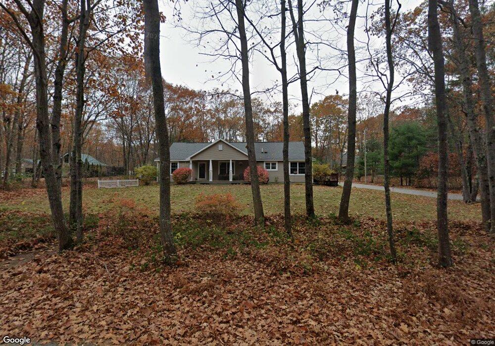
56 Warrens Way Kennebunk, ME 04043
Estimated Value: $547,000 - $622,000
3
Beds
2
Baths
1,736
Sq Ft
$335/Sq Ft
Est. Value
About This Home
This home is located at 56 Warrens Way, Kennebunk, ME 04043 and is currently estimated at $582,068, approximately $335 per square foot. 56 Warrens Way is a home located in York County with nearby schools including Kennebunk High School and The New School.
Ownership History
Date
Name
Owned For
Owner Type
Purchase Details
Closed on
Apr 30, 2020
Sold by
Kinney Susan S
Bought by
Kinney John F
Current Estimated Value
Purchase Details
Closed on
May 13, 2015
Sold by
Woody Creek Rt
Bought by
Potvin 2Nd Richard P
Purchase Details
Closed on
Apr 27, 2015
Sold by
Kinney Susan S and Kinney John F
Bought by
Woody Creek Rt
Purchase Details
Closed on
Sep 24, 2007
Sold by
Estabrooks Alice and Estabrooks Gordon C
Bought by
Woody Creek Rt
Home Financials for this Owner
Home Financials are based on the most recent Mortgage that was taken out on this home.
Original Mortgage
$167,500
Interest Rate
6.63%
Mortgage Type
Purchase Money Mortgage
Create a Home Valuation Report for This Property
The Home Valuation Report is an in-depth analysis detailing your home's value as well as a comparison with similar homes in the area
Home Values in the Area
Average Home Value in this Area
Purchase History
| Date | Buyer | Sale Price | Title Company |
|---|---|---|---|
| Kinney John F | -- | None Available | |
| Potvin 2Nd Richard P | -- | -- | |
| Woody Creek Rt | -- | -- | |
| Mccullough David A | -- | -- | |
| Woody Creek Rt | -- | -- |
Source: Public Records
Mortgage History
| Date | Status | Borrower | Loan Amount |
|---|---|---|---|
| Previous Owner | Woody Creek Rt | $228,000 | |
| Previous Owner | Woody Creek Rt | $167,500 |
Source: Public Records
Tax History Compared to Growth
Tax History
| Year | Tax Paid | Tax Assessment Tax Assessment Total Assessment is a certain percentage of the fair market value that is determined by local assessors to be the total taxable value of land and additions on the property. | Land | Improvement |
|---|---|---|---|---|
| 2024 | $4,724 | $278,700 | $55,200 | $223,500 |
| 2023 | $4,473 | $278,700 | $55,200 | $223,500 |
| 2022 | $4,069 | $278,700 | $55,200 | $223,500 |
| 2021 | $3,971 | $278,700 | $55,200 | $223,500 |
| 2020 | $3,590 | $278,700 | $55,200 | $223,500 |
| 2019 | $3,832 | $278,700 | $55,200 | $223,500 |
| 2018 | $3,658 | $209,000 | $41,400 | $167,600 |
| 2017 | $3,459 | $209,000 | $41,400 | $167,600 |
| 2016 | $3,323 | $209,000 | $41,400 | $167,600 |
| 2015 | $3,360 | $229,100 | $61,500 | $167,600 |
| 2014 | $3,272 | $229,100 | $61,500 | $167,600 |
Source: Public Records
Map
Nearby Homes
- 0 Potvin Rd
- 141 Thompson Rd
- lot #3 Salvato Ln
- 9 Patterson Dr
- 30 Twine Mill Rd
- 4 Millstone Ln
- 24-4,25-10 Chapman Ln
- 19 Old Alewive Rd
- 4 Furbish Ln
- 23 Cascade Cir Unit 22
- 3 Nichols Ln
- 274 Alfred Rd
- 276 Alfred Rd
- 056 Cat Mousam Rd
- 23 Lilac Ln
- 12 Chipmunk Trail
- 5 Meander Ln Unit 2
- 284 Alfred Rd Unit Lot F13
- 6 Dunnhill Dr Unit 28
- 29 Bentley Place Unit 50