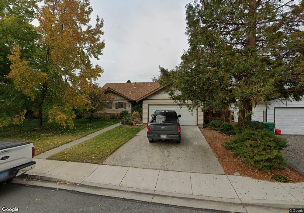
560 Emerson Way Sparks, NV 89431
McCarran Boulevard-Probasco NeighborhoodEstimated Value: $476,709 - $511,000
5
Beds
3
Baths
2,118
Sq Ft
$233/Sq Ft
Est. Value
About This Home
This home is located at 560 Emerson Way, Sparks, NV 89431 and is currently estimated at $493,427, approximately $232 per square foot. 560 Emerson Way is a home located in Washoe County with nearby schools including Lena Juniper Elementary School, Lou Mendive Middle School, and Edward C Reed High School.
Ownership History
Date
Name
Owned For
Owner Type
Purchase Details
Closed on
Jan 19, 2022
Sold by
Myers Lawrence W and Myers Kathleen M
Bought by
Myers Family Revocable Living Trust
Current Estimated Value
Purchase Details
Closed on
Oct 18, 2006
Sold by
Mcpherson Colleen
Bought by
Myers Lawrence W and Myers Kathleen M
Home Financials for this Owner
Home Financials are based on the most recent Mortgage that was taken out on this home.
Original Mortgage
$196,910
Interest Rate
6.46%
Mortgage Type
FHA
Purchase Details
Closed on
Jan 3, 2000
Sold by
Myers Maynard R and Myers Esther
Bought by
Myers Maynard R and Myers Living Trust
Create a Home Valuation Report for This Property
The Home Valuation Report is an in-depth analysis detailing your home's value as well as a comparison with similar homes in the area
Home Values in the Area
Average Home Value in this Area
Purchase History
| Date | Buyer | Sale Price | Title Company |
|---|---|---|---|
| Myers Family Revocable Living Trust | -- | None Listed On Document | |
| Myers Lawrence W | $200,000 | Stewart Title Of Northern Nv | |
| Myers Maynard R | -- | -- |
Source: Public Records
Mortgage History
| Date | Status | Borrower | Loan Amount |
|---|---|---|---|
| Previous Owner | Myers Lawrence W | $196,910 |
Source: Public Records
Tax History Compared to Growth
Tax History
| Year | Tax Paid | Tax Assessment Tax Assessment Total Assessment is a certain percentage of the fair market value that is determined by local assessors to be the total taxable value of land and additions on the property. | Land | Improvement |
|---|---|---|---|---|
| 2025 | $1,082 | $64,971 | $36,715 | $28,256 |
| 2024 | $1,082 | $62,584 | $34,755 | $27,829 |
| 2023 | $1,052 | $60,726 | $34,930 | $25,796 |
| 2022 | $1,022 | $49,425 | $28,455 | $20,970 |
| 2021 | $992 | $40,135 | $19,635 | $20,500 |
| 2020 | $961 | $37,966 | $17,850 | $20,116 |
| 2019 | $933 | $37,692 | $18,725 | $18,967 |
| 2018 | $907 | $31,770 | $13,545 | $18,225 |
| 2017 | $879 | $29,961 | $12,075 | $17,886 |
| 2016 | $857 | $29,479 | $11,550 | $17,929 |
| 2015 | $857 | $27,164 | $9,415 | $17,749 |
| 2014 | $832 | $24,711 | $7,980 | $16,731 |
| 2013 | -- | $22,150 | $5,985 | $16,165 |
Source: Public Records
Map
Nearby Homes
- 780 Emerson Way
- 465 Lenwood Dr
- 3465 Dawn Cir
- 3252 Holman Way
- 119 Devere Way
- 3245 Elaine Way
- 3269 Valley Forge Way
- 3545 4th St
- 3607 Keogh Dr
- 5530 High Rock Way
- 1125 Dodson Way
- 120 E Lenwood Dr
- 10 Sheridan Way
- 1160 York Way
- 1110 Xman Way
- 0 N Mccarran Blvd Unit 250052909
- 1940 4th St Unit 20
- 1940 4th St Unit 51
- 1945 4th St Unit 32
- 1945 4th St Unit 33
- 590 Emerson Way
- 530 Emerson Way
- 563 Abbay Way
- 593 Abbay Way
- 620 Emerson Way
- 533 Abbay Way
- 510 Emerson Way
- 623 Abbay Way
- 565 Emerson Way
- 535 Emerson Way
- 513 Abbay Way
- 595 Emerson Way
- 650 Emerson Way
- 500 Emerson Way
- 515 Emerson Way
- 653 Abbay Way
- 625 Emerson Way
- 503 Abbay Way
- 505 Emerson Way
- 680 Emerson Way