Estimated Value: $211,000 - $230,000
3
Beds
2
Baths
912
Sq Ft
$238/Sq Ft
Est. Value
About This Home
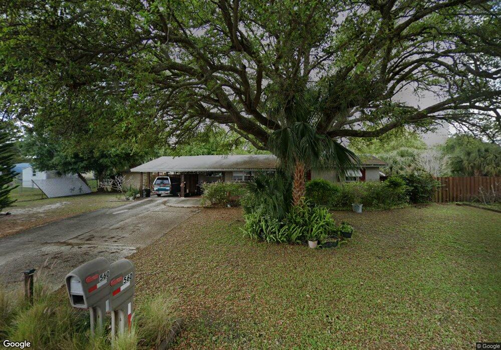
This home is located at 560 Espanol Ave, Cocoa, FL 32927 and is currently estimated at $217,258, approximately $238 per square foot. 560 Espanol Ave is a home located in Brevard County with nearby schools including Atlantis Elementary School, Space Coast Junior/Senior High School, and East Atlantic Prep of Brevard County.
Ownership History
Date
Name
Owned For
Owner Type
Purchase Details
Closed on
Apr 14, 2010
Sold by
Yates Betty R and Romano Susan B
Bought by
Ribaudo Dean
Current Estimated Value
Home Financials for this Owner
Home Financials are based on the most recent Mortgage that was taken out on this home.
Original Mortgage
$70,000
Outstanding Balance
$46,553
Interest Rate
4.97%
Estimated Equity
$170,705
Purchase Details
Closed on
Jan 6, 1998
Sold by
Yates Betty R
Bought by
Yates Betty R and Romano Susan B
Purchase Details
Closed on
Jun 3, 1997
Sold by
Yates Betty R
Bought by
Yates Betty R and Romano Susan B
Create a Home Valuation Report for This Property
The Home Valuation Report is an in-depth analysis detailing your home's value as well as a comparison with similar homes in the area
Home Values in the Area
Average Home Value in this Area
Purchase History
| Date | Buyer | Sale Price | Title Company |
|---|---|---|---|
| Ribaudo Dean | $47,500 | Attorney | |
| Yates Betty R | -- | -- | |
| Yates Betty R | -- | -- |
Source: Public Records
Mortgage History
| Date | Status | Borrower | Loan Amount |
|---|---|---|---|
| Open | Ribaudo Dean | $70,000 |
Source: Public Records
Tax History
| Year | Tax Paid | Tax Assessment Tax Assessment Total Assessment is a certain percentage of the fair market value that is determined by local assessors to be the total taxable value of land and additions on the property. | Land | Improvement |
|---|---|---|---|---|
| 2025 | $708 | $48,170 | -- | -- |
| 2024 | $684 | $41,000 | -- | -- |
| 2023 | $684 | $39,810 | $0 | $0 |
| 2022 | $649 | $38,660 | $0 | $0 |
| 2021 | $631 | $37,540 | $0 | $0 |
| 2020 | $591 | $37,030 | $0 | $0 |
| 2019 | $528 | $36,200 | $0 | $0 |
| 2018 | $519 | $35,530 | $0 | $0 |
| 2017 | $506 | $34,800 | $0 | $0 |
| 2016 | $495 | $34,090 | $18,000 | $16,090 |
| 2015 | $486 | $33,860 | $15,000 | $18,860 |
| 2014 | $484 | $33,600 | $11,000 | $22,600 |
Source: Public Records
Map
Nearby Homes
- 645 Altura Dr
- 6800 N Highway 1 Unit 4202
- 6760 N Highway 1 Unit 3204
- 1050 Barclay Dr
- 6900 N Highway 1 Unit 6307
- 6900 N Highway 1 Unit 6303
- 7000 N Highway 1 Unit Gg-205
- 7020 U S 1 Unit Ee-202
- 1040 Jersey St
- 701 Amor Dr
- 7030 N Highway 1 Unit 101
- 7030 N Highway 1 Unit DD102
- 1131 Covina St
- 1164 Aron St
- 780 Alcazar Ave
- 933 Fay Blvd
- 7060 N Highway 1 Unit AA206
- 7060 N Highway 1 Unit 205
- 7050 N Highway 1 Unit BB106
- 361 Payne Ave
Your Personal Tour Guide
Ask me questions while you tour the home.