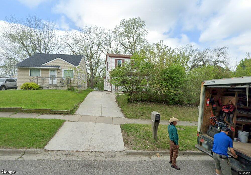
560 Howland Ave Pontiac, MI 48341
Estimated Value: $80,729 - $148,000
3
Beds
1
Bath
904
Sq Ft
$116/Sq Ft
Est. Value
About This Home
This home is located at 560 Howland Ave, Pontiac, MI 48341 and is currently estimated at $104,932, approximately $116 per square foot. 560 Howland Ave is a home located in Oakland County with nearby schools including Walt Whitman Elementary School, Pontiac Middle School, and Pontiac High School.
Ownership History
Date
Name
Owned For
Owner Type
Purchase Details
Closed on
Aug 26, 2022
Sold by
Diaz Chavez Miguel
Bought by
Estrada Alonso
Current Estimated Value
Purchase Details
Closed on
Jun 23, 2022
Sold by
Liliana Amador-Gallegos
Bought by
Chavez Miguel Diaz
Purchase Details
Closed on
Jul 26, 2017
Sold by
Oakland County
Bought by
Gallegos Liliana Amador
Purchase Details
Closed on
Jul 20, 2017
Sold by
Gallagos Liliana Amador
Bought by
Diaz Miguel A and Havaz Loan C
Purchase Details
Closed on
Aug 29, 2013
Sold by
Carson Arzo
Bought by
Williams Luetta
Purchase Details
Closed on
May 25, 2004
Sold by
Tody Dorothy J
Bought by
Sovereign Bank
Create a Home Valuation Report for This Property
The Home Valuation Report is an in-depth analysis detailing your home's value as well as a comparison with similar homes in the area
Home Values in the Area
Average Home Value in this Area
Purchase History
| Date | Buyer | Sale Price | Title Company |
|---|---|---|---|
| Estrada Alonso | $20,000 | Coretitle | |
| Chavez Miguel Diaz | -- | Core Title Services | |
| Gallegos Liliana Amador | $17,500 | None Available | |
| Diaz Miguel A | -- | None Available | |
| Williams Luetta | -- | None Available | |
| Sovereign Bank | $33,400 | -- |
Source: Public Records
Tax History Compared to Growth
Tax History
| Year | Tax Paid | Tax Assessment Tax Assessment Total Assessment is a certain percentage of the fair market value that is determined by local assessors to be the total taxable value of land and additions on the property. | Land | Improvement |
|---|---|---|---|---|
| 2024 | $1,183 | $22,870 | $0 | $0 |
| 2023 | $1,128 | $20,520 | $0 | $0 |
| 2022 | $697 | $17,470 | $0 | $0 |
| 2021 | $677 | $15,260 | $0 | $0 |
| 2020 | $597 | $13,570 | $0 | $0 |
| 2019 | $647 | $11,650 | $0 | $0 |
| 2018 | $815 | $10,430 | $0 | $0 |
| 2017 | $500 | $10,130 | $0 | $0 |
| 2016 | $2,339 | $9,650 | $0 | $0 |
| 2015 | -- | $9,400 | $0 | $0 |
| 2014 | -- | $8,330 | $0 | $0 |
| 2011 | -- | $15,290 | $0 | $0 |
Source: Public Records
Map
Nearby Homes
- 567 Highland Ave
- 371 Nebraska Ave
- 200 Cedardale Ave
- 587 California Ave
- 200 Astorwood St
- 466 Colorado Ave
- 485 Colorado Ave
- 472 Wyoming Ave
- 0000 Franklin Rd
- 483 Pearsall Ave
- 151 South Blvd W
- 533 California Ave
- 559 Arthur Ave
- 534 Nevada Ave
- 305 South Blvd W
- 598 Montana Ave
- 200 Crystal Lake Dr
- 605 Nebraska Ave
- 232 Hughes Ave
- 608 Nevada Ave
- 566 Howland Ave
- 570 Howland Ave
- 576 Howland Ave
- 546 Howland Ave
- 555 Bloomfield Ave
- 565 Bloomfield Ave
- 294 Luther Ave
- 295 Dellwood Ave
- 549 Bloomfield Ave
- 559 Bloomfield Ave
- 569 Bloomfield Ave
- 540 Howland Ave
- 575 Bloomfield Ave
- 545 Bloomfield Ave
- 293 Dellwood Ave
- 290 Luther Ave
- 289 Dellwood Ave
- 584 Howland Ave
- 307 California Ave
- 285 Dellwood Ave