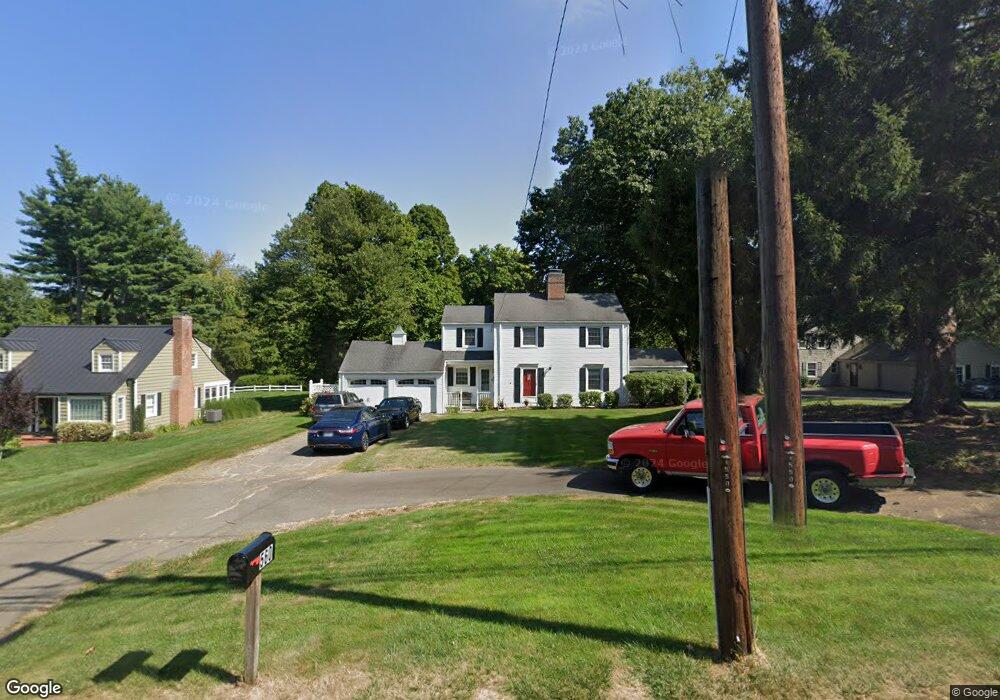
560 Mountain Rd West Hartford, CT 06117
Estimated Value: $434,000 - $532,000
3
Beds
2
Baths
1,563
Sq Ft
$304/Sq Ft
Est. Value
About This Home
This home is located at 560 Mountain Rd, West Hartford, CT 06117 and is currently estimated at $474,999, approximately $303 per square foot. 560 Mountain Rd is a home located in Hartford County with nearby schools including Norfeldt School, King Philip Middle School, and Hall High School.
Ownership History
Date
Name
Owned For
Owner Type
Purchase Details
Closed on
Oct 27, 1995
Sold by
Evert Wilma
Bought by
Greenwald Larry and Greenwald Dianne
Current Estimated Value
Purchase Details
Closed on
Jul 28, 1994
Sold by
Behan Edmund Jr Est
Bought by
Chelli Mark and Chelli Caryn
Home Financials for this Owner
Home Financials are based on the most recent Mortgage that was taken out on this home.
Original Mortgage
$150,100
Interest Rate
8.25%
Mortgage Type
Unknown
Purchase Details
Closed on
May 27, 1994
Sold by
Amich Benjamin and Jacbos Judith
Bought by
Moss Donald and Moss Susan
Home Financials for this Owner
Home Financials are based on the most recent Mortgage that was taken out on this home.
Original Mortgage
$140,000
Interest Rate
8.22%
Mortgage Type
Unknown
Create a Home Valuation Report for This Property
The Home Valuation Report is an in-depth analysis detailing your home's value as well as a comparison with similar homes in the area
Home Values in the Area
Average Home Value in this Area
Purchase History
| Date | Buyer | Sale Price | Title Company |
|---|---|---|---|
| Greenwald Larry | $65,000 | -- | |
| Chelli Mark | $158,000 | -- | |
| Moss Donald | $208,000 | -- |
Source: Public Records
Mortgage History
| Date | Status | Borrower | Loan Amount |
|---|---|---|---|
| Previous Owner | Moss Donald | $150,100 | |
| Previous Owner | Moss Donald | $140,000 |
Source: Public Records
Tax History Compared to Growth
Tax History
| Year | Tax Paid | Tax Assessment Tax Assessment Total Assessment is a certain percentage of the fair market value that is determined by local assessors to be the total taxable value of land and additions on the property. | Land | Improvement |
|---|---|---|---|---|
| 2025 | $9,252 | $206,620 | $83,000 | $123,620 |
| 2024 | $8,750 | $206,620 | $83,000 | $123,620 |
| 2023 | $8,455 | $206,620 | $83,000 | $123,620 |
| 2022 | $8,405 | $206,620 | $83,000 | $123,620 |
| 2021 | $7,403 | $174,510 | $79,800 | $94,710 |
| 2020 | $7,295 | $174,510 | $72,700 | $101,810 |
| 2019 | $7,295 | $174,510 | $72,660 | $101,850 |
| 2018 | $7,155 | $174,510 | $72,660 | $101,850 |
| 2017 | $7,162 | $174,510 | $72,660 | $101,850 |
| 2016 | $7,816 | $197,820 | $78,120 | $119,700 |
| 2015 | $7,578 | $197,820 | $78,120 | $119,700 |
| 2014 | $7,393 | $197,820 | $78,120 | $119,700 |
Source: Public Records
Map
Nearby Homes
- 592 Mountain Rd Unit A
- 124 High Ridge Rd
- 16 Morningcrest Dr
- 56 Fox Chase Ln
- 10 Hosmer Dr
- 47 Flagg Rd
- 26 Berwyn Rd
- 2581 Albany Ave
- 15 Rushleigh Rd
- 21 Rushleigh Rd
- 11 Rye Ridge Pkwy
- 21 Barksdale Rd
- 62 Blue Ridge Ln
- 50 Magnolia Hill
- 40 Ferncliff Dr
- 75 Arlen Way
- 37 W Normandy Dr
- 36 Richmond Ln
- 170 Hunter Dr
- 10 Ironwood Ln
- 564 Mountain Rd
- 556 Mountain Rd
- 550 Mountain Rd
- 570 Mountain Rd
- 183 Flagg Rd
- 561 Mountain Rd
- 555 Mountain Rd
- 546 Mountain Rd
- 565 Mountain Rd
- 571 Mountain Rd
- 542 Mountain Rd
- 575 Mountain Rd
- 545 Mountain Rd
- 538 Mountain Rd
- 25 Mountain Farms Rd
- 671 Mountain Rd
- 21 Mountain Farms Rd
- 579 Mountain Rd
- 27 Mountain Farms Rd
- 534 Mountain Rd