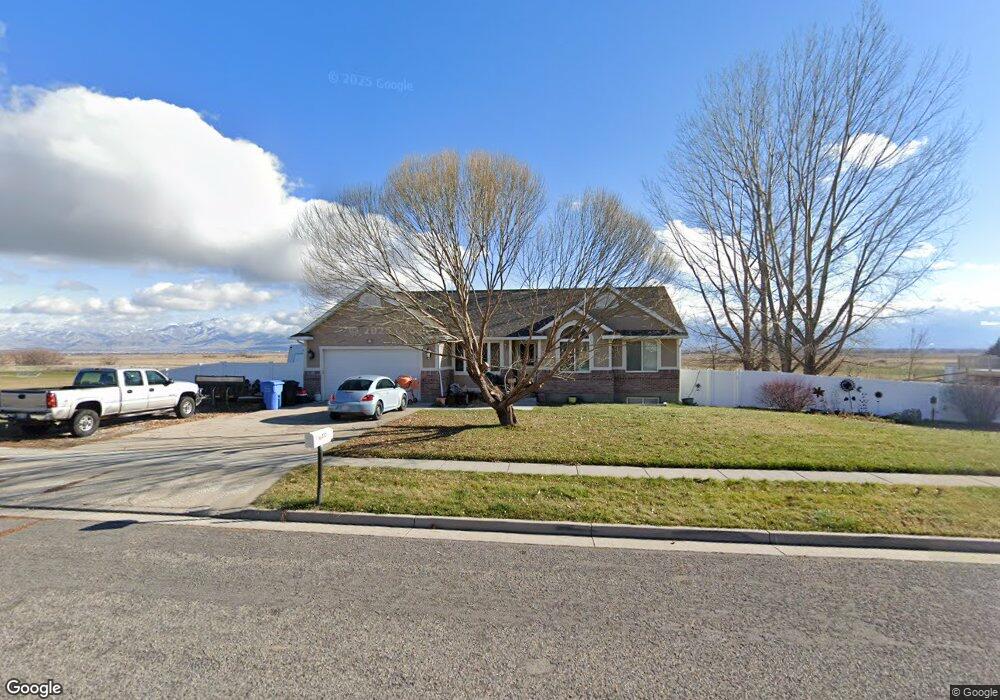
560 N 220 E Mendon, UT 84325
Estimated Value: $699,282 - $883,000
Studio
--
Bath
2,203
Sq Ft
$349/Sq Ft
Est. Value
About This Home
This home is located at 560 N 220 E, Mendon, UT 84325 and is currently estimated at $769,571, approximately $349 per square foot. 560 N 220 E is a home with nearby schools including Mountainside School, South Cache Middle School, and Mountain Crest High School.
Ownership History
Date
Name
Owned For
Owner Type
Purchase Details
Closed on
Feb 22, 2024
Sold by
Franke Deborah M and Franke Bradly J
Bought by
Franke Bradly J and Franke Deborah M
Current Estimated Value
Home Financials for this Owner
Home Financials are based on the most recent Mortgage that was taken out on this home.
Original Mortgage
$150,000
Outstanding Balance
$123,984
Interest Rate
6.66%
Mortgage Type
New Conventional
Estimated Equity
$645,587
Purchase Details
Closed on
Apr 24, 2014
Sold by
Franke Bradley J and Franke Deborah M
Bought by
Franke Deborah M and Franke Bradly J
Home Financials for this Owner
Home Financials are based on the most recent Mortgage that was taken out on this home.
Original Mortgage
$189,000
Interest Rate
4.32%
Mortgage Type
New Conventional
Create a Home Valuation Report for This Property
The Home Valuation Report is an in-depth analysis detailing your home's value as well as a comparison with similar homes in the area
Purchase History
| Date | Buyer | Sale Price | Title Company |
|---|---|---|---|
| Franke Bradly J | -- | Advanced Title | |
| Franke Deborah M | -- | Hickman Land Title Company |
Source: Public Records
Mortgage History
| Date | Status | Borrower | Loan Amount |
|---|---|---|---|
| Open | Franke Bradly J | $150,000 | |
| Previous Owner | Franke Deborah M | $189,000 |
Source: Public Records
Tax History
| Year | Tax Paid | Tax Assessment Tax Assessment Total Assessment is a certain percentage of the fair market value that is determined by local assessors to be the total taxable value of land and additions on the property. | Land | Improvement |
|---|---|---|---|---|
| 2025 | $2,881 | $381,215 | $0 | $0 |
| 2024 | $2,632 | $326,395 | $0 | $0 |
| 2023 | $2,572 | $303,065 | $0 | $0 |
| 2022 | $2,590 | $303,070 | $0 | $0 |
| 2021 | $2,513 | $441,705 | $114,000 | $327,705 |
| 2020 | $1,991 | $323,810 | $67,900 | $255,910 |
| 2019 | $2,098 | $323,809 | $67,900 | $255,909 |
| 2018 | $1,889 | $290,430 | $67,900 | $222,530 |
| 2017 | $1,844 | $148,610 | $0 | $0 |
| 2016 | $1,823 | $141,460 | $0 | $0 |
| 2015 | $1,612 | $130,465 | $0 | $0 |
| 2014 | $1,574 | $130,465 | $0 | $0 |
| 2013 | -- | $130,465 | $0 | $0 |
Source: Public Records
Map
Nearby Homes
- 518 N 220 E
- Hamilton Plan at Blueberry Springs
- Lincoln Plan at Blueberry Springs
- Manhattan Plan at Blueberry Springs
- Viewside Plan at Blueberry Springs
- Fairway Plan at Blueberry Springs
- Camden Plan at Blueberry Springs
- Huntington Plan at Blueberry Springs
- Cedar Ridge Plan at Blueberry Springs
- Jefferson Plan at Blueberry Springs
- Oakridge Plan at Blueberry Springs
- Navigator Plan at Blueberry Springs
- Chamberlain Plan at Blueberry Springs
- Abigail Plan at Blueberry Springs
- Willow Plan at Blueberry Springs
- Armani Plan at Blueberry Springs
- Monroe Plan at Blueberry Springs
- 2500 S 6400 W
- 6770 W 400 S
- 876 N 75 W Unit 9
Your Personal Tour Guide
Ask me questions while you tour the home.