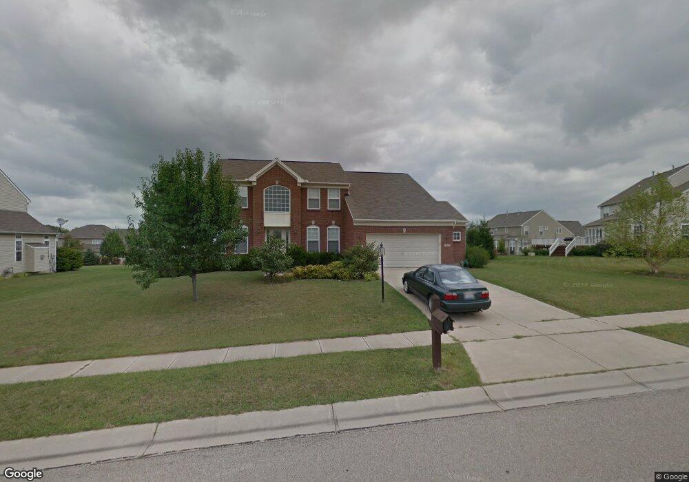
560 Null Blvd Springboro, OH 45066
Estimated Value: $497,982 - $602,000
4
Beds
3
Baths
2,839
Sq Ft
$198/Sq Ft
Est. Value
About This Home
This home is located at 560 Null Blvd, Springboro, OH 45066 and is currently estimated at $561,246, approximately $197 per square foot. 560 Null Blvd is a home located in Warren County with nearby schools including Clearcreek Elementary School, Dennis Elementary School, and Springboro Intermediate School.
Ownership History
Date
Name
Owned For
Owner Type
Purchase Details
Closed on
May 28, 2003
Sold by
Heatherwoode Development Co Llc
Bought by
Stewart Brian C and Stewart Kristy N
Current Estimated Value
Home Financials for this Owner
Home Financials are based on the most recent Mortgage that was taken out on this home.
Original Mortgage
$219,200
Outstanding Balance
$90,031
Interest Rate
5.51%
Mortgage Type
Purchase Money Mortgage
Estimated Equity
$471,215
Create a Home Valuation Report for This Property
The Home Valuation Report is an in-depth analysis detailing your home's value as well as a comparison with similar homes in the area
Home Values in the Area
Average Home Value in this Area
Purchase History
| Date | Buyer | Sale Price | Title Company |
|---|---|---|---|
| Stewart Brian C | $274,066 | First Title |
Source: Public Records
Mortgage History
| Date | Status | Borrower | Loan Amount |
|---|---|---|---|
| Open | Stewart Brian C | $219,200 | |
| Closed | Stewart Brian C | $41,000 |
Source: Public Records
Tax History
| Year | Tax Paid | Tax Assessment Tax Assessment Total Assessment is a certain percentage of the fair market value that is determined by local assessors to be the total taxable value of land and additions on the property. | Land | Improvement |
|---|---|---|---|---|
| 2025 | $5,437 | $139,240 | $35,000 | $104,240 |
| 2024 | $5,437 | $139,240 | $35,000 | $104,240 |
| 2023 | $4,599 | $109,606 | $17,220 | $92,386 |
| 2022 | $4,599 | $109,606 | $17,220 | $92,386 |
| 2021 | $4,280 | $109,606 | $17,220 | $92,386 |
| 2020 | $3,980 | $89,110 | $14,000 | $75,110 |
| 2019 | $3,669 | $89,110 | $14,000 | $75,110 |
| 2018 | $3,672 | $89,110 | $14,000 | $75,110 |
| 2017 | $3,561 | $77,837 | $12,436 | $65,401 |
| 2016 | $3,714 | $77,837 | $12,436 | $65,401 |
| 2015 | $3,572 | $77,837 | $12,436 | $65,401 |
| 2014 | $3,572 | $70,760 | $11,310 | $59,450 |
| 2013 | $3,569 | $87,630 | $14,000 | $73,630 |
Source: Public Records
Map
Nearby Homes
- 50 Martin Ln
- 48 Dinsley Place
- 130 Wells Dr
- 130 Heatherwoode Cir
- 20 Inverness Ct
- 225 Tilly Ct
- 230 Tilly Ct Unit 4
- 270 Tilly Ct
- 250 Tilly Ct Unit 6
- 240 Tilly Ct
- 285 Tilly Ct
- 230 Tilly Ct
- 275 Tilly Ct
- 275 Tilly Ct Unit 12
- 250 Tilly Ct
- 240 Tilly Ct Unit 5
- 39 Glasgow St
- 25 Morris St
- 79 Glasgow St
- 79 Glasgow St Unit 40
Your Personal Tour Guide
Ask me questions while you tour the home.