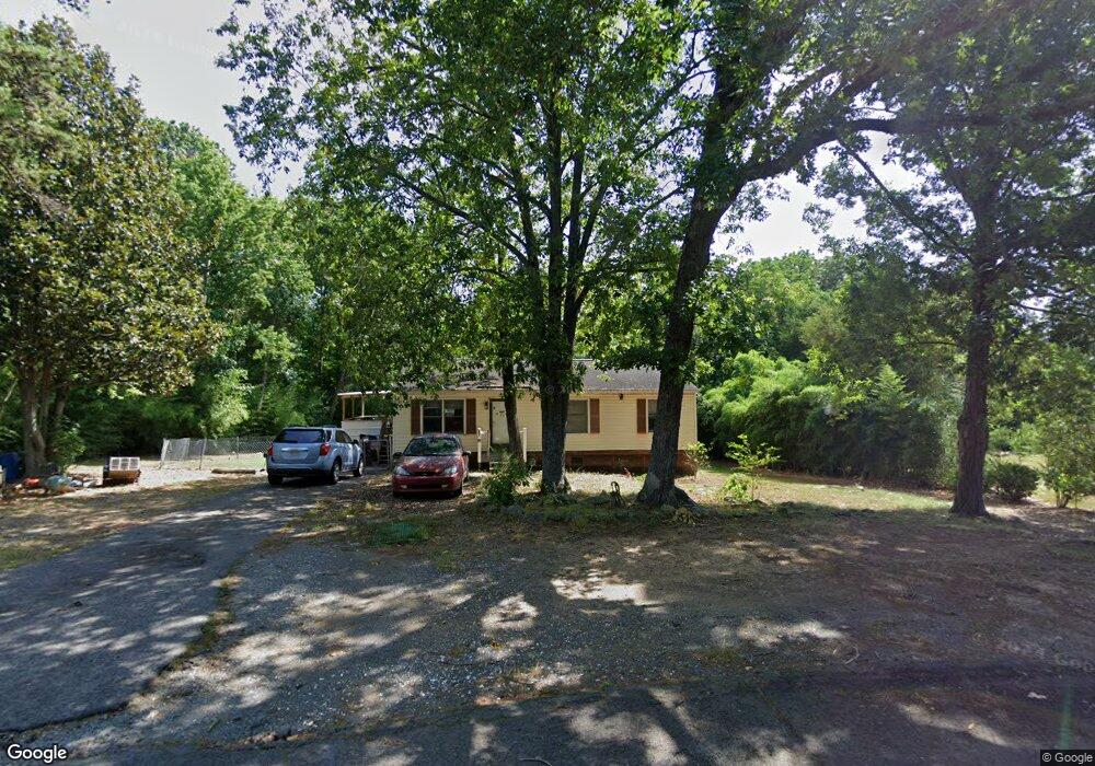
560 Stone Haven Dr Asheboro, NC 27203
Estimated Value: $109,000 - $172,000
--
Bed
1
Bath
988
Sq Ft
$143/Sq Ft
Est. Value
About This Home
This home is located at 560 Stone Haven Dr, Asheboro, NC 27203 and is currently estimated at $141,140, approximately $142 per square foot. 560 Stone Haven Dr is a home located in Randolph County with nearby schools including Lindley Park Elementary School, North Asheboro Middle School, and Asheboro High School.
Ownership History
Date
Name
Owned For
Owner Type
Purchase Details
Closed on
Apr 15, 2016
Sold by
Trollinger Mark B and Trollinger Rhonda J
Bought by
Westmoreland William Ray and Westmoreland Belinda Michelle
Current Estimated Value
Home Financials for this Owner
Home Financials are based on the most recent Mortgage that was taken out on this home.
Original Mortgage
$55,000
Outstanding Balance
$8,855
Interest Rate
3.64%
Mortgage Type
Purchase Money Mortgage
Estimated Equity
$132,285
Purchase Details
Closed on
Feb 15, 2007
Sold by
Trollinger Mark B and Trollinger Rhonda J
Bought by
Drs Vruwink & Young D D S Pa
Purchase Details
Closed on
Feb 1, 1989
Bought by
Trollinger Mark B Trollinger Geor
Purchase Details
Closed on
Mar 4, 1988
Bought by
Trollinger Mark B Trollinger Geor
Create a Home Valuation Report for This Property
The Home Valuation Report is an in-depth analysis detailing your home's value as well as a comparison with similar homes in the area
Home Values in the Area
Average Home Value in this Area
Purchase History
| Date | Buyer | Sale Price | Title Company |
|---|---|---|---|
| Westmoreland William Ray | $60,000 | None Available | |
| Drs Vruwink & Young D D S Pa | $230,000 | None Available | |
| Trollinger Mark B Trollinger Geor | $7,500 | -- | |
| Trollinger Mark B Trollinger Geor | -- | -- |
Source: Public Records
Mortgage History
| Date | Status | Borrower | Loan Amount |
|---|---|---|---|
| Open | Westmoreland William Ray | $55,000 |
Source: Public Records
Tax History Compared to Growth
Tax History
| Year | Tax Paid | Tax Assessment Tax Assessment Total Assessment is a certain percentage of the fair market value that is determined by local assessors to be the total taxable value of land and additions on the property. | Land | Improvement |
|---|---|---|---|---|
| 2025 | $714 | $90,870 | $24,770 | $66,100 |
| 2024 | $695 | $90,870 | $24,770 | $66,100 |
| 2023 | $695 | $90,870 | $24,770 | $66,100 |
| 2022 | $570 | $61,530 | $16,480 | $45,050 |
| 2021 | $570 | $61,530 | $16,480 | $45,050 |
| 2020 | $561 | $61,530 | $16,480 | $45,050 |
| 2019 | $561 | $61,530 | $16,480 | $45,050 |
| 2018 | $543 | $57,890 | $15,360 | $42,530 |
| 2016 | $525 | $57,526 | $15,440 | $42,086 |
| 2015 | $526 | $57,526 | $15,440 | $42,086 |
| 2014 | -- | $57,526 | $15,440 | $42,086 |
Source: Public Records
Map
Nearby Homes
- 00 E Presnell St
- 575 Twain Dr
- 933 Bay Leaf Ct
- 455 Brookwood Dr
- 00 Hillsdale Dr
- 414 Callicut St
- 611 Tucker St
- 443 E Pritchard St
- 0 Salisbury St Unit 1087524
- 0 Salisbury St Unit 1047979
- 703 Eastview Dr
- 830 Country Place Rd
- 1319 E Allred St
- 1249 Eton Ave
- 830 Cool Springs Rd
- 1335 Robins Nest Dr
- 000 W Presnell St
- 222 Gardiner Rd
- 606 Greensboro St
- 842 Parkview St
- 550 Stone Haven Dr
- 555 Stone Haven Dr
- 533 Stone Haven Dr
- 1937 Old Cedar Falls Rd
- 1861 Old Cedar Falls Rd
- 526 Stone Haven Dr
- 1842 Old Cedar Falls Rd
- 1949 Old Cedar Falls Rd
- 1857 Old Cedar Falls Rd
- 502 Stone Haven Dr
- 664 Coventry Place
- 1971 Old Cedar Falls Rd
- 662 Coventry Place
- 1974 Old Cedar Falls Rd
- 1818 Old Cedar Falls Rd
- 656 Coventry Place
- 1975 Old Cedar Falls Rd
- 845 Lansdowne Rd
- 1819 Old Cedar Falls Rd
- 873 Lansdowne Rd