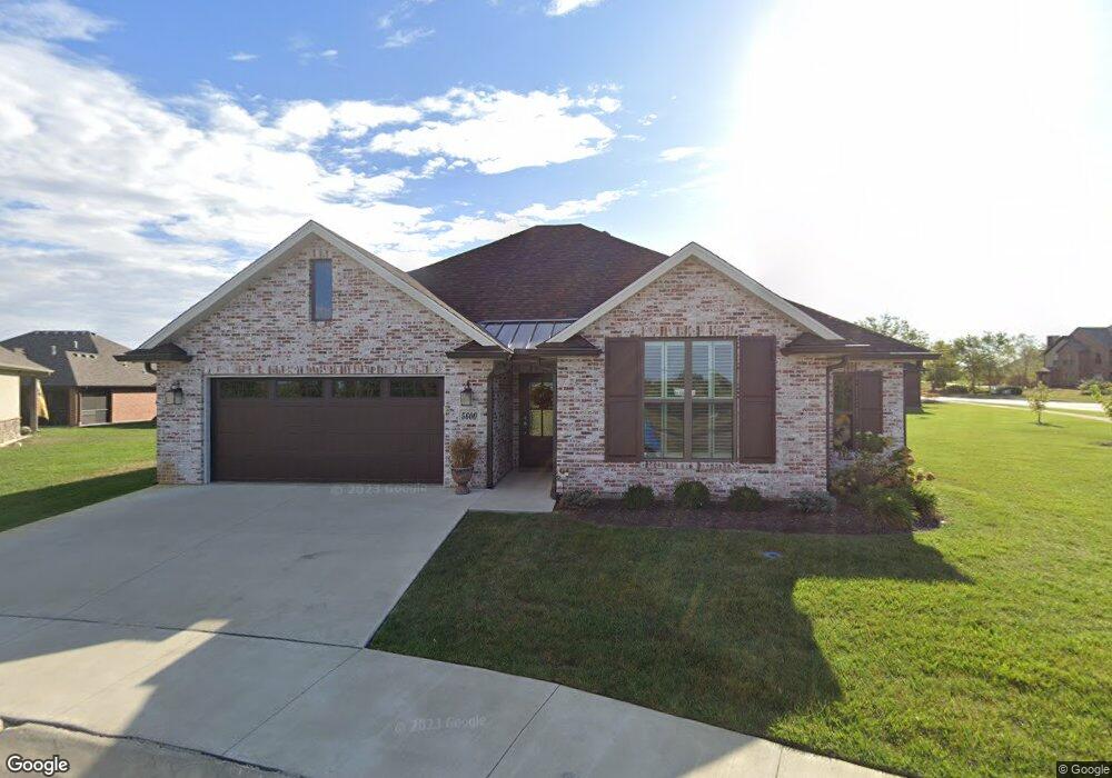
5600 Bower Ln Columbia, MO 65201
Old Hawthorne NeighborhoodEstimated Value: $395,849 - $416,000
3
Beds
2
Baths
1,614
Sq Ft
$251/Sq Ft
Est. Value
About This Home
This home is located at 5600 Bower Ln, Columbia, MO 65201 and is currently estimated at $405,462, approximately $251 per square foot. 5600 Bower Ln is a home with nearby schools including Cedar Ridge Elementary School, Oakland Middle School, and Muriel W. Battle High School.
Ownership History
Date
Name
Owned For
Owner Type
Purchase Details
Closed on
Dec 16, 2020
Sold by
Ramsey And Holzum Investments Llc
Bought by
Eaton Randall D and Eaton Marsha
Current Estimated Value
Home Financials for this Owner
Home Financials are based on the most recent Mortgage that was taken out on this home.
Original Mortgage
$227,007
Outstanding Balance
$202,104
Interest Rate
2.7%
Mortgage Type
New Conventional
Estimated Equity
$203,358
Purchase Details
Closed on
Mar 4, 2010
Sold by
John Hansman Construction L L C
Bought by
Boone Development Inc
Home Financials for this Owner
Home Financials are based on the most recent Mortgage that was taken out on this home.
Original Mortgage
$2,385,770
Interest Rate
4.98%
Mortgage Type
Future Advance Clause Open End Mortgage
Create a Home Valuation Report for This Property
The Home Valuation Report is an in-depth analysis detailing your home's value as well as a comparison with similar homes in the area
Home Values in the Area
Average Home Value in this Area
Purchase History
| Date | Buyer | Sale Price | Title Company |
|---|---|---|---|
| Eaton Randall D | -- | Boone Central Title Co | |
| Boone Development Inc | -- | None Available |
Source: Public Records
Mortgage History
| Date | Status | Borrower | Loan Amount |
|---|---|---|---|
| Open | Eaton Randall D | $227,007 | |
| Previous Owner | Boone Development Inc | $2,385,770 |
Source: Public Records
Tax History Compared to Growth
Tax History
| Year | Tax Paid | Tax Assessment Tax Assessment Total Assessment is a certain percentage of the fair market value that is determined by local assessors to be the total taxable value of land and additions on the property. | Land | Improvement |
|---|---|---|---|---|
| 2025 | $3,099 | $52,611 | $7,600 | $45,011 |
| 2024 | $3,099 | $45,942 | $7,600 | $38,342 |
| 2023 | $3,074 | $45,942 | $7,600 | $38,342 |
| 2022 | $2,952 | $44,175 | $7,600 | $36,575 |
| 2021 | $2,958 | $44,175 | $7,600 | $36,575 |
| 2020 | $191 | $2,676 | $2,676 | $0 |
| 2019 | $191 | $2,676 | $2,676 | $0 |
| 2018 | $192 | $0 | $0 | $0 |
| 2017 | $189 | $2,676 | $2,676 | $0 |
| 2016 | $189 | $2,676 | $2,676 | $0 |
| 2015 | $174 | $2,676 | $2,676 | $0 |
| 2014 | $174 | $2,676 | $2,676 | $0 |
Source: Public Records
Map
Nearby Homes
- 1811 Trellis Ln
- 5703 Bower Ln
- 5402 Wild Horse Ct
- 1301 Morning Dove Dr
- 1303 Morning Dove Dr
- 1209 Marcassin Dr
- 1715 Linkside Dr
- LOT 122 Signature Ridge
- LOT 123 Signature Ridge
- 1914 Lasso Cir
- 1104 Caymus Ct
- 2109 August Briggs Dr
- 6308 Bridle Bend Dr
- 5004 Stone Mountain Pkwy
- 2322 Pride Mountain Dr
- 2326 Pride Mountain Dr
- 2365 Pride Mountain Dr
- 4910 Stone Mountain Pkwy
- 6501 Upper Bridle Bend Dr
- 5012 Kenora Dr
- 1812 Trellis Ln
- 5602 Bower Ln
- 1814 Trellis Ln
- 1810 Trellis Ln
- 1800 Wes Milligan Ln
- 1808 Trellis Ln
- 5604 Bower Ln
- 1704 Trellis Ln
- 1815 Trellis Ln
- 1809 Trellis Ln
- 1708 Trellis Ln
- 1807 Trellis Ln
- 1703 Trellis Ln
- LOT 427 Troylene Ct
- 1808 Wes Milligan Ln
- 1705 Trellis Ln
- 1805 Trellis Ln
- 1803 Trellis Ln
- 1707 Trellis Ln
- 5610 Bower Ln