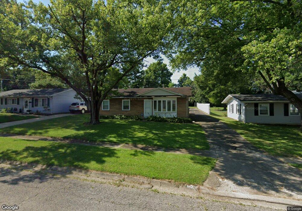
5600 Sharp Rd Dayton, OH 45432
Estimated Value: $174,215 - $196,000
3
Beds
1
Bath
1,046
Sq Ft
$180/Sq Ft
Est. Value
About This Home
This home is located at 5600 Sharp Rd, Dayton, OH 45432 and is currently estimated at $188,304, approximately $180 per square foot. 5600 Sharp Rd is a home located in Montgomery County with nearby schools including Parkwood Elementary School, Herman K Ankeney Middle School, and Beavercreek High School.
Ownership History
Date
Name
Owned For
Owner Type
Purchase Details
Closed on
Sep 21, 2007
Sold by
Armstrong Michael E
Bought by
Davis Mark H
Current Estimated Value
Purchase Details
Closed on
Aug 3, 2003
Sold by
Armstrong Darlene M
Bought by
Armstrong Michael E
Create a Home Valuation Report for This Property
The Home Valuation Report is an in-depth analysis detailing your home's value as well as a comparison with similar homes in the area
Home Values in the Area
Average Home Value in this Area
Purchase History
| Date | Buyer | Sale Price | Title Company |
|---|---|---|---|
| Davis Mark H | $136,650 | Attorney | |
| Armstrong Michael E | -- | -- |
Source: Public Records
Tax History
| Year | Tax Paid | Tax Assessment Tax Assessment Total Assessment is a certain percentage of the fair market value that is determined by local assessors to be the total taxable value of land and additions on the property. | Land | Improvement |
|---|---|---|---|---|
| 2025 | $2,580 | $41,950 | $9,640 | $32,310 |
| 2024 | $2,502 | $41,950 | $9,640 | $32,310 |
| 2023 | $2,502 | $41,950 | $9,640 | $32,310 |
| 2022 | $1,916 | $27,420 | $6,300 | $21,120 |
| 2021 | $1,924 | $27,420 | $6,300 | $21,120 |
| 2020 | $1,931 | $27,420 | $6,300 | $21,120 |
| 2019 | $2,019 | $26,120 | $6,300 | $19,820 |
| 2018 | $1,875 | $26,120 | $6,300 | $19,820 |
| 2017 | $1,839 | $26,120 | $6,300 | $19,820 |
| 2016 | $1,828 | $24,900 | $6,300 | $18,600 |
| 2015 | $1,983 | $24,900 | $6,300 | $18,600 |
| 2014 | $1,983 | $24,900 | $6,300 | $18,600 |
| 2012 | -- | $28,570 | $7,000 | $21,570 |
Source: Public Records
Map
Nearby Homes
- 5588 Sharp Rd
- 1176 Irmal Dr
- 5664 Mayville Dr
- 5713 Mayville Dr
- Lot 10 Linden Ave
- Lot 11 Linden Ave
- 5943 Sharp Rd
- 1301 Ames Ave
- 6000 Sharp Rd
- 1726 Rausch Ave
- 4328 Richland Ave
- 1538 Lytton Place
- 4301 Richland Ave
- 4931 Arcadia Blvd
- 4460 Mohave Dr
- 5303 Underwood Rd
- 4677 Kolmar Ave
- 1792 Stedman Ln
- 4856 Barnhart Ave
- 4701 Tall Oaks Dr
Your Personal Tour Guide
Ask me questions while you tour the home.