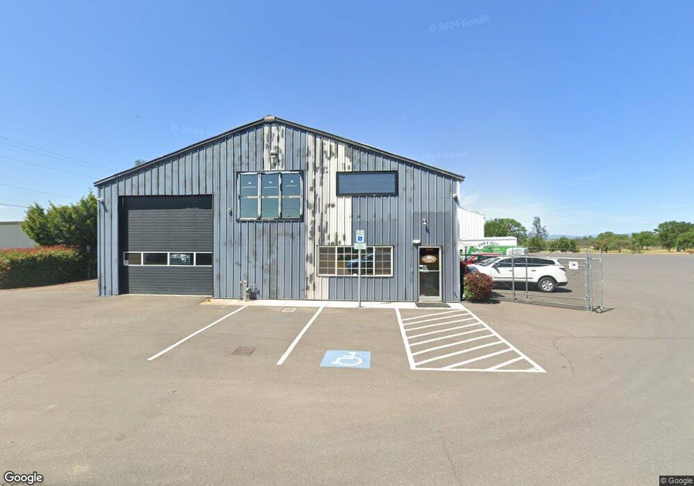
5600 Table Rock Rd Central Point, OR 97502
Estimated Value: $1,133,860
--
Bed
--
Bath
3,750
Sq Ft
$302/Sq Ft
Est. Value
About This Home
This home is located at 5600 Table Rock Rd, Central Point, OR 97502 and is currently estimated at $1,133,860, approximately $302 per square foot. 5600 Table Rock Rd is a home located in Jackson County with nearby schools including Sams Valley Elementary School, Scenic Middle School, and Crater High School.
Ownership History
Date
Name
Owned For
Owner Type
Purchase Details
Closed on
Jul 1, 2013
Sold by
Plunk Transportation Inc
Bought by
Davis Wayne E and Davis Rayven M
Current Estimated Value
Home Financials for this Owner
Home Financials are based on the most recent Mortgage that was taken out on this home.
Original Mortgage
$308,250
Outstanding Balance
$146,643
Interest Rate
3.48%
Mortgage Type
Commercial
Estimated Equity
$987,217
Purchase Details
Closed on
Jun 23, 2004
Sold by
Plunk Transportation Inc
Bought by
Plunk Transportation Inc
Home Financials for this Owner
Home Financials are based on the most recent Mortgage that was taken out on this home.
Original Mortgage
$210,000
Interest Rate
6.29%
Mortgage Type
Credit Line Revolving
Purchase Details
Closed on
Jan 26, 1999
Sold by
Gene Plunk Trucking Inc
Bought by
Plunk Transportation
Purchase Details
Closed on
May 20, 1998
Sold by
Gene Plunk Trucking Inc
Bought by
City Of Medford
Create a Home Valuation Report for This Property
The Home Valuation Report is an in-depth analysis detailing your home's value as well as a comparison with similar homes in the area
Home Values in the Area
Average Home Value in this Area
Purchase History
| Date | Buyer | Sale Price | Title Company |
|---|---|---|---|
| Davis Wayne E | -- | Amerititle | |
| Plunk Transportation Inc | -- | Lawyers Title Ins | |
| Plunk Transportation | -- | Crater Title Insurance | |
| City Of Medford | -- | -- |
Source: Public Records
Mortgage History
| Date | Status | Borrower | Loan Amount |
|---|---|---|---|
| Open | Davis Wayne E | $308,250 | |
| Previous Owner | Plunk Transportation Inc | $210,000 |
Source: Public Records
Tax History Compared to Growth
Tax History
| Year | Tax Paid | Tax Assessment Tax Assessment Total Assessment is a certain percentage of the fair market value that is determined by local assessors to be the total taxable value of land and additions on the property. | Land | Improvement |
|---|---|---|---|---|
| 2025 | $6,016 | $417,840 | $219,340 | $198,500 |
| 2024 | $6,016 | $405,670 | $212,950 | $192,720 |
| 2023 | $5,820 | $393,860 | $206,750 | $187,110 |
| 2022 | $5,689 | $393,860 | $206,750 | $187,110 |
| 2021 | $5,527 | $382,390 | $200,730 | $181,660 |
| 2020 | $5,263 | $358,980 | $244,670 | $114,310 |
| 2019 | $5,303 | $358,980 | $244,670 | $114,310 |
| 2018 | $5,296 | $332,380 | $226,540 | $105,840 |
| 2017 | $4,920 | $332,380 | $226,540 | $105,840 |
| 2016 | $4,937 | $323,640 | $217,870 | $105,770 |
| 2015 | $4,970 | $330,340 | $222,350 | $107,990 |
| 2014 | $4,989 | $330,340 | $222,350 | $107,990 |
Source: Public Records
Map
Nearby Homes
- 225 Wilson Rd
- 5156 Peace Ln
- 2598 St James Way
- 4824 Airway Dr Unit 371W06BB410
- 2330 Savannah Dr
- 1182 E Justice Rd
- 2035 Rabun Way
- 4676 Industry Dr
- 2248 Evan Way
- 2225 New Haven Dr
- 862 Enterprise Dr
- 4702 Industry Dr
- 4595 Table Rock Rd
- 1409 Twin Rocks Dr
- 705 Mountain Ave
- 1141 Helicopter Way
- 1250 Vilas Rd
- 4399 Table Rock Rd
- 1151 Helicopter Way
- 4922 Gebhard Rd
- 5606 Table Rock Rd
- 5558 Table Rock Rd
- 5734 Table Rock Rd
- 245 Bateman
- 217 Bateman Dr
- 201 Bateman Dr Unit 5
- 201 Bateman Dr Unit 17 & 18
- 201 Bateman Dr Unit 17
- 201 Bateman Dr
- 201 Bateman Dr Unit 6
- 201 Bateman Dr Unit 15
- 201 Bateman Dr Unit 6-8
- 201 Bateman Dr Unit 19-23
- 201 Bateman Dr Unit 6-7
- 201 Bateman Dr Unit 15-17
- 201 Bateman Dr Unit 13&14
- 201 Bateman Dr Unit 16-23
- 201 Bateman Dr Unit 19&20
- 201 Bateman Dr Unit 12
- 201 Bateman Dr Unit 3 & 4