Estimated Value: $211,000 - $249,000
--
Bed
--
Bath
2,074
Sq Ft
$114/Sq Ft
Est. Value
About This Home
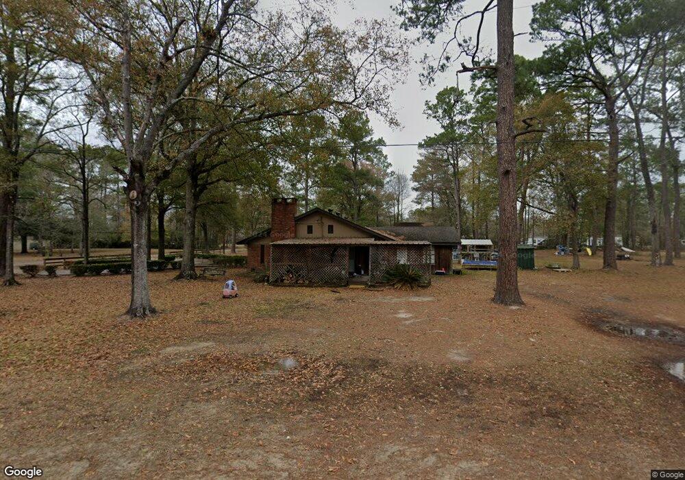
This home is located at 5600 Wayside Dr, Vidor, TX 77662 and is currently estimated at $235,485, approximately $113 per square foot. 5600 Wayside Dr is a home located in Orange County.
Ownership History
Date
Name
Owned For
Owner Type
Purchase Details
Closed on
Sep 11, 2009
Sold by
Jones Brittney Elizabeth
Bought by
Jones Lucas Allen
Current Estimated Value
Purchase Details
Closed on
Feb 4, 2005
Sold by
Jones Roger Allen and Jones Debra Ann
Bought by
Jones Lucas Allen
Home Financials for this Owner
Home Financials are based on the most recent Mortgage that was taken out on this home.
Original Mortgage
$104,000
Interest Rate
5.82%
Mortgage Type
New Conventional
Create a Home Valuation Report for This Property
The Home Valuation Report is an in-depth analysis detailing your home's value as well as a comparison with similar homes in the area
Home Values in the Area
Average Home Value in this Area
Purchase History
| Date | Buyer | Sale Price | Title Company |
|---|---|---|---|
| Jones Lucas Allen | -- | None Available | |
| Jones Lucas Allen | -- | None Available |
Source: Public Records
Mortgage History
| Date | Status | Borrower | Loan Amount |
|---|---|---|---|
| Closed | Jones Lucas Allen | $104,000 | |
| Closed | Jones Lucas Allen | $0 |
Source: Public Records
Tax History Compared to Growth
Tax History
| Year | Tax Paid | Tax Assessment Tax Assessment Total Assessment is a certain percentage of the fair market value that is determined by local assessors to be the total taxable value of land and additions on the property. | Land | Improvement |
|---|---|---|---|---|
| 2025 | $3,644 | $235,497 | $10,125 | $225,372 |
| 2024 | $2,063 | $235,497 | $10,125 | $225,372 |
| 2023 | $3,130 | $210,457 | $10,125 | $200,332 |
| 2022 | $2,323 | $182,195 | $10,125 | $172,070 |
| 2021 | $3,110 | $167,215 | $10,125 | $157,090 |
| 2020 | $3,036 | $158,385 | $10,125 | $148,260 |
| 2019 | $2,881 | $149,065 | $10,125 | $138,940 |
| 2018 | $2,707 | $141,725 | $10,125 | $131,600 |
| 2017 | $2,056 | $141,725 | $10,125 | $131,600 |
| 2016 | $2,528 | $132,425 | $10,125 | $122,300 |
| 2015 | $1,910 | $125,381 | $10,125 | $115,256 |
| 2014 | $1,910 | $126,176 | $10,125 | $116,051 |
Source: Public Records
Map
Nearby Homes
- Lot 14 Ironwood Dr
- 197 Decker Rd
- 395 Willette Rd Unit 400 Willette
- 5200 Farm To Market 105
- 145 Bellard Rd
- N/A Oldbury Rd
- 0 Oldbury Rd
- 280 Pug Rd Unit 295 Pug
- 5855 Tyler St
- 140 Princeton St
- 5820 Jefferson St
- 1330 Hwy 1311
- 1330 Highway 1131
- 185 Brookhollow St
- 380 Croom
- 397 Stephenson Rd
- 4030 Barnhill Rd Unit TRACT II (East Side)
- 4025 Barnhill Rd Unit Tract I (west)
- 3930 Carter Rd
- 3670 Lakeview Cutoff St
- 5605 Wayside Dr
- 320 Stateside St
- 5680 Wayside Dr
- 350 Stateside St
- 5685 Wayside Dr
- 370 Stateside St
- 315 Ironwood St
- 5678 Wayside Dr
- 1205 W Circle Dr
- 380 Ironwood St
- 375 Stateside St
- 165 Milam St
- 5615 Woodside St
- 330 Alex St
- 327 Alex St
- 155 Milam St
- 325 Alex St
- 5695 Wayside Dr
- 160 Milam St
- 315 Alex St