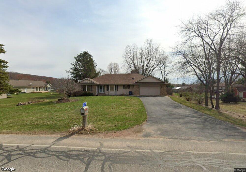
5601 Bittersweet Rd Wausau, WI 54401
Estimated Value: $424,406 - $445,000
--
Bed
--
Bath
--
Sq Ft
0.48
Acres
About This Home
This home is located at 5601 Bittersweet Rd, Wausau, WI 54401 and is currently estimated at $438,352. 5601 Bittersweet Rd is a home located in Marathon County with nearby schools including South Mountain Elementary School, John Muir Middle School, and West High School.
Ownership History
Date
Name
Owned For
Owner Type
Purchase Details
Closed on
Aug 28, 2024
Sold by
Evert Family Irrevocable Trust and Evert Dale W
Bought by
Roberts Tyler
Current Estimated Value
Home Financials for this Owner
Home Financials are based on the most recent Mortgage that was taken out on this home.
Original Mortgage
$368,910
Outstanding Balance
$365,001
Interest Rate
6.78%
Mortgage Type
New Conventional
Estimated Equity
$73,351
Purchase Details
Closed on
Aug 25, 2021
Sold by
Evert Dale W and Evert Janice M
Bought by
Evert Family Irrevocable Trust
Purchase Details
Closed on
Apr 22, 2005
Sold by
Schemenauer Keith
Bought by
Evert Dale W and Evert Janice M
Create a Home Valuation Report for This Property
The Home Valuation Report is an in-depth analysis detailing your home's value as well as a comparison with similar homes in the area
Home Values in the Area
Average Home Value in this Area
Purchase History
| Date | Buyer | Sale Price | Title Company |
|---|---|---|---|
| Roberts Tyler | $409,900 | Avenue Title Services | |
| Evert Family Irrevocable Trust | -- | None Available | |
| Evert Dale W | $213,000 | None Available |
Source: Public Records
Mortgage History
| Date | Status | Borrower | Loan Amount |
|---|---|---|---|
| Open | Roberts Tyler | $368,910 |
Source: Public Records
Tax History Compared to Growth
Tax History
| Year | Tax Paid | Tax Assessment Tax Assessment Total Assessment is a certain percentage of the fair market value that is determined by local assessors to be the total taxable value of land and additions on the property. | Land | Improvement |
|---|---|---|---|---|
| 2024 | $4,984 | $278,600 | $40,800 | $237,800 |
| 2023 | $5,092 | $278,600 | $40,800 | $237,800 |
| 2022 | $5,337 | $278,600 | $40,800 | $237,800 |
| 2021 | $5,194 | $278,600 | $40,800 | $237,800 |
| 2020 | $5,126 | $278,600 | $40,800 | $237,800 |
| 2019 | $4,889 | $278,600 | $40,800 | $237,800 |
| 2018 | $4,800 | $231,000 | $36,700 | $194,300 |
| 2017 | $4,656 | $231,000 | $36,700 | $194,300 |
| 2016 | $4,202 | $207,500 | $36,700 | $170,800 |
| 2015 | $4,039 | $207,500 | $36,700 | $170,800 |
| 2014 | $3,932 | $205,600 | $36,700 | $168,900 |
Source: Public Records
Map
Nearby Homes
- 150939 Fern Ln
- 151125 Jonquil Ln
- 150775 Cloudberry Ln
- Lot #34 Buck Wood Ln
- Lot #35 Buck Wood Ln
- Lot #33 Buck Wood Ln
- Lot #37 Buck Wood Ln
- Lot #24 Deer Tail Ln
- Lot #25 Deer Tail Ln
- 226440 Kingbird Ave
- 151257 Kingfisher Ln
- 222512 Starflower Dr
- 4201 Rib Mountain Dr
- 153318 Shoreland Ln
- 226944 Boulder Ridge Cir
- 226936 Boulder Ridge Cir
- 227308 Shrike Ave
- 150609 Lavender Ln
- 150811 Cth Nn
- 150811 County Road Nn
- 224529 Bittersweet Rd
- 5701 Bittersweet Rd
- 150825 Lily Ln
- 2701 Lily Ln
- 2703 Lily Ln
- 2702 Iris Ln
- 2704 Iris Ln
- 2609 Lily Ln
- 2608 Iris Ln
- 2606 Iris Ln
- 150740 Lavender Ln
- 5505 Bittersweet Rd
- 2604 Iris Ln
- 2703 Iris Ln
- 2701 Iris Ln
- 2608 Lily Ln
- 2607 Iris Ln
- 150771 Lavender Ln
- 5501 Bittersweet Rd
- 2506 Iris Ln