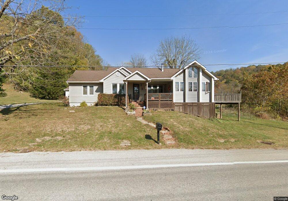
5603 Us Highway 52 Ripley, OH 45167
Estimated Value: $321,000 - $350,513
4
Beds
3
Baths
2,472
Sq Ft
$135/Sq Ft
Est. Value
About This Home
This home is located at 5603 Us Highway 52, Ripley, OH 45167 and is currently estimated at $333,878, approximately $135 per square foot. 5603 Us Highway 52 is a home located in Brown County with nearby schools including Ripley Union Lewis Huntington Elementary School, Ripley Union Lewis Huntington Middle School, and Ripley-Union-Lewis-Huntington High School.
Ownership History
Date
Name
Owned For
Owner Type
Purchase Details
Closed on
Aug 11, 2025
Sold by
Bourland Timothy D and Bourland Wendy
Bought by
Jefferson April and Jefferson Stacy
Current Estimated Value
Home Financials for this Owner
Home Financials are based on the most recent Mortgage that was taken out on this home.
Original Mortgage
$316,167
Outstanding Balance
$315,896
Interest Rate
6.77%
Mortgage Type
FHA
Estimated Equity
$17,982
Purchase Details
Closed on
Jul 10, 2018
Sold by
Pfeffer Michael S
Bought by
Bourland Timothy D and Bourland Wendy
Home Financials for this Owner
Home Financials are based on the most recent Mortgage that was taken out on this home.
Original Mortgage
$75,937
Interest Rate
4.5%
Mortgage Type
VA
Create a Home Valuation Report for This Property
The Home Valuation Report is an in-depth analysis detailing your home's value as well as a comparison with similar homes in the area
Home Values in the Area
Average Home Value in this Area
Purchase History
| Date | Buyer | Sale Price | Title Company |
|---|---|---|---|
| Jefferson April | $322,000 | None Listed On Document | |
| Jefferson April | $322,000 | None Listed On Document | |
| Bourland Timothy D | $149,000 | None Available |
Source: Public Records
Mortgage History
| Date | Status | Borrower | Loan Amount |
|---|---|---|---|
| Open | Jefferson April | $316,167 | |
| Closed | Jefferson April | $316,167 | |
| Previous Owner | Bourland Timothy D | $75,937 |
Source: Public Records
Tax History Compared to Growth
Tax History
| Year | Tax Paid | Tax Assessment Tax Assessment Total Assessment is a certain percentage of the fair market value that is determined by local assessors to be the total taxable value of land and additions on the property. | Land | Improvement |
|---|---|---|---|---|
| 2024 | $2,700 | $90,440 | $10,750 | $79,690 |
| 2023 | $2,700 | $66,160 | $6,400 | $59,760 |
| 2022 | $2,204 | $66,160 | $6,400 | $59,760 |
| 2021 | $2,115 | $66,160 | $6,400 | $59,760 |
| 2020 | $1,905 | $57,540 | $5,570 | $51,970 |
| 2019 | $1,891 | $57,540 | $5,570 | $51,970 |
| 2018 | $1,805 | $55,440 | $3,470 | $51,970 |
| 2017 | $967 | $47,610 | $3,810 | $43,800 |
| 2016 | $966 | $47,610 | $3,810 | $43,800 |
| 2015 | $1,315 | $47,610 | $3,810 | $43,800 |
| 2014 | $1,315 | $47,270 | $3,470 | $43,800 |
| 2013 | $1,489 | $47,270 | $3,470 | $43,800 |
Source: Public Records
Map
Nearby Homes
- 45 Main St
- 220 Main St
- 5205 U S 52
- 316 Circle Dr
- 2028 Lucretia St
- 402 Circle Dr
- 5796 Mary Ingles Hwy
- 5050 U S 52
- 3635 Circle Dr
- 65 Governor St
- 4381 E Us Highway 52
- 1016 Elizabeth St
- 3150 Dover Minerva Rd
- 1205 Pearl St
- 3034 Augusta-Dover Rd
- Lot 0600 Shawnee Dr
- Lot 1200 Shawnee Dr
- Lot 0700 Shawnee Dr
- Lot 1000 Shawnee Dr
- Lot 0900 Shawnee Dr
- 5603 Us Route 52
- 5591 Us Highway 52
- 5912 Cornicks Run Rd
- 4255 Old Us Highway 68
- 5656 Us Rt 52
- 5656 Us Highway 52
- 626 N Second St
- 626 N 2nd St
- 625 N 2nd St
- 619 Lower North 2nd St
- 4323 Old Us Highway 68
- 617 N 2nd St
- 617 N 2nd St
- 617 N 2nd St
- 616 N 2nd St
- 613 Lower North 2nd St
- 605 Lower North 2nd St
- 5889 Cornicks Run Rd
- 609 Lower North 2nd St
- 615 Lower North 2nd St