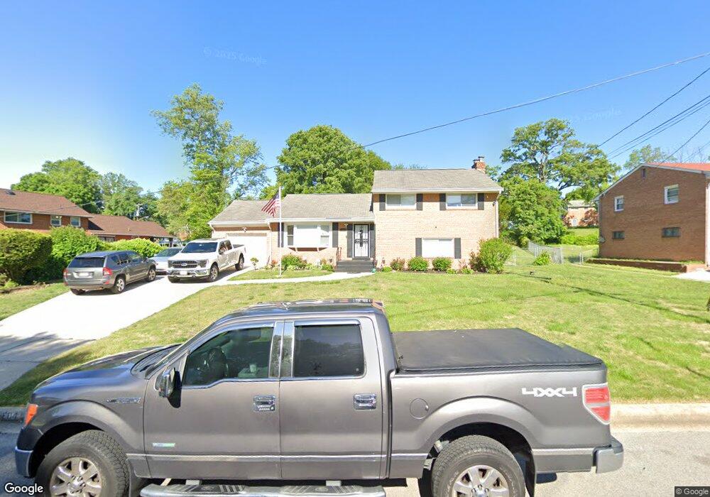
5604 Lansing Dr Temple Hills, MD 20748
Estimated Value: $304,000
--
Bed
3
Baths
2,268
Sq Ft
$134/Sq Ft
Est. Value
About This Home
This home is located at 5604 Lansing Dr, Temple Hills, MD 20748 and is currently priced at $304,000, approximately $134 per square foot. 5604 Lansing Dr is a home located in Prince George's County with nearby schools including Avalon Elementary School, Thurgood Marshall Middle School, and Crossland High School.
Ownership History
Date
Name
Owned For
Owner Type
Purchase Details
Closed on
Jul 16, 2021
Sold by
Lee Bullock Jr Harold
Bought by
Bullock Harold Lee
Current Estimated Value
Home Financials for this Owner
Home Financials are based on the most recent Mortgage that was taken out on this home.
Original Mortgage
$255,000
Interest Rate
3%
Mortgage Type
VA
Create a Home Valuation Report for This Property
The Home Valuation Report is an in-depth analysis detailing your home's value as well as a comparison with similar homes in the area
Home Values in the Area
Average Home Value in this Area
Purchase History
| Date | Buyer | Sale Price | Title Company |
|---|---|---|---|
| Bullock Harold Lee | -- | Westcor Land Title |
Source: Public Records
Mortgage History
| Date | Status | Borrower | Loan Amount |
|---|---|---|---|
| Previous Owner | Bullock Harold Lee | $255,000 |
Source: Public Records
Tax History Compared to Growth
Tax History
| Year | Tax Paid | Tax Assessment Tax Assessment Total Assessment is a certain percentage of the fair market value that is determined by local assessors to be the total taxable value of land and additions on the property. | Land | Improvement |
|---|---|---|---|---|
| 2025 | $399 | $361,100 | $102,300 | $258,800 |
| 2024 | $399 | $338,033 | $0 | $0 |
| 2023 | $398 | $314,967 | $0 | $0 |
| 2022 | $0 | $291,900 | $102,300 | $189,600 |
| 2021 | $4,960 | $285,567 | $0 | $0 |
| 2020 | $22 | $279,233 | $0 | $0 |
| 2019 | $4,097 | $272,900 | $101,100 | $171,800 |
| 2018 | $4,451 | $258,233 | $0 | $0 |
| 2017 | $22 | $243,567 | $0 | $0 |
| 2016 | -- | $228,900 | $0 | $0 |
| 2015 | $347 | $224,667 | $0 | $0 |
| 2014 | $347 | $220,433 | $0 | $0 |
Source: Public Records
Map
Nearby Homes
- 5700 Mansfield Dr
- 7002 Taylor Manor Ave
- 5509 Windsor Dr
- 6901 Westchester Dr
- 7308 Berkshire Dr
- 6807 Allentown Rd
- 6702 Berkshire Dr
- 6631 Allentown Rd
- 0 Allentown Unit MDPG2181264
- 5218 Kenstan Dr
- 6006 Runnymeade Ave
- 7100 Murphy Ct
- 6500 Beechwood Dr
- 6109 Kirby Rd
- 7201 Loch Raven Rd
- 6810 Ashleys Crossing Ct
- 5900 Arbroath Dr
- 6505 Acorn Ct
- 5910 Arbroath Dr
- 6501 Northam Rd
- 7120 Westchester Dr
- 7118 Westchester Dr
- 5608 Lansing Dr
- 5603 Devon Ct
- 7114 Westchester Dr
- 5605 Devon Ct
- 7100 Westhaven Dr
- 5603 Lansing Dr
- 5610 Lansing Dr
- 7200 Westchester Dr
- 7119 Westchester Dr
- 7103 Westhaven Dr
- 5609 Lansing Dr
- 7112 Westchester Dr
- 7117 Westchester Dr
- 5607 Devon Ct
- 5614 Lansing Dr
- 7104 Westhaven Dr
- 5515 Lansing Dr
- 7115 Westchester Dr