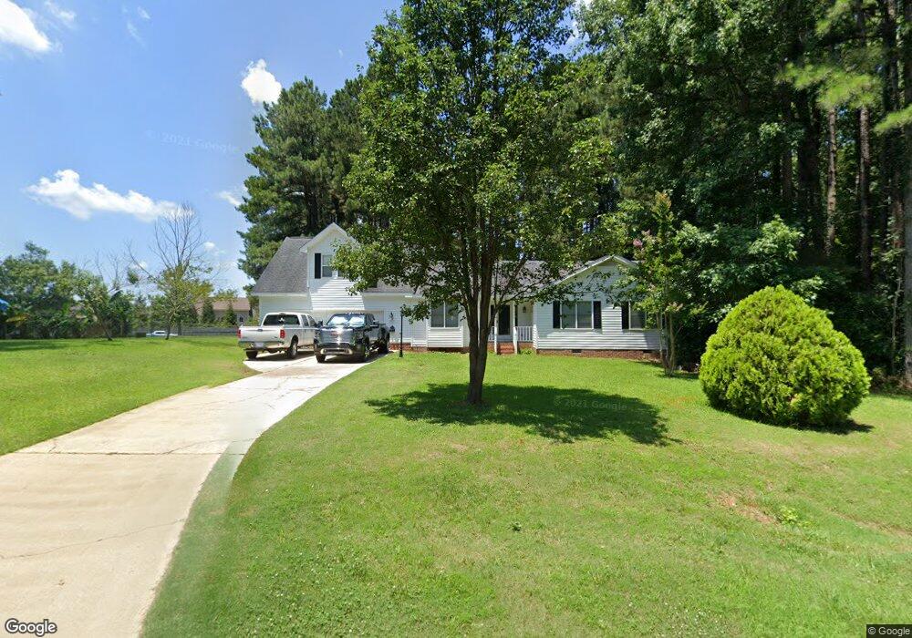
5604 Soft Wind Dr Fuquay Varina, NC 27526
Estimated Value: $295,000 - $341,000
3
Beds
2
Baths
1,325
Sq Ft
$241/Sq Ft
Est. Value
About This Home
This home is located at 5604 Soft Wind Dr, Fuquay Varina, NC 27526 and is currently estimated at $319,358, approximately $241 per square foot. 5604 Soft Wind Dr is a home located in Wake County with nearby schools including Banks Road Elementary School and West Lake Middle.
Ownership History
Date
Name
Owned For
Owner Type
Purchase Details
Closed on
Aug 9, 2021
Sold by
Wall Ronald Keith
Bought by
Haynes Terry R and Haynes Wendy C
Current Estimated Value
Home Financials for this Owner
Home Financials are based on the most recent Mortgage that was taken out on this home.
Original Mortgage
$175,000
Outstanding Balance
$133,169
Interest Rate
2.3%
Mortgage Type
New Conventional
Estimated Equity
$186,190
Purchase Details
Closed on
Feb 27, 2012
Sold by
Masterson John B and Masterson Sandra F
Bought by
Wall Ronald Keith and Wall Cynthia Ann
Create a Home Valuation Report for This Property
The Home Valuation Report is an in-depth analysis detailing your home's value as well as a comparison with similar homes in the area
Home Values in the Area
Average Home Value in this Area
Purchase History
| Date | Buyer | Sale Price | Title Company |
|---|---|---|---|
| Haynes Terry R | $230,000 | None Available | |
| Wall Ronald Keith | $142,000 | None Available |
Source: Public Records
Mortgage History
| Date | Status | Borrower | Loan Amount |
|---|---|---|---|
| Open | Haynes Terry R | $175,000 |
Source: Public Records
Tax History Compared to Growth
Tax History
| Year | Tax Paid | Tax Assessment Tax Assessment Total Assessment is a certain percentage of the fair market value that is determined by local assessors to be the total taxable value of land and additions on the property. | Land | Improvement |
|---|---|---|---|---|
| 2025 | $2,151 | $333,186 | $93,500 | $239,686 |
| 2024 | $2,089 | $333,186 | $93,500 | $239,686 |
| 2023 | $1,885 | $239,192 | $58,000 | $181,192 |
| 2022 | $1,747 | $239,192 | $58,000 | $181,192 |
| 2021 | $1,701 | $239,192 | $58,000 | $181,192 |
| 2020 | $1,673 | $239,192 | $58,000 | $181,192 |
| 2019 | $1,453 | $175,409 | $48,000 | $127,409 |
| 2018 | $1,336 | $175,409 | $48,000 | $127,409 |
| 2017 | $1,267 | $175,409 | $48,000 | $127,409 |
| 2016 | $1,242 | $175,409 | $48,000 | $127,409 |
| 2015 | $1,276 | $180,780 | $48,000 | $132,780 |
| 2014 | -- | $180,780 | $48,000 | $132,780 |
Source: Public Records
Map
Nearby Homes
- 3324 Air Park Rd
- 1601 Malcus Ct Unit 65
- 6208 Silver Spring Ct
- 3320 Highgate Rd
- 1320 Taylor Farm Rd
- 5817 Shedd Dr
- 1813 Middle Ridge Dr
- 9045 Chelsea Dr
- 4012 Sorrell Brothers Ct
- 6125 Willow Crest Ln
- 4313 Darius Ln
- 1504 Malcus Ct Unit 52
- 4313 Darius Ln Unit 25
- 4400 Emeline Way Unit 36
- 4301 Emeline Way Unit 15
- 1401 Malcus Ct Unit 58
- 9008 Chelsea Dr
- 6112 Walnut Glen Dr
- Macon Plan at Rowland's Grant
- Knox Plan at Rowland's Grant
- 5608 Soft Wind Dr
- 3433 Air Park Rd
- 5600 Soft Wind Dr
- 5601 Soft Wind Dr
- 3437 Air Park Rd
- 5605 Soft Wind Dr
- 2115 Stonewall Farms Dr
- 2115 Stonewall Farms Dr Unit 9
- 5612 Soft Wind Dr
- 2119 Stonewall Farms Dr
- 2123 Stonewall Farms Dr
- 2111 Stonewall Farms Dr
- 5609 Soft Wind Dr
- 3441 Air Park Rd
- 3400 Air Park Rd
- 0 Stonewall Farms Dr Unit 1831876
- 0 Stonewall Farms Dr Unit 2 TR1831876
- 0 Stonewall Farms Dr Unit 2
- 2127 Stonewall Farms Dr
- 3408 Air Park Rd