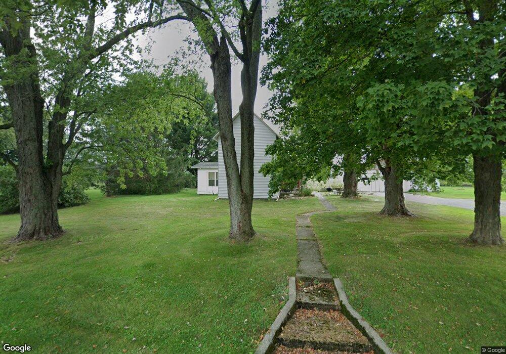
5605 E County Line Rd N Battle Ground, IN 47920
Estimated Value: $258,622 - $333,000
--
Bed
--
Bath
1,528
Sq Ft
$192/Sq Ft
Est. Value
About This Home
This home is located at 5605 E County Line Rd N, Battle Ground, IN 47920 and is currently estimated at $292,906, approximately $191 per square foot. 5605 E County Line Rd N is a home located in Tippecanoe County with nearby schools including Battle Ground Elementary School, Battle Ground Middle School, and William Henry Harrison High School.
Ownership History
Date
Name
Owned For
Owner Type
Purchase Details
Closed on
May 21, 2007
Sold by
Roudebush Jerry L
Bought by
Roudebush Marilyn R
Current Estimated Value
Purchase Details
Closed on
Mar 29, 2007
Sold by
Roudebush Evelyn J
Bought by
Roudebush Jerry L
Purchase Details
Closed on
Apr 2, 2004
Sold by
Roudebush Jerry L
Bought by
Roudebush Jerry L and Roudebush Evelyn J
Purchase Details
Closed on
Nov 24, 2003
Sold by
Daugherty Carl David and Roudebush Marilyn
Bought by
Miller Stan M and Miller Jimi Carter
Home Financials for this Owner
Home Financials are based on the most recent Mortgage that was taken out on this home.
Original Mortgage
$370,000
Interest Rate
6.01%
Mortgage Type
Purchase Money Mortgage
Create a Home Valuation Report for This Property
The Home Valuation Report is an in-depth analysis detailing your home's value as well as a comparison with similar homes in the area
Home Values in the Area
Average Home Value in this Area
Purchase History
| Date | Buyer | Sale Price | Title Company |
|---|---|---|---|
| Roudebush Marilyn R | -- | None Available | |
| Roudebush Jerry L | -- | None Available | |
| Roudebush Jerry L | -- | Conestoga Title Company | |
| Miller Stan M | -- | -- |
Source: Public Records
Mortgage History
| Date | Status | Borrower | Loan Amount |
|---|---|---|---|
| Previous Owner | Miller Stan M | $370,000 |
Source: Public Records
Tax History Compared to Growth
Tax History
| Year | Tax Paid | Tax Assessment Tax Assessment Total Assessment is a certain percentage of the fair market value that is determined by local assessors to be the total taxable value of land and additions on the property. | Land | Improvement |
|---|---|---|---|---|
| 2024 | $819 | $180,200 | $35,300 | $144,900 |
| 2023 | $890 | $175,400 | $35,300 | $140,100 |
| 2022 | $856 | $148,600 | $35,300 | $113,300 |
| 2021 | $740 | $134,700 | $35,300 | $99,400 |
| 2020 | $655 | $128,300 | $35,300 | $93,000 |
| 2019 | $625 | $125,100 | $35,300 | $89,800 |
| 2018 | $626 | $124,100 | $35,300 | $88,800 |
| 2017 | $606 | $121,300 | $35,300 | $86,000 |
| 2016 | $585 | $119,300 | $35,300 | $84,000 |
| 2014 | $480 | $110,100 | $35,300 | $74,800 |
| 2013 | $516 | $111,400 | $35,300 | $76,100 |
Source: Public Records
Map
Nearby Homes
- 1579 W Herring Way
- 9170 Herring Ln
- 9120 Herring Ln
- 12814 W Bicycle Bridge Rd
- 1578 W Herring Way Rd
- 7413 Greenview Dr
- 7020 Indian Mound Trail
- 7207 E Greenview Dr
- 10357 S Black Locust Ct
- 3886 E 1000 S
- 1109 E Creekside Ct
- 7319 N 300 E
- 404 Sherman St
- Lot 1 S 300 E
- 6209 Huston Rd
- 105 Tippecanoe St
- 203 Jefferson St
- 9099 Herring Ln
- 9060 Herring Ln
- 117 Holden Dr
- 3371 E 1300 S
- 12789 S 300 E
- 5200 E 900 N
- 5903 E Co Line N Rd N
- 0 E County Line Rd N
- 12645 S 300 E
- 3597 E 1300 S
- 12650 S 300 E
- 12618 S 300 E
- 6127 E Co Line N Rd N
- 2982 E 1250 S
- 12459 S 300 E
- 3795 E 1300 S
- 2924 E 1250 S
- 2955 E 1250 S
- 5030 E 900 N
- 2617 E 1300 S
- 12468 S 300 E
- 12417 S 300 E
- 4527 E Co Line N Rd N