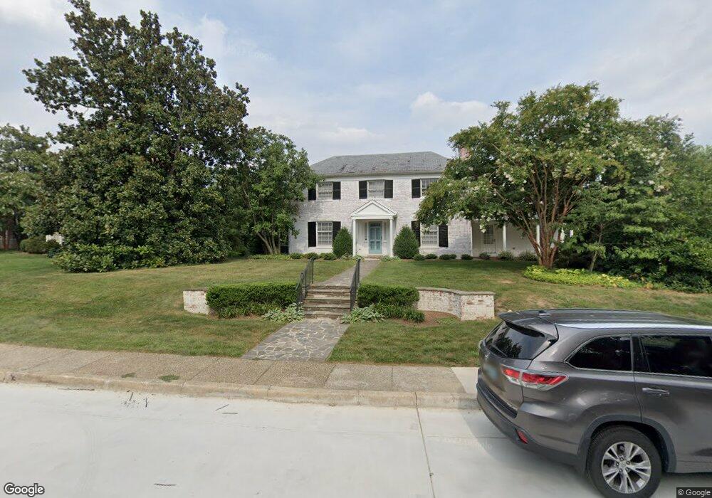
5605 Saint Albans Way Baltimore, MD 21212
Homeland NeighborhoodEstimated Value: $796,322
--
Bed
3
Baths
2,890
Sq Ft
$276/Sq Ft
Est. Value
About This Home
This home is located at 5605 Saint Albans Way, Baltimore, MD 21212 and is currently estimated at $796,322, approximately $275 per square foot. 5605 Saint Albans Way is a home located in Baltimore City with nearby schools including Roland Park Elementary/Middle School, Booker T. Washington Middle School, and Forest Park High School.
Ownership History
Date
Name
Owned For
Owner Type
Purchase Details
Closed on
May 21, 2013
Sold by
Orourk Thomas R and Orourk Maria Digges
Bought by
Malley Niall H O and Malley Maria Orourk O
Current Estimated Value
Home Financials for this Owner
Home Financials are based on the most recent Mortgage that was taken out on this home.
Original Mortgage
$603,000
Outstanding Balance
$131,011
Interest Rate
3.43%
Mortgage Type
New Conventional
Estimated Equity
$665,311
Create a Home Valuation Report for This Property
The Home Valuation Report is an in-depth analysis detailing your home's value as well as a comparison with similar homes in the area
Home Values in the Area
Average Home Value in this Area
Purchase History
| Date | Buyer | Sale Price | Title Company |
|---|---|---|---|
| Malley Niall H O | $615,000 | Penfed Title Llc |
Source: Public Records
Mortgage History
| Date | Status | Borrower | Loan Amount |
|---|---|---|---|
| Open | Malley Niall H O | $603,000 |
Source: Public Records
Tax History Compared to Growth
Tax History
| Year | Tax Paid | Tax Assessment Tax Assessment Total Assessment is a certain percentage of the fair market value that is determined by local assessors to be the total taxable value of land and additions on the property. | Land | Improvement |
|---|---|---|---|---|
| 2025 | $15,098 | $655,667 | -- | -- |
| 2024 | $15,098 | $642,800 | $305,900 | $336,900 |
| 2023 | $14,627 | $622,733 | $0 | $0 |
| 2022 | $14,223 | $602,667 | $0 | $0 |
| 2021 | $13,749 | $582,600 | $305,900 | $276,700 |
| 2020 | $13,603 | $576,400 | $0 | $0 |
| 2019 | $13,393 | $570,200 | $0 | $0 |
| 2018 | $13,310 | $564,000 | $305,900 | $258,100 |
| 2017 | $13,310 | $564,000 | $0 | $0 |
| 2016 | $9,635 | $564,000 | $0 | $0 |
| 2015 | $9,635 | $565,800 | $0 | $0 |
| 2014 | $9,635 | $565,800 | $0 | $0 |
Source: Public Records
Map
Nearby Homes
- 5510 N Charles St
- 11 W Melrose Ave
- 5804 N Charles St
- 5806 N Charles St
- 307 E Lake Ave
- 6235 Bellona Ave
- 102 Cotswold Rd
- 6003 Henderson Ave
- 442 Rosebank Ave
- 5208 Tilbury Way
- 6316 Mossway
- 437,439,441,443,&445 Kenneth Square
- 2A Gittings Ave
- 406 Lyman Ave
- 405 Lyman Ave
- 411 Gittings Ave
- 5706 Bellona Ave
- 5806 Halwyn Ave
- 5712 Roland Ave Unit TC
- 443 Schwartz Ave
- 5607 Saint Albans Way
- 5602 Enderly Rd
- 5604 Enderly Rd
- 200 Churchwardens Rd
- 5604 Saint Albans Way
- 5609 Saint Albans Way
- 120 Churchwardens Rd
- 5606 Saint Albans Way
- 5606 Enderly Rd
- 5608 Saint Albans Way
- 5611 Saint Albans Way
- 5610 Saint Albans Way
- 5608 Enderly Rd
- 110 Churchwardens Rd
- 202 Churchwardens Rd
- 5603 Enderly Rd
- 104 Churchwardens Rd
- 5613 Saint Albans Way
- 5612 Saint Albans Way
- 102 Churchwardens Rd