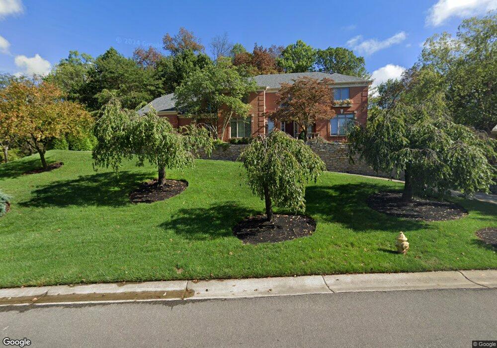
5606 Brookstone Dr Cincinnati, OH 45230
Salem Heights NeighborhoodEstimated Value: $851,223 - $897,000
4
Beds
3
Baths
4,126
Sq Ft
$211/Sq Ft
Est. Value
About This Home
This home is located at 5606 Brookstone Dr, Cincinnati, OH 45230 and is currently estimated at $868,806, approximately $210 per square foot. 5606 Brookstone Dr is a home located in Hamilton County with nearby schools including Sherwood Elementary School, Nagel Middle School, and Anderson High School.
Ownership History
Date
Name
Owned For
Owner Type
Purchase Details
Closed on
Jun 24, 1994
Sold by
Zaring Homes Inc
Bought by
Sebring Joseph B and Sebring Judith L
Current Estimated Value
Home Financials for this Owner
Home Financials are based on the most recent Mortgage that was taken out on this home.
Original Mortgage
$160,000
Interest Rate
8.78%
Create a Home Valuation Report for This Property
The Home Valuation Report is an in-depth analysis detailing your home's value as well as a comparison with similar homes in the area
Home Values in the Area
Average Home Value in this Area
Purchase History
| Date | Buyer | Sale Price | Title Company |
|---|---|---|---|
| Sebring Joseph B | -- | -- |
Source: Public Records
Mortgage History
| Date | Status | Borrower | Loan Amount |
|---|---|---|---|
| Closed | Sebring Joseph B | $160,000 |
Source: Public Records
Tax History
| Year | Tax Paid | Tax Assessment Tax Assessment Total Assessment is a certain percentage of the fair market value that is determined by local assessors to be the total taxable value of land and additions on the property. | Land | Improvement |
|---|---|---|---|---|
| 2025 | $16,026 | $251,132 | $41,426 | $209,706 |
| 2024 | $15,915 | $251,132 | $41,426 | $209,706 |
| 2023 | $14,936 | $251,132 | $41,426 | $209,706 |
| 2022 | $13,220 | $197,737 | $42,557 | $155,180 |
| 2021 | $13,145 | $197,737 | $42,557 | $155,180 |
| 2020 | $12,998 | $197,737 | $42,557 | $155,180 |
| 2019 | $12,724 | $174,986 | $37,660 | $137,326 |
| 2018 | $11,935 | $174,986 | $37,660 | $137,326 |
| 2017 | $11,405 | $174,986 | $37,660 | $137,326 |
| 2016 | $12,577 | $186,649 | $38,308 | $148,341 |
| 2015 | $12,104 | $186,649 | $38,308 | $148,341 |
| 2014 | $12,092 | $186,649 | $38,308 | $148,341 |
| 2013 | $10,930 | $177,762 | $36,484 | $141,278 |
Source: Public Records
Map
Nearby Homes
- 1484 Apple Farm Ln
- 3 Salem Rd
- 2 Salem Rd
- 4 Salem Rd
- 1190 Linden Hill Ln
- 770 Sutton Rd
- 1 Salem Rd
- 1069 Doolittle Ln
- 1508 Beth Ln
- 6952 Shadow Ridge Rd
- 6029 Lockard Ave
- 6201 Thole Rd
- 6023 Squirehill Ct
- 6123 Cambridge Ave
- 5965 Wayside Ave
- 1341 Mayland Dr
- 6050 Colter Ave
- 1229 Meadowbright Ln
- 5818 Croslin St
- 1741 Mears Ave
- 5620 Brookstone Dr
- 5607 Brookstone Dr
- 1260 Apple Hill Rd
- 1256 Coventry Woods Dr
- 5619 Brookstone Dr
- 5630 Brookstone Dr
- 1254 Coventry Woods Dr
- 5675 Salem Rd
- 5629 Brookstone Dr
- 1196 Apple Hill Rd
- 1252 Coventry Woods Dr
- 1258 Coventry Woods Dr
- 5650 Brookstone Dr
- 1 Apple Farm Ln
- 2 Apple Farm Ln
- 1404 Apple Farm Ln
- 1209 Apple Hill Rd
- 1110 Coventry Woods Dr
- 1250 Coventry Woods Dr
- 1250 Coventry Woods Dr Unit 25
Your Personal Tour Guide
Ask me questions while you tour the home.