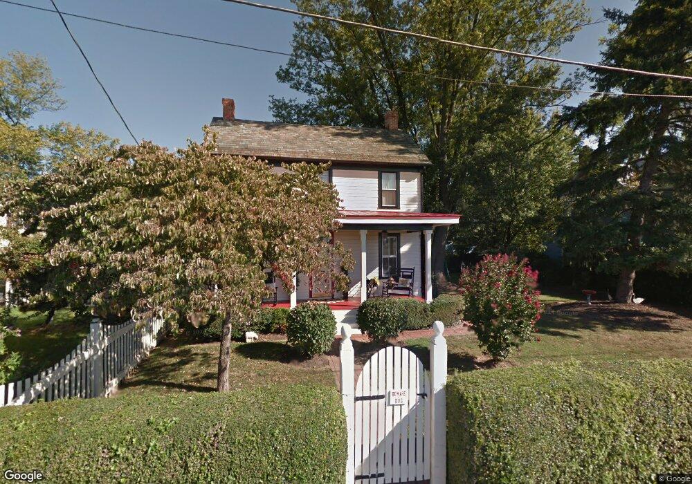
5608 Adamstown Rd Adamstown, MD 21710
Estimated Value: $300,236 - $456,000
--
Bed
1
Bath
1,648
Sq Ft
$234/Sq Ft
Est. Value
About This Home
This home is located at 5608 Adamstown Rd, Adamstown, MD 21710 and is currently estimated at $385,559, approximately $233 per square foot. 5608 Adamstown Rd is a home located in Frederick County with nearby schools including Carroll Manor Elementary School, Ballenger Creek Middle School, and Tuscarora High School.
Ownership History
Date
Name
Owned For
Owner Type
Purchase Details
Closed on
Feb 21, 1990
Sold by
Royer William D and Royer Nancy H
Bought by
Garrett Ashton M and Garrett Sharon H
Current Estimated Value
Home Financials for this Owner
Home Financials are based on the most recent Mortgage that was taken out on this home.
Original Mortgage
$92,641
Interest Rate
10.1%
Purchase Details
Closed on
Nov 30, 1983
Sold by
Benton David M and Benton Deborah K
Bought by
Royer William D and Royer Nancy H
Home Financials for this Owner
Home Financials are based on the most recent Mortgage that was taken out on this home.
Original Mortgage
$12,000
Interest Rate
13.43%
Create a Home Valuation Report for This Property
The Home Valuation Report is an in-depth analysis detailing your home's value as well as a comparison with similar homes in the area
Home Values in the Area
Average Home Value in this Area
Purchase History
| Date | Buyer | Sale Price | Title Company |
|---|---|---|---|
| Garrett Ashton M | $119,000 | -- | |
| Royer William D | $80,000 | -- |
Source: Public Records
Mortgage History
| Date | Status | Borrower | Loan Amount |
|---|---|---|---|
| Closed | Garrett Ashton M | $92,641 | |
| Previous Owner | Royer William D | $12,000 |
Source: Public Records
Tax History Compared to Growth
Tax History
| Year | Tax Paid | Tax Assessment Tax Assessment Total Assessment is a certain percentage of the fair market value that is determined by local assessors to be the total taxable value of land and additions on the property. | Land | Improvement |
|---|---|---|---|---|
| 2025 | $3,106 | $260,733 | -- | -- |
| 2024 | $3,106 | $249,200 | $96,600 | $152,600 |
| 2023 | $2,880 | $240,400 | $0 | $0 |
| 2022 | $2,778 | $231,600 | $0 | $0 |
| 2021 | $2,633 | $222,800 | $88,100 | $134,700 |
| 2020 | $2,633 | $219,133 | $0 | $0 |
| 2019 | $2,590 | $215,467 | $0 | $0 |
| 2018 | $2,570 | $211,800 | $76,200 | $135,600 |
| 2017 | $2,509 | $211,800 | $0 | $0 |
| 2016 | $2,610 | $205,067 | $0 | $0 |
| 2015 | $2,610 | $201,700 | $0 | $0 |
| 2014 | $2,610 | $201,700 | $0 | $0 |
Source: Public Records
Map
Nearby Homes
- 5798 Morland Dr N
- 5523 Modly Ct
- 2735 Tuscarora St
- 2731 Tuscarora St
- 2730 Tuscarora St
- 2734 Tuscarora St
- Macon II Plan at The Enclave at Carrollton Manor
- Adamstown Plan at The Enclave at Carrollton Manor
- Fayetteville Plan at The Enclave at Carrollton Manor
- Oban Plan at The Enclave at Carrollton Manor
- 000 Modly Ct
- 00 Modly Ct
- 00000 Modly Ct
- 0000 Modly Ct
- 5880 Union Ridge Dr
- 2727 Bill Dorsey Blvd
- 2730 John Mills Rd
- 2422 Doubs Ct
- 3039 Ballenger Creek Pike
- 6230 Manor Woods Rd
- 5610 Adamstown Rd
- 5604 Adamstown Rd
- 5602 Adamstown Rd
- 5614 Adamstown Rd
- 5525 Adamstown Rd
- 2807 Decatur Dr
- 2805 Decatur Dr
- 5515 Adamstown Rd
- 5819 Morland Dr N
- 2803 Decatur Dr
- 5693 Adamstown Rd
- 5817 Morland Dr N
- 2801 Decatur Dr
- 5509 Adamstown Rd
- 5820 Morland Dr N
- 5815 Morland Dr N
- 5536 Adamstown Rd
- 5818 Morland Dr N
- 5552 Mountville Rd
- 2799 Decatur Dr