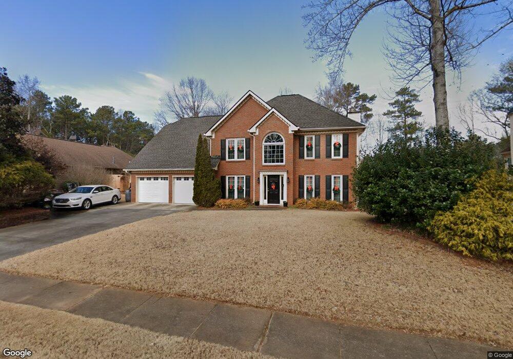
5608 Brookstone Dr NW Unit 1 Acworth, GA 30101
Estimated Value: $504,671 - $565,000
4
Beds
3
Baths
2,908
Sq Ft
$181/Sq Ft
Est. Value
About This Home
This home is located at 5608 Brookstone Dr NW Unit 1, Acworth, GA 30101 and is currently estimated at $526,418, approximately $181 per square foot. 5608 Brookstone Dr NW Unit 1 is a home located in Cobb County with nearby schools including Pickett's Mill Elementary School, Durham Middle School, and Allatoona High School.
Ownership History
Date
Name
Owned For
Owner Type
Purchase Details
Closed on
Feb 16, 2016
Sold by
Barba Geoffrey S
Bought by
Barba Geoffrey S and Barba Linda J
Current Estimated Value
Purchase Details
Closed on
Apr 28, 2000
Sold by
Magnussen David L and Magnussen Catherine M
Bought by
Barha Geoffrey S
Home Financials for this Owner
Home Financials are based on the most recent Mortgage that was taken out on this home.
Original Mortgage
$152,800
Interest Rate
8.28%
Mortgage Type
New Conventional
Purchase Details
Closed on
May 30, 1997
Sold by
Giles Walter L and Giles Margaret D
Bought by
Magnussen David L and Magnussen Catherine M
Home Financials for this Owner
Home Financials are based on the most recent Mortgage that was taken out on this home.
Original Mortgage
$168,400
Interest Rate
7.97%
Mortgage Type
New Conventional
Create a Home Valuation Report for This Property
The Home Valuation Report is an in-depth analysis detailing your home's value as well as a comparison with similar homes in the area
Home Values in the Area
Average Home Value in this Area
Purchase History
| Date | Buyer | Sale Price | Title Company |
|---|---|---|---|
| Barba Geoffrey S | -- | -- | |
| Barha Geoffrey S | $191,000 | -- | |
| Magnussen David L | $177,300 | -- |
Source: Public Records
Mortgage History
| Date | Status | Borrower | Loan Amount |
|---|---|---|---|
| Previous Owner | Barha Geoffrey S | $152,800 | |
| Previous Owner | Magnussen David L | $168,400 |
Source: Public Records
Tax History Compared to Growth
Tax History
| Year | Tax Paid | Tax Assessment Tax Assessment Total Assessment is a certain percentage of the fair market value that is determined by local assessors to be the total taxable value of land and additions on the property. | Land | Improvement |
|---|---|---|---|---|
| 2024 | $1,148 | $203,756 | $52,000 | $151,756 |
| 2023 | $796 | $154,920 | $34,000 | $120,920 |
| 2022 | $1,002 | $154,920 | $34,000 | $120,920 |
| 2021 | $884 | $115,556 | $34,000 | $81,556 |
| 2020 | $861 | $107,556 | $26,000 | $81,556 |
| 2019 | $861 | $107,556 | $26,000 | $81,556 |
| 2018 | $807 | $89,764 | $24,000 | $65,764 |
| 2017 | $2,216 | $89,764 | $24,000 | $65,764 |
| 2016 | $2,178 | $87,944 | $24,000 | $63,944 |
| 2015 | $2,247 | $88,724 | $24,000 | $64,724 |
| 2014 | $2,264 | $88,724 | $0 | $0 |
Source: Public Records
Map
Nearby Homes
- 1799 Mclain Rd NW
- 5485 Brookstone Dr NW
- 5654 Brookstone Dr NW
- 5711 Brynwood Cir NW
- The Ashburn Plan at Woodford
- The Rebecca Plan at Woodford
- The Dillard Plan at Woodford
- The Oxford Plan at Woodford
- The Pinehurst Plan at Woodford
- The Trenton Plan at Woodford
- The Vinings Plan at Woodford
- The Bainbridge Plan at Woodford
- The Brooks Plan at Woodford
- The Evans Plan at Woodford
- 1963 Heatherbrooke Ln NW
- 1670 Knob Creek Ct NW
- 1496 Fallsbrook Ct NW
- 002 Knob Creek Ct NW
- 2009 Mclain Rd NW
- 5362 Manor View Dr NW Unit 12
- 5610 Brookstone Dr NW
- 5606 Brookstone Dr NW Unit 29
- 5606 Brookstone Dr NW
- 1815 Mclain Rd NW
- 5607 Brookstone Dr NW
- 5612 Brookstone Dr NW
- 1736 Brookstone Way NW Unit 1
- 5604 Brookstone Dr NW
- 1739 Brookstone Ln NW
- 5602 Brookstone Dr NW
- 5614 Brookstone Dr NW
- 1734 Brookstone Way NW Unit 1
- 1735 Brookstone Way NW
- 02 Brookstone Dr NW
- 01 Brookstone Dr NW Unit 39
- 01 Brookstone Dr NW
- 1740 Brookstone Ln NW
- 1737 Brookstone Ln NW Unit 1
- 0 Brookstone Way Unit 8585287
- 0 Brookstone Way Unit 8428289