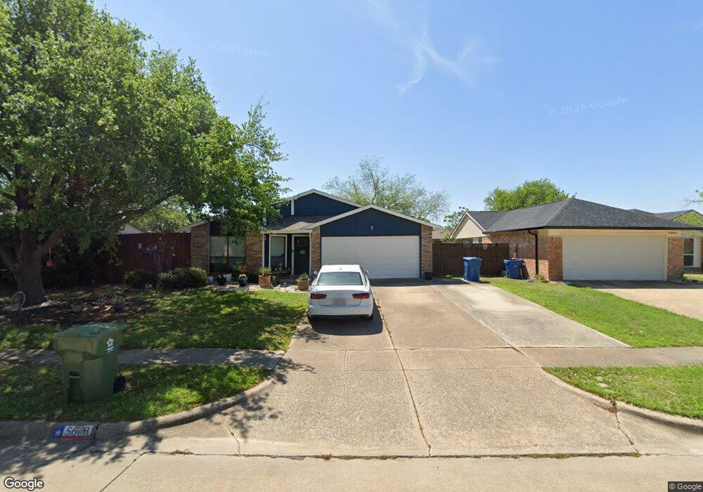
5608 Powers St the Colony, TX 75056
Estimated Value: $300,474 - $329,000
3
Beds
2
Baths
1,294
Sq Ft
$244/Sq Ft
Est. Value
About This Home
This home is located at 5608 Powers St, the Colony, TX 75056 and is currently estimated at $315,119, approximately $243 per square foot. 5608 Powers St is a home located in Denton County with nearby schools including B B Owen Elementary School, Griffin Middle School, and The Colony High School.
Ownership History
Date
Name
Owned For
Owner Type
Purchase Details
Closed on
Oct 28, 1997
Sold by
Paul Dewey and Paul Sheila Kay
Bought by
Vargas Rodney F and Vargas Lisa D
Current Estimated Value
Home Financials for this Owner
Home Financials are based on the most recent Mortgage that was taken out on this home.
Original Mortgage
$76,735
Outstanding Balance
$12,582
Interest Rate
7.27%
Mortgage Type
VA
Estimated Equity
$302,537
Purchase Details
Closed on
Jul 15, 1994
Sold by
Wood Ricky Floyd and Wood Debora Sue
Bought by
Paul Dewey and Paul Sheila Kay
Home Financials for this Owner
Home Financials are based on the most recent Mortgage that was taken out on this home.
Original Mortgage
$63,681
Interest Rate
8.21%
Mortgage Type
Seller Take Back
Create a Home Valuation Report for This Property
The Home Valuation Report is an in-depth analysis detailing your home's value as well as a comparison with similar homes in the area
Home Values in the Area
Average Home Value in this Area
Purchase History
| Date | Buyer | Sale Price | Title Company |
|---|---|---|---|
| Vargas Rodney F | -- | -- | |
| Paul Dewey | -- | -- |
Source: Public Records
Mortgage History
| Date | Status | Borrower | Loan Amount |
|---|---|---|---|
| Open | Vargas Rodney F | $76,735 | |
| Previous Owner | Paul Dewey | $63,681 |
Source: Public Records
Tax History Compared to Growth
Tax History
| Year | Tax Paid | Tax Assessment Tax Assessment Total Assessment is a certain percentage of the fair market value that is determined by local assessors to be the total taxable value of land and additions on the property. | Land | Improvement |
|---|---|---|---|---|
| 2025 | $3,593 | $255,200 | $71,610 | $183,590 |
| 2024 | $4,771 | $245,852 | $0 | $0 |
| 2023 | $3,208 | $223,502 | $61,380 | $206,620 |
| 2022 | $4,266 | $203,184 | $61,380 | $168,620 |
| 2021 | $4,114 | $191,539 | $47,740 | $143,799 |
| 2020 | $3,732 | $167,920 | $47,740 | $141,707 |
| 2019 | $3,504 | $152,655 | $47,740 | $129,260 |
| 2018 | $3,206 | $138,777 | $47,740 | $113,751 |
| 2017 | $2,947 | $126,161 | $35,464 | $105,577 |
| 2016 | $2,679 | $114,692 | $35,464 | $91,745 |
| 2015 | $2,074 | $104,265 | $19,437 | $90,132 |
| 2013 | -- | $86,169 | $19,437 | $66,732 |
Source: Public Records
Map
Nearby Homes
- 5548 Rice Dr
- 5612 Pearce St
- 5549 Ragan Dr
- 5528 King Dr
- 5613 Woodlands Dr
- 5617 Woodlands Dr
- 5621 Woodlands Dr
- 5400 N Colony Blvd
- 5633 Trego St
- 5500 Slay Dr
- 5305 Sagers Blvd
- 5529 Gates Dr
- 5513 Rearn Dr
- 5220 Gibson Dr
- 5512 Gates Dr
- 5204 Gibson Dr
- 6705 Matson Dr
- 5200 Gibson Dr
- 5632 Westwood Ln
- 5605 Overland Dr
- 5604 Powers St
- 5612 Powers St
- 5611 Foster St
- 5600 Powers St
- 5605 Powers St
- 5607 Foster St
- 5601 Powers St
- 5609 Powers St
- 5613 Powers St
- 5603 Foster St
- 5626 Foster St
- 5630 Foster St
- 5622 Foster St
- 5617 Powers St
- 5618 Foster St
- 5557 Adams Dr
- 5621 Powers St
- 5601 N Colony Blvd
- 5605 N Colony Blvd
- 5614 Foster St