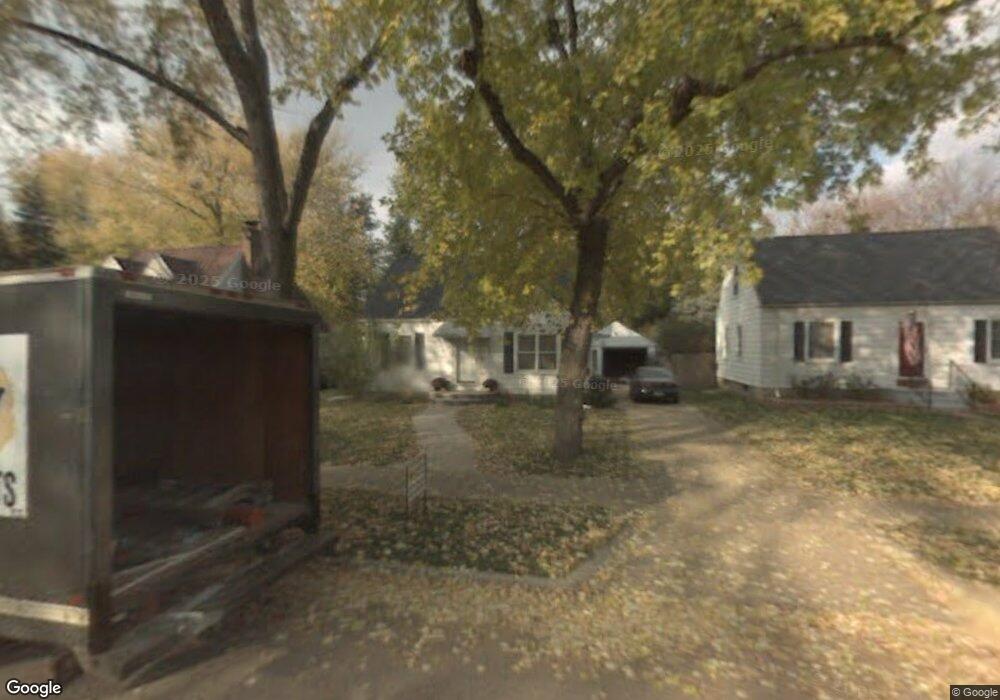
561 Brookland Blvd Lansing, MI 48910
Old Everett NeighborhoodEstimated Value: $141,645 - $188,000
--
Bed
--
Bath
1,137
Sq Ft
$145/Sq Ft
Est. Value
About This Home
This home is located at 561 Brookland Blvd, Lansing, MI 48910 and is currently estimated at $165,161, approximately $145 per square foot. 561 Brookland Blvd is a home located in Ingham County with nearby schools including Lyons Elementary School, Attwood School, and Everett High School.
Ownership History
Date
Name
Owned For
Owner Type
Purchase Details
Closed on
Mar 21, 2002
Sold by
Burger Russell H
Bought by
Burger Russell H and Burger Julie A
Current Estimated Value
Home Financials for this Owner
Home Financials are based on the most recent Mortgage that was taken out on this home.
Original Mortgage
$52,600
Interest Rate
6.82%
Mortgage Type
Purchase Money Mortgage
Create a Home Valuation Report for This Property
The Home Valuation Report is an in-depth analysis detailing your home's value as well as a comparison with similar homes in the area
Home Values in the Area
Average Home Value in this Area
Purchase History
| Date | Buyer | Sale Price | Title Company |
|---|---|---|---|
| Burger Russell H | -- | -- |
Source: Public Records
Mortgage History
| Date | Status | Borrower | Loan Amount |
|---|---|---|---|
| Closed | Burger Russell H | $52,600 |
Source: Public Records
Tax History Compared to Growth
Tax History
| Year | Tax Paid | Tax Assessment Tax Assessment Total Assessment is a certain percentage of the fair market value that is determined by local assessors to be the total taxable value of land and additions on the property. | Land | Improvement |
|---|---|---|---|---|
| 2025 | $2,828 | $69,700 | $9,700 | $60,000 |
| 2024 | $22 | $63,600 | $9,700 | $53,900 |
| 2023 | $2,652 | $58,300 | $9,700 | $48,600 |
| 2022 | $2,392 | $52,200 | $9,300 | $42,900 |
| 2021 | $2,342 | $48,100 | $4,200 | $43,900 |
| 2020 | $2,327 | $45,700 | $4,200 | $41,500 |
| 2019 | $2,231 | $41,200 | $4,200 | $37,000 |
| 2018 | $2,091 | $37,500 | $4,200 | $33,300 |
| 2017 | $2,002 | $37,500 | $4,200 | $33,300 |
| 2016 | $1,914 | $36,100 | $4,200 | $31,900 |
| 2015 | $1,914 | $34,500 | $8,407 | $26,093 |
| 2014 | $1,914 | $33,800 | $8,407 | $25,393 |
Source: Public Records
Map
Nearby Homes
- 610 N Dexter Dr
- 3216 Ellen Ave
- 3145 S Cedar St
- 3114 Alden Dr
- 413 E Hodge Ave
- 3101 Plymouth Dr
- 3319 Jewell Ave
- 3603 Parkway Dr
- 3611 Homewood Ave
- 3725 Parkway Dr
- 100 Dunlap St
- 626 Tisdale Ave
- 3805 Donald St
- 3716 S Pennsylvania Ave
- 601 Tisdale Ave
- 701 Tisdale Ave
- 538 Pacific Ave
- 736 Fenton St
- 2340 S Pennsylvania Ave
- 709 Jessop Ave
- 565 Brookland Blvd
- 555 Brookland Blvd
- 571 Brookland Blvd
- 551 Brookland Blvd
- 544 N Dexter Dr
- 548 N Dexter Dr
- 536 N Dexter Dr
- 530 N Dexter Dr
- 552 N Dexter Dr
- 524 N Dexter Dr
- 601 Brookland Blvd
- 560 Brookland Blvd
- 556 N Dexter Dr
- 564 Brookland Blvd
- 556 Brookland Blvd
- 518 N Dexter Dr
- 570 Brookland Blvd
- 512 N Dexter Dr
- 605 Brookland Blvd