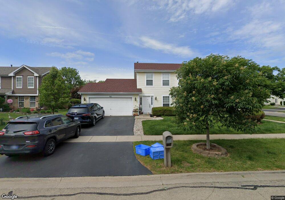
561 Buckboard Rd Bolingbrook, IL 60490
Lily Cache NeighborhoodEstimated Value: $310,000 - $383,000
3
Beds
3
Baths
1,520
Sq Ft
$227/Sq Ft
Est. Value
About This Home
This home is located at 561 Buckboard Rd, Bolingbrook, IL 60490 and is currently estimated at $345,593, approximately $227 per square foot. 561 Buckboard Rd is a home located in Will County with nearby schools including Pioneer Elementary School, Brooks Middle School, and Bolingbrook High School.
Ownership History
Date
Name
Owned For
Owner Type
Purchase Details
Closed on
Jun 25, 2021
Sold by
Silva Magdalena and Silva David
Bought by
Silva Magdalena and Silva David
Current Estimated Value
Home Financials for this Owner
Home Financials are based on the most recent Mortgage that was taken out on this home.
Original Mortgage
$167,500
Outstanding Balance
$154,123
Interest Rate
3.87%
Mortgage Type
New Conventional
Estimated Equity
$191,470
Purchase Details
Closed on
Jan 19, 2009
Sold by
Silva Magdalena
Bought by
Silva Magdalena and Silva David
Home Financials for this Owner
Home Financials are based on the most recent Mortgage that was taken out on this home.
Original Mortgage
$226,017
Interest Rate
5.09%
Mortgage Type
FHA
Purchase Details
Closed on
Aug 29, 2005
Sold by
Marou Sameeh and Marou Mary
Bought by
Silva Magdalena
Home Financials for this Owner
Home Financials are based on the most recent Mortgage that was taken out on this home.
Original Mortgage
$183,600
Interest Rate
6.55%
Mortgage Type
Balloon
Purchase Details
Closed on
Sep 13, 2003
Sold by
Marou Sameeh and Marou Mary
Bought by
Marou Sameeh and Marou Mary
Home Financials for this Owner
Home Financials are based on the most recent Mortgage that was taken out on this home.
Original Mortgage
$110,000
Interest Rate
5.66%
Mortgage Type
New Conventional
Purchase Details
Closed on
Apr 6, 1998
Sold by
Manalo Emerito and Manalo Elizabeth
Bought by
Manalo Emerito and Manalo Manolo Elizabeth
Home Financials for this Owner
Home Financials are based on the most recent Mortgage that was taken out on this home.
Original Mortgage
$136,200
Interest Rate
7.19%
Purchase Details
Closed on
Nov 28, 1995
Sold by
Welsh Thomas F and Welsch Judith A
Bought by
Manalo Emerito and Manalo Elizabeth
Home Financials for this Owner
Home Financials are based on the most recent Mortgage that was taken out on this home.
Original Mortgage
$132,107
Interest Rate
7.44%
Mortgage Type
FHA
Create a Home Valuation Report for This Property
The Home Valuation Report is an in-depth analysis detailing your home's value as well as a comparison with similar homes in the area
Home Values in the Area
Average Home Value in this Area
Purchase History
| Date | Buyer | Sale Price | Title Company |
|---|---|---|---|
| Silva Magdalena | -- | National Title Solutions Inc | |
| Silva Magdalena | -- | None Available | |
| Silva Magdalena | $229,500 | -- | |
| Marou Sameeh | -- | -- | |
| Manalo Emerito | -- | Chicago Title Insurance Co | |
| Manalo Emerito | $136,000 | Law Title |
Source: Public Records
Mortgage History
| Date | Status | Borrower | Loan Amount |
|---|---|---|---|
| Open | Silva Magdalena | $167,500 | |
| Closed | Silva Magdalena | $226,017 | |
| Closed | Silva Magdalena | $183,600 | |
| Previous Owner | Marou Sameeh | $110,000 | |
| Previous Owner | Manalo Emerito | $136,200 | |
| Previous Owner | Manalo Emerito | $132,107 |
Source: Public Records
Tax History
| Year | Tax Paid | Tax Assessment Tax Assessment Total Assessment is a certain percentage of the fair market value that is determined by local assessors to be the total taxable value of land and additions on the property. | Land | Improvement |
|---|---|---|---|---|
| 2024 | $8,630 | $101,440 | $19,560 | $81,880 |
| 2023 | $8,630 | $91,272 | $17,599 | $73,673 |
| 2022 | $7,541 | $82,286 | $15,866 | $66,420 |
| 2021 | $7,142 | $76,939 | $14,835 | $62,104 |
| 2020 | $6,920 | $74,409 | $14,347 | $60,062 |
| 2019 | $6,692 | $70,866 | $13,664 | $57,202 |
| 2018 | $6,422 | $67,827 | $13,078 | $54,749 |
| 2017 | $6,109 | $64,291 | $12,396 | $51,895 |
| 2016 | $5,928 | $61,200 | $11,800 | $49,400 |
| 2015 | $5,869 | $58,700 | $11,300 | $47,400 |
| 2014 | $5,869 | $60,500 | $11,600 | $48,900 |
| 2013 | $5,869 | $60,500 | $11,600 | $48,900 |
Source: Public Records
Map
Nearby Homes
- 566 Pinebrook Dr
- 1445 Somerfield Dr
- 402 S Palmer Dr Unit 2B
- 842 Dalton Ln Unit 1
- 452 Pheasant Chase Dr
- 402 Marshall Ash St Unit 3
- 1472 Misty Ln Unit 2B
- 301 Inner Circle Dr
- 420 Quarry Dr
- 1568 Woodland Ln
- 504 Pheasant Chase Dr
- 749 Lenox Ave
- 1404 Lily Cache Ln
- 725 Delacourte Ave
- 313 Thistle Dr
- 803 Lenox Ave
- 358 Thistle Dr
- 1582 Arlington St
- 7 Pampas Ct
- 1450 Shaman Dr
- 567 Buckboard Rd
- 620 Harvest Dr
- 626 Harvest Dr
- 573 Buckboard Rd
- 1351 Parkside Dr
- 1360 Parkside Dr
- 1372 Parkside Dr
- 632 Harvest Dr
- 1354 Parkside Dr
- 579 Buckboard Rd
- 1378 Parkside Dr
- 1 Buckboard Ct
- 1343 Parkside Dr
- 638 Harvest Dr
- 1348 Parkside Dr
- 1381 Parkside Dr
- 1384 Parkside Dr
- 585 Buckboard Rd
- 2 Buckboard Ct
- 644 Harvest Dr
Your Personal Tour Guide
Ask me questions while you tour the home.