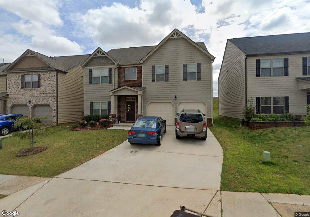
561 Emporia Loop Unit 24 Mc Donough, GA 30253
Estimated Value: $317,364 - $355,000
4
Beds
3
Baths
2,693
Sq Ft
$125/Sq Ft
Est. Value
About This Home
This home is located at 561 Emporia Loop Unit 24, Mc Donough, GA 30253 and is currently estimated at $335,591, approximately $124 per square foot. 561 Emporia Loop Unit 24 is a home located in Henry County with nearby schools including Wesley Lakes Elementary School, Eagle's Landing Middle School, and Eagle's Landing High School.
Ownership History
Date
Name
Owned For
Owner Type
Purchase Details
Closed on
Feb 22, 2019
Sold by
Rrcap Sfr Iv Llc
Bought by
Cerberus Sfr Holdings Ii Lp
Current Estimated Value
Purchase Details
Closed on
Jun 26, 2018
Sold by
Dr Horton Wph Llc
Bought by
Rrcap Sfr Iv Llc
Purchase Details
Closed on
Jul 14, 2017
Sold by
Gdci Ga 5 Lp
Bought by
Dr Horton Wph Llc
Purchase Details
Closed on
May 21, 2015
Sold by
Hamilton State Bank
Bought by
Pembrooke Henry Llc
Purchase Details
Closed on
Apr 7, 2015
Sold by
Kelly Capital Investments Llc
Bought by
Hamilton State Bank
Create a Home Valuation Report for This Property
The Home Valuation Report is an in-depth analysis detailing your home's value as well as a comparison with similar homes in the area
Home Values in the Area
Average Home Value in this Area
Purchase History
| Date | Buyer | Sale Price | Title Company |
|---|---|---|---|
| Cerberus Sfr Holdings Ii Lp | $1,246,700 | -- | |
| Rrcap Sfr Iv Llc | $224,000 | -- | |
| Dr Horton Wph Llc | $166,316 | -- | |
| Pembrooke Henry Llc | $5,000,000 | -- | |
| Hamilton State Bank | -- | -- |
Source: Public Records
Tax History Compared to Growth
Tax History
| Year | Tax Paid | Tax Assessment Tax Assessment Total Assessment is a certain percentage of the fair market value that is determined by local assessors to be the total taxable value of land and additions on the property. | Land | Improvement |
|---|---|---|---|---|
| 2025 | $5,773 | $143,960 | $18,000 | $125,960 |
| 2024 | $5,773 | $136,800 | $18,000 | $118,800 |
| 2023 | $5,922 | $152,240 | $20,000 | $132,240 |
| 2022 | $3,581 | $91,240 | $18,000 | $73,240 |
| 2021 | $3,581 | $91,240 | $18,000 | $73,240 |
| 2020 | $3,581 | $91,240 | $18,000 | $73,240 |
| 2019 | $3,400 | $86,520 | $16,800 | $69,720 |
| 2018 | $3,103 | $78,760 | $14,000 | $64,760 |
| 2016 | $219 | $4,620 | $4,620 | $0 |
| 2015 | $469 | $10,800 | $10,800 | $0 |
| 2014 | -- | $2,600 | $2,600 | $0 |
Source: Public Records
Map
Nearby Homes
- 161 Swindon Dr
- 3324 Baylor Cir
- 150 Spyglass Cir
- 3277 Baylor Cir
- 361 Navigator Ln
- 352 Navigator Ln
- 348 Navigator Ln
- 1597 Culpepper Ln
- Aster Plan at Kendall Grove - Single Family Homes
- Splendor Plan at Kendall Grove - Single Family Homes
- Radiance Plan at Kendall Grove - Single Family Homes
- Echo Plan at Kendall Grove - Townhomes
- Beacon Plan at Kendall Grove - Single Family Homes
- Triton Plan at Kendall Grove - Townhomes
- Spectra Plan at Kendall Grove - Single Family Homes
- 50 Silver Tip Ct
- 1601 Fuma Leaf Way
- 2513 Shropshire Place
- 505 Chipwood Ct
- 2529 Shropshire Place
- 561 Emporia Loop
- 565 Emporia Loop
- 557 Emporia Loop
- 569 Emporia Loop Unit 22
- 569 Emporia Loop
- 553 Emporia Loop
- 549 Emporia Loop Unit 27
- 549 Emporia Loop
- 573 Emporia Loop Unit 21
- 560 Emporia Loop
- 564 Emporia Loop
- 568 Emporia Loop
- 185 Swindon Dr
- 181 Swindon Dr
- 173 Swindon Dr
- 177 Swindon Dr
- 193 Swindon Dr Unit 24
- 577 Emporia Loop Unit 20
- 577 Emporia Loop
- 165 Swindon Dr