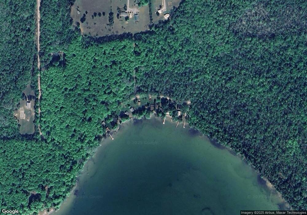
561 Latocha Dr Pellston, MI 49769
Estimated Value: $193,583 - $305,000
--
Bed
--
Bath
712
Sq Ft
$353/Sq Ft
Est. Value
About This Home
This home is located at 561 Latocha Dr, Pellston, MI 49769 and is currently estimated at $251,194, approximately $352 per square foot. 561 Latocha Dr is a home located in Emmet County with nearby schools including Pellston Elementary School and Pellston Middle/High School.
Ownership History
Date
Name
Owned For
Owner Type
Purchase Details
Closed on
Jul 21, 2025
Sold by
Emmet County Treasurer
Bought by
Matz Kenneth J Trust
Current Estimated Value
Purchase Details
Closed on
Mar 1, 2025
Sold by
Matz Kenneth
Bought by
Emmet County Treasurer
Purchase Details
Closed on
Jul 19, 2024
Sold by
Matz Kenneth and Matz Y
Bought by
The Kenneth J Matz Revocable Trust
Purchase Details
Closed on
Jun 1, 1990
Sold by
Horton Wd L454 P776
Bought by
Matz
Purchase Details
Closed on
Sep 1, 1984
Sold by
Richman Wd L359 P952
Bought by
Horton
Purchase Details
Closed on
Jan 1, 1983
Bought by
Richman
Create a Home Valuation Report for This Property
The Home Valuation Report is an in-depth analysis detailing your home's value as well as a comparison with similar homes in the area
Home Values in the Area
Average Home Value in this Area
Purchase History
| Date | Buyer | Sale Price | Title Company |
|---|---|---|---|
| Matz Kenneth J Trust | $2,105 | -- | |
| Emmet County Treasurer | $2,021 | -- | |
| The Kenneth J Matz Revocable Trust | -- | -- | |
| Matz | $51,000 | -- | |
| Horton | -- | -- | |
| Richman | $11,000 | -- |
Source: Public Records
Tax History Compared to Growth
Tax History
| Year | Tax Paid | Tax Assessment Tax Assessment Total Assessment is a certain percentage of the fair market value that is determined by local assessors to be the total taxable value of land and additions on the property. | Land | Improvement |
|---|---|---|---|---|
| 2025 | $1,399 | $91,700 | $10,000 | $81,700 |
| 2024 | $1,399 | $85,600 | $10,000 | $75,600 |
| 2023 | $1,294 | $82,700 | $10,000 | $72,700 |
| 2022 | $1,294 | $64,000 | $10,000 | $54,000 |
| 2021 | $1,322 | $53,400 | $10,000 | $43,400 |
| 2020 | $1,321 | $49,700 | $10,000 | $39,700 |
| 2019 | -- | $45,100 | $10,000 | $35,100 |
| 2018 | -- | $35,100 | $10,000 | $25,100 |
| 2017 | -- | $35,300 | $10,000 | $25,300 |
| 2016 | -- | $34,600 | $10,000 | $24,600 |
| 2015 | -- | $32,800 | $0 | $0 |
| 2014 | -- | $34,200 | $0 | $0 |
Source: Public Records
Map
Nearby Homes
- 0 E Levering Rd Unit 25049809
- 309 Creekside Dr
- 7663 Pleasantview Rd
- TBD Teal Rd
- 8439 Sturgeon Bay Dr Unit Lot 61
- 10683 Hebron Town Hall Rd
- 3645 Sturgeon Bay Shores Trail
- 2210 Black Rock Unit 42
- 9400 W Robinson Rd Unit 2
- 9400 W Robinson Rd Unit 1
- TBD Sturgeon Bay Dr Unit 26
- TBD Sturgeon Bay Dr Unit Lors 1 & 2
- TBD Wintergreen Dr
- Lot 1 Leeward Dr
- TBD Sturgeon Bay Dr
- 899 S State Rd
- 2263 Knollwood Dr
- 1150 Sumac St
- 0 Sumac St
- 2135 Welsheimer Rd
