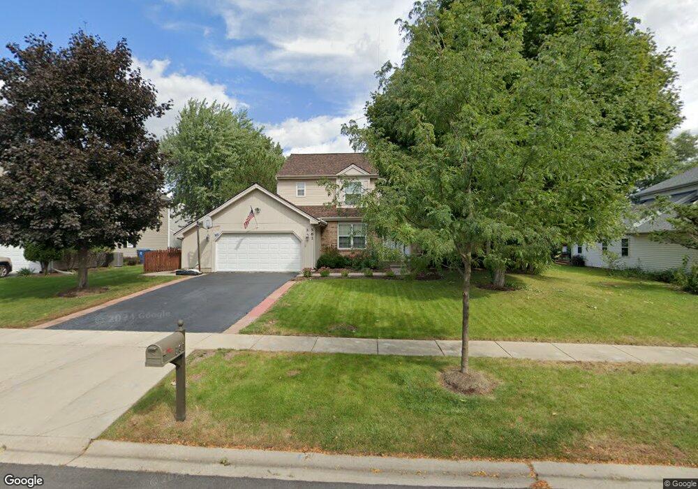
561 Lindsay Ln West Dundee, IL 60118
Estimated Value: $426,656 - $454,000
4
Beds
3
Baths
2,444
Sq Ft
$182/Sq Ft
Est. Value
About This Home
This home is located at 561 Lindsay Ln, West Dundee, IL 60118 and is currently estimated at $444,164, approximately $181 per square foot. 561 Lindsay Ln is a home located in Kane County with nearby schools including Dundee Highlands Elementary School, Dundee Middle School, and Harry D Jacobs High School.
Ownership History
Date
Name
Owned For
Owner Type
Purchase Details
Closed on
Jul 27, 2018
Sold by
Lenth Michael E and Lenth Elvie J
Bought by
Delcaratio Michael and Delcaratio Elvie Lenth Joint
Current Estimated Value
Purchase Details
Closed on
Sep 30, 2005
Sold by
Browder Jon and Browder Sherri
Bought by
Lenth Michael E and Lenth Elvie J
Home Financials for this Owner
Home Financials are based on the most recent Mortgage that was taken out on this home.
Original Mortgage
$274,600
Outstanding Balance
$147,626
Interest Rate
5.83%
Mortgage Type
Fannie Mae Freddie Mac
Estimated Equity
$296,538
Create a Home Valuation Report for This Property
The Home Valuation Report is an in-depth analysis detailing your home's value as well as a comparison with similar homes in the area
Home Values in the Area
Average Home Value in this Area
Purchase History
| Date | Buyer | Sale Price | Title Company |
|---|---|---|---|
| Delcaratio Michael | -- | Attorney | |
| Lenth Michael E | $344,000 | First American Title |
Source: Public Records
Mortgage History
| Date | Status | Borrower | Loan Amount |
|---|---|---|---|
| Open | Lenth Michael E | $274,600 |
Source: Public Records
Tax History Compared to Growth
Tax History
| Year | Tax Paid | Tax Assessment Tax Assessment Total Assessment is a certain percentage of the fair market value that is determined by local assessors to be the total taxable value of land and additions on the property. | Land | Improvement |
|---|---|---|---|---|
| 2024 | $9,290 | $121,969 | $26,492 | $95,477 |
| 2023 | $8,707 | $109,744 | $23,837 | $85,907 |
| 2022 | $8,227 | $99,385 | $23,837 | $75,548 |
| 2021 | $7,937 | $93,839 | $22,507 | $71,332 |
| 2020 | $7,789 | $91,729 | $22,001 | $69,728 |
| 2019 | $7,537 | $87,079 | $20,886 | $66,193 |
| 2018 | $7,568 | $85,354 | $20,472 | $64,882 |
| 2017 | $7,204 | $79,845 | $19,151 | $60,694 |
| 2016 | $6,762 | $71,686 | $23,612 | $48,074 |
| 2015 | -- | $67,172 | $22,125 | $45,047 |
| 2014 | -- | $65,317 | $21,514 | $43,803 |
| 2013 | -- | $67,317 | $22,173 | $45,144 |
Source: Public Records
Map
Nearby Homes
- 496 Edinburgh Ln
- 503 Edinburgh Ln
- 825 Lindsay Ln
- 818 Lindsay Ln
- 814 Lindsay Ln
- Charlotte Plan at Hickory Glen
- Marianne Plan at Hickory Glen
- 829 Lindsay Ln
- 906 Shagbark Ln
- 902 Shagbark Ln
- 916 Shagbark Ln
- 823 Lindsay Ln
- 904 Shagbark Ln
- 910 Shagbark Ln Unit 1601
- 1715 W Main St
- 2131 Stewart Ln
- 429 Harbor Dr
- Lots 24-133 Walnut Spruce Ash Oak Dr
- 315 Spring Point Dr Unit 18315
- 215 Sharon Dr
- 541 Lindsay Ln
- 573 Lindsay Ln
- 621 Lindsay Ct
- 566 Edinburgh Ln
- 588 Edinburgh Ln
- 524 Edinburgh Ln
- 523 Lindsay Ln
- 540 Lindsay Ln
- 622 Edinburgh Ln
- 518 Edinburgh Ln
- 562 Lindsay Ln
- 641 Lindsay Ct
- 504 Lindsay Ln
- 582 Lindsay Ln
- 501 Lindsay Ln
- 640 Edinburgh Ln
- 681 Lindsay Ct
- 596 Lindsay Ln
- 561 Edinburgh Ln
- 527 Edinburgh Ln