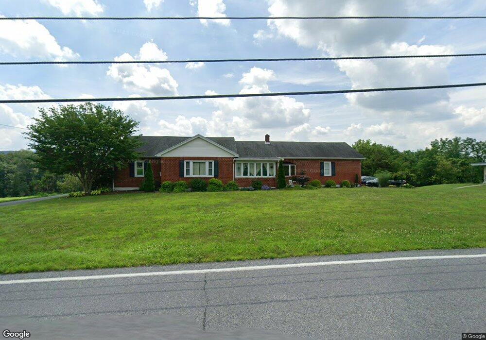
561 Mahoning Dr W Lehighton, PA 18235
Estimated Value: $290,443 - $548,000
2
Beds
1
Bath
1,227
Sq Ft
$318/Sq Ft
Est. Value
About This Home
This home is located at 561 Mahoning Dr W, Lehighton, PA 18235 and is currently estimated at $390,361, approximately $318 per square foot. 561 Mahoning Dr W is a home located in Carbon County with nearby schools including Lehighton Area High School, Sts. Peter & Paul School, and Valley Ridge Academy.
Ownership History
Date
Name
Owned For
Owner Type
Purchase Details
Closed on
Dec 15, 2017
Sold by
Hill Ronald A and Hill Josephine Ann
Bought by
Valish Brian Adam and Lesko Janna S
Current Estimated Value
Home Financials for this Owner
Home Financials are based on the most recent Mortgage that was taken out on this home.
Original Mortgage
$216,015
Outstanding Balance
$183,983
Interest Rate
4.4%
Mortgage Type
FHA
Estimated Equity
$206,378
Purchase Details
Closed on
May 5, 2004
Bought by
Hill Ronald A and Josephine Ann
Create a Home Valuation Report for This Property
The Home Valuation Report is an in-depth analysis detailing your home's value as well as a comparison with similar homes in the area
Home Values in the Area
Average Home Value in this Area
Purchase History
| Date | Buyer | Sale Price | Title Company |
|---|---|---|---|
| Valish Brian Adam | $220,000 | Lighthouse Abstract Ltd | |
| Hill Ronald A | -- | -- |
Source: Public Records
Mortgage History
| Date | Status | Borrower | Loan Amount |
|---|---|---|---|
| Open | Valish Brian Adam | $216,015 |
Source: Public Records
Tax History Compared to Growth
Tax History
| Year | Tax Paid | Tax Assessment Tax Assessment Total Assessment is a certain percentage of the fair market value that is determined by local assessors to be the total taxable value of land and additions on the property. | Land | Improvement |
|---|---|---|---|---|
| 2025 | $5,234 | $68,400 | $9,800 | $58,600 |
| 2024 | $5,029 | $68,400 | $9,800 | $58,600 |
| 2023 | $4,977 | $68,400 | $9,800 | $58,600 |
| 2022 | $4,909 | $68,400 | $9,800 | $58,600 |
| 2021 | $4,763 | $68,400 | $9,800 | $58,600 |
| 2020 | $4,643 | $68,400 | $9,800 | $58,600 |
| 2019 | $4,404 | $68,400 | $9,800 | $58,600 |
| 2018 | $4,352 | $68,400 | $9,800 | $58,600 |
| 2017 | $4,101 | $64,450 | $9,800 | $54,650 |
| 2016 | -- | $64,450 | $9,800 | $54,650 |
| 2015 | -- | $64,450 | $9,800 | $54,650 |
| 2014 | -- | $64,450 | $9,800 | $54,650 |
Source: Public Records
Map
Nearby Homes
- 104 Laurel Rd
- 0 Laurel Rd Unit PM-134334
- 93 Heartwood Ct
- 94 Heartwood Ct
- 94 Heartwood Ct Unit Lot 61
- TBD Pleasantview Dr
- 0 Abbey Plan at Summit Ridge Unit PACC2005470
- TBD Andrea Ln
- Abbey Plan at Summit Ridge
- Beacon Pointe Plan at Summit Ridge
- White Oak Plan at Summit Ridge
- Black Cherry Plan at Summit Ridge
- Blue Ridge Plan at Summit Ridge
- Copper Beech Plan at Summit Ridge
- Sweet Birch Plan at Summit Ridge
- Georgia Mae Plan at Summit Ridge
- Emily Plan at Summit Ridge
- 0 Georgia Mae Plan at Summit Ridge Unit PACC2005482
- 0 Blue Ridge Plan at Summit Ridge Unit PACC2005476
- 7 Sage Ct
- 587 Mahoning Dr W
- 659 Mahoning Dr W
- 648 Mahoning Dr W
- 680 Mahoning Dr W
- 692 Mahoning Dr W
- 225 Breezewood Dr
- 270 Mahoning Dr W
- 259 Mahoning Dr W
- 259 Mahoning Dr W
- 207 Mahoning Dr W
- 910 Mahoning Dr W
- 205 Mahoning Dr W
- 838 Mahoning Dr W
- 220 Mahoning Dr W
- 220 Mahoning Dr W
- 220 Mahoning Dr W
- 220 Mahoning Dr W
- 30 Breezewood Rd
- 203 Mahoning Dr W
- 133 Mahoning Dr W