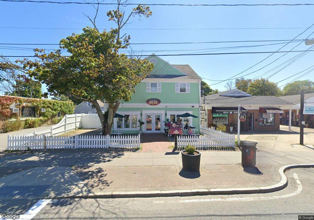
561 Main St Unit A Hyannis, MA 02601
Estimated Value: $1,055,729
--
Bed
--
Bath
3,648
Sq Ft
$289/Sq Ft
Est. Value
About This Home
This home is located at 561 Main St Unit A, Hyannis, MA 02601 and is currently estimated at $1,055,729, approximately $289 per square foot. 561 Main St Unit A is a home located in Barnstable County with nearby schools including Hyannis West Elementary School, Barnstable United Elementary School, and Barnstable Intermediate School.
Ownership History
Date
Name
Owned For
Owner Type
Purchase Details
Closed on
Jan 25, 2023
Sold by
Digiovanni Gerald J and Digiovanni Lynn M
Bought by
Gerry & Lynn Llc
Current Estimated Value
Purchase Details
Closed on
Jul 19, 2021
Sold by
Shechtman Richard B and Shechtman Stephen J
Bought by
Digiovanni Gerald J and Digiovanni Lynn
Purchase Details
Closed on
Dec 12, 2011
Sold by
Five Sixty One Assoc
Bought by
Shechtman Richard B and Shechtman Stephen J
Home Financials for this Owner
Home Financials are based on the most recent Mortgage that was taken out on this home.
Original Mortgage
$400,000
Interest Rate
4.09%
Mortgage Type
Commercial
Purchase Details
Closed on
Nov 18, 1994
Sold by
Plantations Invest
Bought by
561 Assoc
Create a Home Valuation Report for This Property
The Home Valuation Report is an in-depth analysis detailing your home's value as well as a comparison with similar homes in the area
Home Values in the Area
Average Home Value in this Area
Purchase History
| Date | Buyer | Sale Price | Title Company |
|---|---|---|---|
| Gerry & Lynn Llc | -- | None Available | |
| Digiovanni Gerald J | $800,000 | None Available | |
| Shechtman Richard B | $157,500 | -- | |
| 561 Assoc | $95,000 | -- |
Source: Public Records
Mortgage History
| Date | Status | Borrower | Loan Amount |
|---|---|---|---|
| Previous Owner | Shechtman Richard B | $400,000 |
Source: Public Records
Tax History Compared to Growth
Tax History
| Year | Tax Paid | Tax Assessment Tax Assessment Total Assessment is a certain percentage of the fair market value that is determined by local assessors to be the total taxable value of land and additions on the property. | Land | Improvement |
|---|---|---|---|---|
| 2025 | $6,170 | $783,600 | $0 | $783,600 |
| 2024 | $6,170 | $759,400 | $0 | $759,400 |
| 2023 | $0 | $759,400 | $0 | $759,400 |
| 2022 | $0 | $706,900 | $0 | $706,900 |
| 2021 | $6,170 | $482,000 | $0 | $482,000 |
| 2020 | $6,284 | $477,500 | $0 | $477,500 |
| 2019 | $6,510 | $482,200 | $0 | $482,200 |
| 2018 | $6,897 | $511,600 | $0 | $511,600 |
| 2017 | $6,436 | $511,600 | $0 | $511,600 |
| 2016 | $6,282 | $511,600 | $0 | $511,600 |
| 2015 | $6,157 | $513,100 | $0 | $513,100 |
Source: Public Records
Map
Nearby Homes
- 93 Sea St
- 65 Louis St Unit A
- 142 Chestnut St
- 24 Betty's Pond Rd Unit 1K
- 24 Bettys Pond Rd Unit K
- 287 Ocean St Unit C2
- 287 Ocean St Unit 2 BLDG C
- 72 Grove St
- 35 Pleasant St
- 381 Ocean St Unit 1
- 25 Ripple Cove Rd
- 16 Iyanough Rd
- 110 School St Unit E114
- 110 School St Unit E209
- 110 School St Unit E101
- 135 W Main St Unit 45
- 342 Sea St
- 87 Spring St
- 292 Megan Rd
- 281 Gosnold St
- 561 Main St Unit C
- 561 Main St Unit 561C
- 561 Main St
- 573 Main St Unit B
- 573 Main St
- 569 Main St
- 569 Main St Unit D3
- 569 Main St Unit 9
- 569 Main St Unit 8
- 569 Main St Unit 7
- 569 Main St Unit 6
- 569 Main St Unit 5
- 569 Main St Unit 4
- 569 Main St Unit 1210
- 569 Main St Unit B
- 569 Main St Unit D
- 569 Main St Unit 8
- 569 Main St Unit 12
- 569 Main St Unit 11
- 569 Main St Unit 2