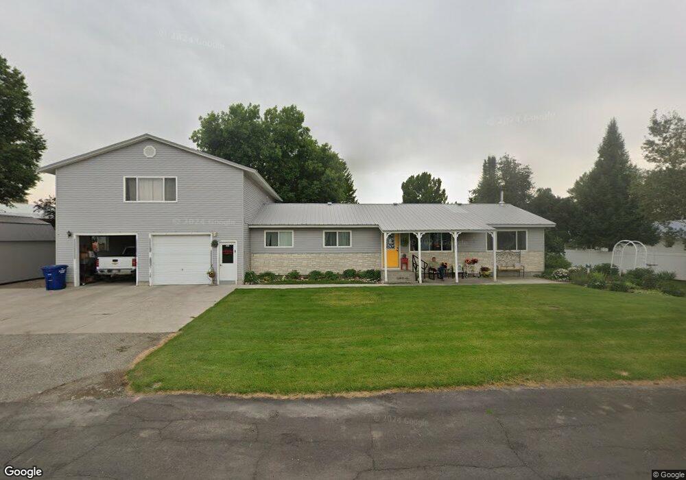
561 Maple Leaf Dr Ashton, ID 83420
Estimated Value: $357,000 - $616,000
3
Beds
2
Baths
2,524
Sq Ft
$178/Sq Ft
Est. Value
About This Home
This home is located at 561 Maple Leaf Dr, Ashton, ID 83420 and is currently estimated at $448,077, approximately $177 per square foot. 561 Maple Leaf Dr is a home with nearby schools including Ashton Elementary School and North Fremont Junior/Senior High School.
Ownership History
Date
Name
Owned For
Owner Type
Purchase Details
Closed on
Jan 20, 2012
Sold by
Whitmore Dan and Whitmore Letha
Bought by
Whitmore Dan and Whitmore Letha
Current Estimated Value
Home Financials for this Owner
Home Financials are based on the most recent Mortgage that was taken out on this home.
Original Mortgage
$137,000
Interest Rate
3.88%
Mortgage Type
New Conventional
Create a Home Valuation Report for This Property
The Home Valuation Report is an in-depth analysis detailing your home's value as well as a comparison with similar homes in the area
Purchase History
| Date | Buyer | Sale Price | Title Company |
|---|---|---|---|
| Whitmore Dan | -- | First American Title |
Source: Public Records
Mortgage History
| Date | Status | Borrower | Loan Amount |
|---|---|---|---|
| Closed | Whitmore Dan | $137,000 |
Source: Public Records
Tax History
| Year | Tax Paid | Tax Assessment Tax Assessment Total Assessment is a certain percentage of the fair market value that is determined by local assessors to be the total taxable value of land and additions on the property. | Land | Improvement |
|---|---|---|---|---|
| 2025 | $2,188 | $242,264 | $25,114 | $217,150 |
| 2024 | $2,139 | $234,177 | $25,114 | $209,063 |
| 2023 | $1,956 | $234,177 | $25,114 | $209,063 |
| 2022 | $2,323 | $153,686 | $23,362 | $130,324 |
| 2021 | $2,132 | $109,256 | $20,442 | $88,814 |
| 2020 | $1,933 | $95,260 | $20,442 | $74,818 |
| 2019 | $1,903 | $95,260 | $20,442 | $74,818 |
| 2018 | $1,828 | $88,365 | $20,442 | $67,923 |
| 2017 | $18 | $78,098 | $19,829 | $58,269 |
| 2016 | $1,714 | $78,098 | $19,829 | $58,269 |
| 2015 | $1,696 | $156,198 | $0 | $0 |
| 2014 | $1,502 | $78,098 | $0 | $0 |
| 2013 | $1,502 | $78,098 | $0 | $0 |
Source: Public Records
Map
Nearby Homes
- 540 N 4th St Unit 6
- 863 Maple St
- 118 N 8th St Unit 2
- 885 Maple St
- Lot 22 Sunflower Ln
- 417 Main St
- 511 Id-47
- 161 Walnut St
- 137 Spruce St
- 641 Fremont St
- LOTS 1-3 E 1300 Rd N
- L2 BLK 1 E 1300 Rd N
- 1331 N 3687 E
- L4A B2 N 3706 E
- L6A B2 N 3706 E
- L5A B2 N 3706 E
- 3656 Fishermans Dr
- 3660 E 1100 N
- 1105 N 3400 E
- 1640 Ashton Hill Loop
- 531 Maple Leaf Dr
- 545 Maple Leaf Dr
- 581 Maple Leaf Dr
- 564 Maple Leaf Dr
- 560 Maple Leaf Dr
- 570 Maple Leaf Dr
- 530 Maple Leaf Dr
- 525 N 5th St
- 526 Maple Leaf Dr
- 578 Maple Leaf Dr
- 534 Maple Leaf Dr
- 550 Maple Leaf Dr
- 580 Maple Leaf Dr
- 557 Baker Rd
- 502 Maple Leaf Dr
- 576 Baker Rd
- 0 5th St
- 514 Walnut St
- 584 Baker Rd
- 487 Spruce St
Your Personal Tour Guide
Ask me questions while you tour the home.