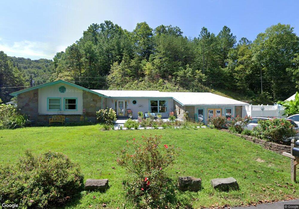
561 Millpond Dr Manchester, KY 40962
Estimated Value: $165,000 - $204,000
4
Beds
2
Baths
2,568
Sq Ft
$70/Sq Ft
Est. Value
About This Home
This home is located at 561 Millpond Dr, Manchester, KY 40962 and is currently estimated at $179,333, approximately $69 per square foot. 561 Millpond Dr is a home located in Clay County with nearby schools including Clay County High School, Appalachian Christian Academy, and Manchester Christian Academy.
Ownership History
Date
Name
Owned For
Owner Type
Purchase Details
Closed on
Apr 30, 2014
Sold by
Sowders Dinah and Sowders Paul
Bought by
Sowders Amber J
Current Estimated Value
Home Financials for this Owner
Home Financials are based on the most recent Mortgage that was taken out on this home.
Original Mortgage
$60,000
Outstanding Balance
$18,468
Interest Rate
4.37%
Mortgage Type
New Conventional
Estimated Equity
$160,865
Create a Home Valuation Report for This Property
The Home Valuation Report is an in-depth analysis detailing your home's value as well as a comparison with similar homes in the area
Home Values in the Area
Average Home Value in this Area
Purchase History
| Date | Buyer | Sale Price | Title Company |
|---|---|---|---|
| Sowders Amber J | $75,000 | None Available |
Source: Public Records
Mortgage History
| Date | Status | Borrower | Loan Amount |
|---|---|---|---|
| Open | Sowders Amber J | $60,000 |
Source: Public Records
Tax History Compared to Growth
Tax History
| Year | Tax Paid | Tax Assessment Tax Assessment Total Assessment is a certain percentage of the fair market value that is determined by local assessors to be the total taxable value of land and additions on the property. | Land | Improvement |
|---|---|---|---|---|
| 2024 | $522 | $90,000 | $0 | $0 |
| 2023 | $521 | $90,000 | $0 | $0 |
| 2022 | $585 | $90,000 | $0 | $0 |
| 2021 | $584 | $90,000 | $0 | $0 |
| 2020 | $595 | $90,000 | $0 | $0 |
| 2019 | $532 | $126,500 | $0 | $0 |
| 2018 | $541 | $85,000 | $0 | $0 |
| 2017 | -- | $0 | $0 | $0 |
| 2016 | $516 | $0 | $0 | $0 |
| 2015 | $914 | $0 | $0 | $0 |
| 2014 | $914 | $0 | $0 | $0 |
| 2013 | $914 | $0 | $0 | $0 |
Source: Public Records
Map
Nearby Homes
- 31, 32, 33 Justice Dr
- 0 Highway 638 Unit 25018932
- 174 Collins Gibson Rd
- 215 Colony Rd
- 173 Charlie Sizemore Rd
- 85 Blackwell Dr
- 497 Hooker Rd
- 180 Calanna Estate Rd
- 0 Hooker Rd
- 111 House Ave
- 14 Lewis and Collins Rd
- Tract 15 Lewis & Collins Farm
- 00 Hwy 421 Richmond Rd
- 9999 Memorial Dr
- 0 Kentucky 11
- 307 River St
- 91 Jones St
- 1 Kentucky 11
- 8549 Us Highway 421
- 1847 Jacks Branch Rd
- 561 Upper Rader Rd
- 589 Upper Rader Rd
- 973 Upper Rader Rd
- 561 Upper Rader Rd
- 973 Upper Rader Rd
- 502 Price Hollow Rd
- 453 Price Hollow Rd
- 82 Crestview Dr
- 21 Crestview Dr
- 21 Crest View Dr
- 35 Chelsea Ln
- 593 Price Hollow Rd
- 152 Price Hollow Rd
- 124 Price Hollow Rd
- 661 Price Hollow Rd
- 661 Price Hollow Rd
- 646 Price Hollow Rd
- 3 Price Hollow Rd
- 360 Maupin Hollow Rd
- 21 Price Hollow Rd