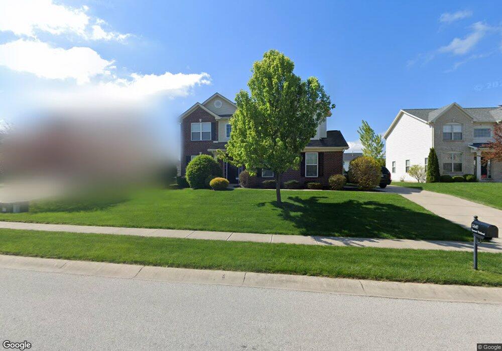
5610 Somerset Blvd Bargersville, IN 46106
Estimated Value: $380,000 - $391,097
4
Beds
3
Baths
2,295
Sq Ft
$167/Sq Ft
Est. Value
About This Home
This home is located at 5610 Somerset Blvd, Bargersville, IN 46106 and is currently estimated at $384,274, approximately $167 per square foot. 5610 Somerset Blvd is a home with nearby schools including Maple Grove Elementary School, Center Grove Middle School Central, and Center Grove High School.
Ownership History
Date
Name
Owned For
Owner Type
Purchase Details
Closed on
May 7, 2010
Sold by
The Princeton Group Inc
Bought by
Baker Eric S and Baker Sara M
Current Estimated Value
Home Financials for this Owner
Home Financials are based on the most recent Mortgage that was taken out on this home.
Original Mortgage
$181,163
Outstanding Balance
$122,903
Interest Rate
5.3%
Mortgage Type
New Conventional
Estimated Equity
$261,371
Create a Home Valuation Report for This Property
The Home Valuation Report is an in-depth analysis detailing your home's value as well as a comparison with similar homes in the area
Home Values in the Area
Average Home Value in this Area
Purchase History
| Date | Buyer | Sale Price | Title Company |
|---|---|---|---|
| Baker Eric S | -- | None Available |
Source: Public Records
Mortgage History
| Date | Status | Borrower | Loan Amount |
|---|---|---|---|
| Open | Baker Eric S | $181,163 |
Source: Public Records
Tax History Compared to Growth
Tax History
| Year | Tax Paid | Tax Assessment Tax Assessment Total Assessment is a certain percentage of the fair market value that is determined by local assessors to be the total taxable value of land and additions on the property. | Land | Improvement |
|---|---|---|---|---|
| 2025 | $3,336 | $359,500 | $86,700 | $272,800 |
| 2024 | $3,336 | $333,600 | $86,700 | $246,900 |
| 2023 | $3,193 | $319,300 | $86,700 | $232,600 |
| 2022 | $2,962 | $296,200 | $73,200 | $223,000 |
| 2021 | $2,476 | $247,600 | $57,100 | $190,500 |
| 2020 | $2,399 | $239,900 | $57,100 | $182,800 |
| 2019 | $2,320 | $232,000 | $57,100 | $174,900 |
| 2018 | $2,330 | $230,500 | $57,100 | $173,400 |
| 2017 | $2,354 | $235,400 | $40,400 | $195,000 |
| 2016 | $1,990 | $213,700 | $40,400 | $173,300 |
| 2014 | $1,989 | $193,700 | $40,400 | $153,300 |
| 2013 | $1,989 | $198,900 | $40,400 | $158,500 |
Source: Public Records
Map
Nearby Homes
- 3058 Mcintosh Dr
- 5571 Auburndale Dr
- 5502 Breaburn Rd
- 3270 Cherokee Cir
- 3301 Cheyenne Ct
- 3176 Tecumseh Way
- 000 N State Road 135
- 4000 N State Road 135
- 6093 Tremont Blvd
- 3808 Claybrook Ct
- 3762 Woodruff Place
- 963 Booneway Ln
- Bellamy Plan at Lone Pine Farms
- Henley Plan at Lone Pine Farms
- Chatham Plan at Lone Pine Farms
- Harmony Plan at Lone Pine Farms
- Freeport Plan at Lone Pine Farms
- Stamford Plan at Lone Pine Farms
- 1359 Foxtail Ln
- 1359 Foxtail Ln
- 5598 Somerset Blvd
- 5622 Somerset Blvd
- 5586 Somerset Blvd
- 5634 Somerset Blvd
- 3108 Woodhaven Way
- 5701 Tembrooke Way
- 5700 Tembrooke Way
- 3120 Woodhaven Way
- 5574 Somerset Blvd
- 5599 Somerset Blvd
- 3096 Woodhaven Way
- 5635 Somerset Blvd
- 3132 Woodhaven Way
- 5587 Somerset Blvd
- 5562 Somerset Blvd
- 3084 Woodhaven Way
- 5575 Somerset Blvd
- 5647 Somerset Blvd
- 5725 Tembrooke Way
- 3144 Woodhaven Way