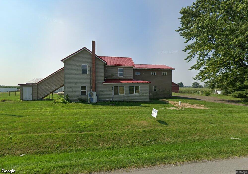
5610 W Us Highway 20 Lagrange, IN 46761
Estimated Value: $113,000 - $423,000
4
Beds
3
Baths
2,432
Sq Ft
$102/Sq Ft
Est. Value
About This Home
This home is located at 5610 W Us Highway 20, Lagrange, IN 46761 and is currently estimated at $247,472, approximately $101 per square foot. 5610 W Us Highway 20 is a home located in LaGrange County with nearby schools including Shipshewana-Scott Elementary School, Westview Elementary School, and Westview Junior/Senior High School.
Ownership History
Date
Name
Owned For
Owner Type
Purchase Details
Closed on
Feb 19, 2025
Sold by
L M Evolving Llc
Bought by
Northern Indiana Rentals Llc
Current Estimated Value
Purchase Details
Closed on
Jan 29, 2025
Sold by
Morrison Patsy E and Riley Patsy E
Bought by
L M Evolving Llc
Create a Home Valuation Report for This Property
The Home Valuation Report is an in-depth analysis detailing your home's value as well as a comparison with similar homes in the area
Home Values in the Area
Average Home Value in this Area
Purchase History
| Date | Buyer | Sale Price | Title Company |
|---|---|---|---|
| Northern Indiana Rentals Llc | -- | Metropolitan Title | |
| L M Evolving Llc | -- | None Listed On Document |
Source: Public Records
Tax History Compared to Growth
Tax History
| Year | Tax Paid | Tax Assessment Tax Assessment Total Assessment is a certain percentage of the fair market value that is determined by local assessors to be the total taxable value of land and additions on the property. | Land | Improvement |
|---|---|---|---|---|
| 2024 | $992 | $213,300 | $27,900 | $185,400 |
| 2023 | $768 | $184,400 | $31,600 | $152,800 |
| 2022 | $726 | $162,300 | $27,500 | $134,800 |
| 2021 | $607 | $136,900 | $25,000 | $111,900 |
| 2020 | $589 | $133,900 | $25,000 | $108,900 |
| 2019 | $576 | $132,400 | $25,000 | $107,400 |
| 2018 | $526 | $122,700 | $25,000 | $97,700 |
| 2017 | $539 | $125,700 | $24,000 | $101,700 |
| 2016 | $473 | $116,000 | $18,800 | $97,200 |
| 2014 | $326 | $90,300 | $18,800 | $71,500 |
| 2013 | $326 | $91,100 | $18,800 | $72,300 |
Source: Public Records
Map
Nearby Homes
- 7260 W 350 N
- 365 Country Ln
- 7820 W 350 N
- 1575 W 195 N
- 3295 N 980 W
- 4720 N State Road 5
- 0 Corner of Factory St & Townline Rd Unit 202541800
- 217 N Sherman St
- 915 N 015 E
- 5145 N 290 W
- 245 E 100 S
- 914 S Detroit St
- 207 S Poplar St
- 737 N Canal St
- 306 N 100 E
- 522 N Main St
- 310 Todd St
- 429 Jay St
- 423 Jay St
- 1895 W 570 N
- 5560 W Us Highway 20
- 5520 W Us Highway 20
- 5480 W Us Highway 20
- 5450 W Us Highway 20
- 5360 W Us Highway 20
- 5375 W Us Highway 20
- 5880 W Us Highway 20
- 465 N 600 W
- 5920 W Us Highway 20
- 5930 W Us Highway 20
- 5975 W Us Highway 20
- 5975 U S 20
- 5 S 600 W
- 7 S 600 W
- 3 S 600 W
- 1 S 600 W
- 5190 W Us Highway 20
- 6 S 600 W
- 2 S 600 W
- 40 S 600 W