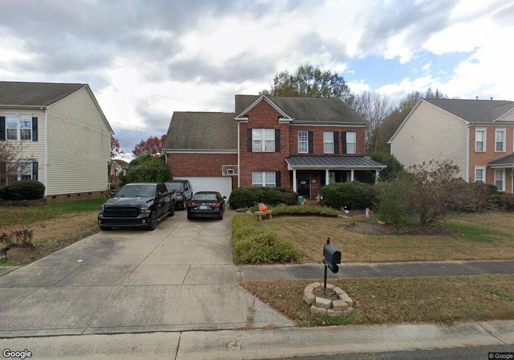
5611 Ginger Ln Indian Trail, NC 28079
Estimated Value: $467,000 - $526,000
--
Bed
3
Baths
2,654
Sq Ft
$188/Sq Ft
Est. Value
About This Home
This home is located at 5611 Ginger Ln, Indian Trail, NC 28079 and is currently estimated at $499,994, approximately $188 per square foot. 5611 Ginger Ln is a home located in Union County with nearby schools including Poplin Elementary School, Porter Ridge Middle School, and Porter Ridge High School.
Ownership History
Date
Name
Owned For
Owner Type
Purchase Details
Closed on
May 17, 2004
Sold by
Mocete Liza
Bought by
Mocete Liza and Lopez Joseph
Current Estimated Value
Purchase Details
Closed on
Oct 31, 2002
Sold by
Nvr Inc
Bought by
Mocete Peter
Home Financials for this Owner
Home Financials are based on the most recent Mortgage that was taken out on this home.
Original Mortgage
$198,456
Outstanding Balance
$80,244
Interest Rate
5.93%
Estimated Equity
$419,750
Create a Home Valuation Report for This Property
The Home Valuation Report is an in-depth analysis detailing your home's value as well as a comparison with similar homes in the area
Home Values in the Area
Average Home Value in this Area
Purchase History
| Date | Buyer | Sale Price | Title Company |
|---|---|---|---|
| Mocete Liza | -- | -- | |
| Mocete Peter | $205,000 | -- |
Source: Public Records
Mortgage History
| Date | Status | Borrower | Loan Amount |
|---|---|---|---|
| Open | Mocete Peter | $198,456 |
Source: Public Records
Tax History Compared to Growth
Tax History
| Year | Tax Paid | Tax Assessment Tax Assessment Total Assessment is a certain percentage of the fair market value that is determined by local assessors to be the total taxable value of land and additions on the property. | Land | Improvement |
|---|---|---|---|---|
| 2025 | $3,751 | $565,400 | $0 | $0 |
| 2024 | $3,036 | $348,800 | $50,700 | $298,100 |
| 2023 | $2,911 | $348,800 | $50,700 | $298,100 |
| 2022 | $2,914 | $343,700 | $50,700 | $293,000 |
| 2021 | $2,871 | $343,700 | $50,700 | $293,000 |
| 2020 | $1,828 | $234,500 | $28,000 | $206,500 |
| 2019 | $2,460 | $234,500 | $28,000 | $206,500 |
| 2018 | $1,828 | $234,500 | $28,000 | $206,500 |
| 2017 | $2,519 | $234,500 | $28,000 | $206,500 |
| 2016 | $2,451 | $234,500 | $28,000 | $206,500 |
| 2015 | $1,941 | $234,500 | $28,000 | $206,500 |
| 2014 | $1,498 | $209,750 | $37,500 | $172,250 |
Source: Public Records
Map
Nearby Homes
- 5516 Beverly Dr
- 7215 Conifer Cir
- 6708 Mimosa St
- 6200 Trevor Simpson Dr
- 1541 Banham Dr
- 3903 Etheredge St
- 6825 Creft Cir Unit 49
- 3805 Balsam St Unit 321
- 6303 Margaret Ct Unit 82
- 3910 Faith Church Rd
- 3508 Mayhurst Dr
- 3802 Balsam St
- 7002 Creft Cir
- 3800 York Aly
- 3722 Society Ct
- 7607 Taft Place
- 1010 Mapletree Ln
- 1092 Mapletree Ln
- 1073 Mapletree Ln
- 0 Rose Dr Unit CAR4322172
- 5613 Ginger Ln
- 5609 Ginger Ln
- 6628 Courtland St
- 5607 Ginger Ln
- 6632 Courtland St
- 5615 Ginger Ln
- 5610 Ginger Ln
- 5610 Ginger Ln Unit 59
- 5619 Ginger Ln
- 6626 Courtland St
- 5612 Ginger Ln
- 5606 Ginger Ln
- 6631 Courtland St
- 5605 Ginger Ln
- 5618 Ginger Ln
- 5604 Ginger Ln
- 6624 Courtland St
- 5613 Carol Ave
- 5614 Ginger Ln
- 5609 Carol Ave