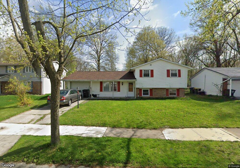
5612 Countess Dr Fort Wayne, IN 46815
North Anthony NeighborhoodEstimated Value: $220,000 - $224,000
3
Beds
3
Baths
1,496
Sq Ft
$149/Sq Ft
Est. Value
About This Home
This home is located at 5612 Countess Dr, Fort Wayne, IN 46815 and is currently estimated at $222,743, approximately $148 per square foot. 5612 Countess Dr is a home located in Allen County with nearby schools including J Wilbur Haley Elementary School, Blackhawk Middle School, and R Nelson Snider High School.
Ownership History
Date
Name
Owned For
Owner Type
Purchase Details
Closed on
Nov 14, 2003
Sold by
Schuckel David R and Schuckel Jill E
Bought by
Louis Paul Jean Pierre and Dorce Marie S
Current Estimated Value
Home Financials for this Owner
Home Financials are based on the most recent Mortgage that was taken out on this home.
Original Mortgage
$86,640
Outstanding Balance
$39,482
Interest Rate
6.1%
Mortgage Type
FHA
Estimated Equity
$183,261
Create a Home Valuation Report for This Property
The Home Valuation Report is an in-depth analysis detailing your home's value as well as a comparison with similar homes in the area
Home Values in the Area
Average Home Value in this Area
Purchase History
| Date | Buyer | Sale Price | Title Company |
|---|---|---|---|
| Louis Paul Jean Pierre | -- | Metropolitan Title In Llc |
Source: Public Records
Mortgage History
| Date | Status | Borrower | Loan Amount |
|---|---|---|---|
| Open | Louis Paul Jean Pierre | $86,640 |
Source: Public Records
Tax History
| Year | Tax Paid | Tax Assessment Tax Assessment Total Assessment is a certain percentage of the fair market value that is determined by local assessors to be the total taxable value of land and additions on the property. | Land | Improvement |
|---|---|---|---|---|
| 2025 | $2,279 | $206,700 | $28,300 | $178,400 |
| 2024 | $1,872 | $200,600 | $28,300 | $172,300 |
| 2022 | $1,706 | $153,800 | $28,300 | $125,500 |
| 2021 | $1,461 | $133,100 | $17,700 | $115,400 |
| 2020 | $1,338 | $124,600 | $17,700 | $106,900 |
| 2019 | $1,138 | $110,900 | $17,700 | $93,200 |
| 2018 | $925 | $98,500 | $17,700 | $80,800 |
| 2017 | $807 | $90,700 | $17,700 | $73,000 |
| 2016 | $684 | $84,200 | $17,700 | $66,500 |
| 2014 | $730 | $87,100 | $17,700 | $69,400 |
| 2013 | $655 | $83,800 | $17,700 | $66,100 |
Source: Public Records
Map
Nearby Homes
- 6038 Monarch Dr
- 1416 Lofton Way
- 1304 Ardsley Ct
- 2611 Neptunes Crossing
- 5722 Port Royal
- 5723 Port Royal
- 5720 Bayside Dr
- 1605 Benham Dr
- 5717 Bayside Dr
- 6124 Millhollow Ln
- 6601 Bennington Dr
- 6113 Millhollow Ln
- 2818 1/2 Reed Rd
- 1409 Lake Forest Dr
- 4328 Dodge Ave
- 3303 Walden Run
- 3502 Weston Ridge Place
- 2927 Woodstock Ct
- 2704 Farnsworth Dr
- 5826 Thoreau Ave
- 5618 Countess Dr
- 5606 Countess Dr
- 5624 Countess Dr
- 5534 Countess Dr
- 1809 Coronet Dr
- 5632 Countess Dr
- 5605 Countess Dr
- 5528 Countess Dr
- 1810 Coronet Dr
- 5533 Countess Dr
- 5640 Countess Dr
- 5631 Countess Dr
- 1819 Coronet Dr
- 5522 Countess Dr
- 5525 Countess Dr
- 5639 Countess Dr
- 1820 Coronet Dr
- 5646 Countess Dr
- 1827 Coronet Dr
- 5516 Countess Dr
Your Personal Tour Guide
Ask me questions while you tour the home.