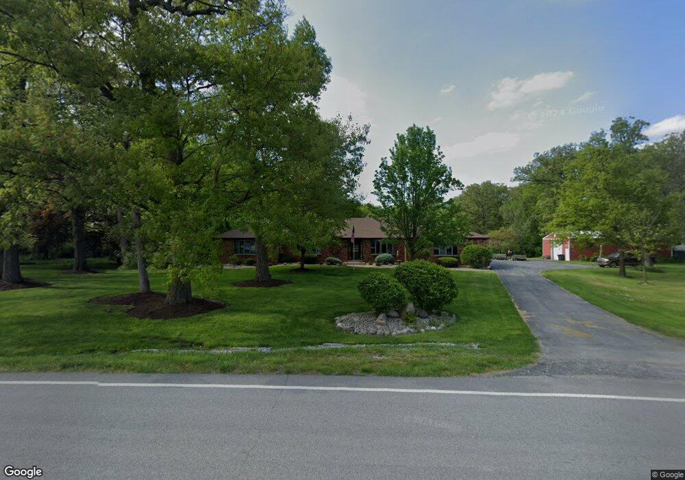
5612 W 91st Ave Crown Point, IN 46307
Estimated Value: $471,000 - $671,526
4
Beds
4
Baths
3,034
Sq Ft
$187/Sq Ft
Est. Value
About This Home
This home is located at 5612 W 91st Ave, Crown Point, IN 46307 and is currently estimated at $566,842, approximately $186 per square foot. 5612 W 91st Ave is a home located in Lake County with nearby schools including Hal E Clark Middle School, Peifer Elementary School, and Lake Central High School.
Ownership History
Date
Name
Owned For
Owner Type
Purchase Details
Closed on
Apr 29, 2025
Sold by
Rosenwinkel Barbara J and Rosenwinkel Barbara H
Bought by
Barbara Rosenwinkel Living Trust and Rosenwinkel
Current Estimated Value
Purchase Details
Closed on
Apr 7, 2017
Sold by
Rosenwinkel Barbara J and Rosenwinkel Barbara H
Bought by
Rosenwinkel Barbara J and Rosenwinkel Michael F
Purchase Details
Closed on
Feb 24, 2017
Sold by
Rosenwinkel Barbara J and Rosenwinkel Barbara H
Bought by
Rosenwinkel Barbara J and Rosenwinkel Michael F
Purchase Details
Closed on
Feb 8, 2017
Sold by
Rosenwinkel Barbara
Bought by
Rosenwinkel Barbara H
Create a Home Valuation Report for This Property
The Home Valuation Report is an in-depth analysis detailing your home's value as well as a comparison with similar homes in the area
Home Values in the Area
Average Home Value in this Area
Purchase History
| Date | Buyer | Sale Price | Title Company |
|---|---|---|---|
| Barbara Rosenwinkel Living Trust | -- | None Listed On Document | |
| Rosenwinkel Barbara J | -- | None Available | |
| Rosenwinkel Barbara J | -- | None Available | |
| Rosenwinkel Barbara H | -- | None Available |
Source: Public Records
Tax History Compared to Growth
Tax History
| Year | Tax Paid | Tax Assessment Tax Assessment Total Assessment is a certain percentage of the fair market value that is determined by local assessors to be the total taxable value of land and additions on the property. | Land | Improvement |
|---|---|---|---|---|
| 2024 | $9,946 | $601,700 | $170,500 | $431,200 |
| 2023 | $5,658 | $602,300 | $170,500 | $431,800 |
| 2022 | $5,658 | $573,700 | $150,500 | $423,200 |
| 2021 | $4,384 | $476,100 | $84,300 | $391,800 |
| 2020 | $4,388 | $464,100 | $84,300 | $379,800 |
| 2019 | $4,738 | $455,900 | $80,200 | $375,700 |
| 2018 | $4,507 | $427,600 | $92,700 | $334,900 |
| 2017 | $4,098 | $410,900 | $94,200 | $316,700 |
| 2016 | $3,675 | $376,500 | $94,200 | $282,300 |
| 2014 | $3,421 | $368,000 | $94,100 | $273,900 |
| 2013 | $3,366 | $361,000 | $94,100 | $266,900 |
Source: Public Records
Map
Nearby Homes
- 9017 Mathews St
- 5063 W 89th Ct
- 5012 W 92nd Ave
- 8849 Calhoun Place
- 4944 W 89th Terrace
- 8748 Durbin Ln
- 4862 W 92nd Ave
- 9251 Clark Place
- 6308 W 91st Ave
- 9195 Williams St
- 6501 W 89th Ave
- 6076 Wexford Way
- 4229 W 92nd Place
- 6440 W 89th Ave
- 9204 Wright St
- 6915 W 93rd Ave
- 8903 Edison St
- 4930 W 84th Terrace
- 5547 Maggie Mae Ct
- 5544 Maggie Mae Ct
- 5605 W 91st St
- 5705 W 91st Ave
- 5815 W 91st Ave
- 5409 Woodland Dr
- 5419 Woodland Dr
- 5419 Woodland Dr
- 5429 Woodland Dr
- 5367 Woodland Dr
- 5347 Woodland Dr
- 5439 Woodland Dr
- 5439 Woodland Dr
- 5327 Woodland Dr
- 5814 W 91st Ave
- 5449 Woodland Dr
- 5449 Woodland Dr
- 8945 Burr St
- 5307 Woodland Dr
- 5899 W 91st Ave
- 5432 Woodland Dr
- 9035 Burr St