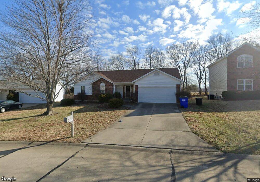
5612 Walnut Point Ln Saint Charles, MO 63304
Estimated Value: $351,000 - $361,000
3
Beds
3
Baths
1,500
Sq Ft
$237/Sq Ft
Est. Value
About This Home
This home is located at 5612 Walnut Point Ln, Saint Charles, MO 63304 and is currently estimated at $355,199, approximately $236 per square foot. 5612 Walnut Point Ln is a home located in St. Charles County with nearby schools including Independence Elementary School, Francis Howell Middle School, and Francis Howell Union High School.
Ownership History
Date
Name
Owned For
Owner Type
Purchase Details
Closed on
Oct 31, 2000
Sold by
Sphar John I and Spahr Deborah S
Bought by
Sphar John I and Sphar Deborah S
Current Estimated Value
Purchase Details
Closed on
Nov 4, 1999
Sold by
Broker Russell E & Broker Sarah E
Bought by
Sphar John I and Sphar Deborah S
Home Financials for this Owner
Home Financials are based on the most recent Mortgage that was taken out on this home.
Original Mortgage
$101,000
Outstanding Balance
$29,657
Interest Rate
7.25%
Estimated Equity
$325,542
Create a Home Valuation Report for This Property
The Home Valuation Report is an in-depth analysis detailing your home's value as well as a comparison with similar homes in the area
Home Values in the Area
Average Home Value in this Area
Purchase History
| Date | Buyer | Sale Price | Title Company |
|---|---|---|---|
| Sphar John I | -- | -- | |
| Sphar John I | -- | -- |
Source: Public Records
Mortgage History
| Date | Status | Borrower | Loan Amount |
|---|---|---|---|
| Open | Sphar John I | $101,000 |
Source: Public Records
Tax History Compared to Growth
Tax History
| Year | Tax Paid | Tax Assessment Tax Assessment Total Assessment is a certain percentage of the fair market value that is determined by local assessors to be the total taxable value of land and additions on the property. | Land | Improvement |
|---|---|---|---|---|
| 2025 | $3,080 | $57,685 | -- | -- |
| 2023 | $3,079 | $51,481 | $0 | $0 |
| 2022 | $2,614 | $40,551 | $0 | $0 |
| 2021 | $2,617 | $40,551 | $0 | $0 |
| 2020 | $2,607 | $39,113 | $0 | $0 |
| 2019 | $2,595 | $39,113 | $0 | $0 |
| 2018 | $2,371 | $34,131 | $0 | $0 |
| 2017 | $2,352 | $34,131 | $0 | $0 |
| 2016 | $2,213 | $30,914 | $0 | $0 |
| 2015 | $2,180 | $30,914 | $0 | $0 |
| 2014 | $2,234 | $30,730 | $0 | $0 |
Source: Public Records
Map
Nearby Homes
- 232 Maple Point Dr
- 1361 Briar Creek Dr
- 14 Walnut Hill Ct
- 1209 Crooked Creek Dr
- 5701 Wrenwyck Place
- 1184 Clydesdale Dr
- 212 Country Hollow Ct
- 1218 Saddlemaker Dr
- 5821 Saddlebrook Dr
- 5576 Wavecrest Cir
- 831 Ridgetop Cir
- 5504 Dressel Dr
- 1005 Waldo Ln
- 3009 Bruce Trail Ct
- 1000 Santiago Trail
- 1004 Santiago Trail
- 2009 Butte Trail Ct
- McKinley Plan at Cottleville Trails - Liberty Series
- Madison II Plan at Cottleville Trails - Liberty Series
- Jefferson Plan at Cottleville Trails - Liberty Series
- 5616 Walnut Point Ln
- 5608 Walnut Point Ln
- 5620 Walnut Point Ln
- 5697 Gutermuth Rd
- 5609 Walnut Point Ln
- 5604 Walnut Point Ln
- 5617 Walnut Point Ln
- 5624 Walnut Point Ln
- 5621 Walnut Point Ln
- 5690 Gutermuth Rd
- 66 Walnut Point Ct
- 5623 Walnut Point Ln
- 60 Walnut Point Ct
- 5628 Walnut Point Ln
- 65 Walnut Point Ct
- 5684 Gutermuth Rd
- 5629 Walnut Point Ln
- 53 Walnut Run Ct
- 52 Walnut Run Ct
- 61 Walnut Point Ct