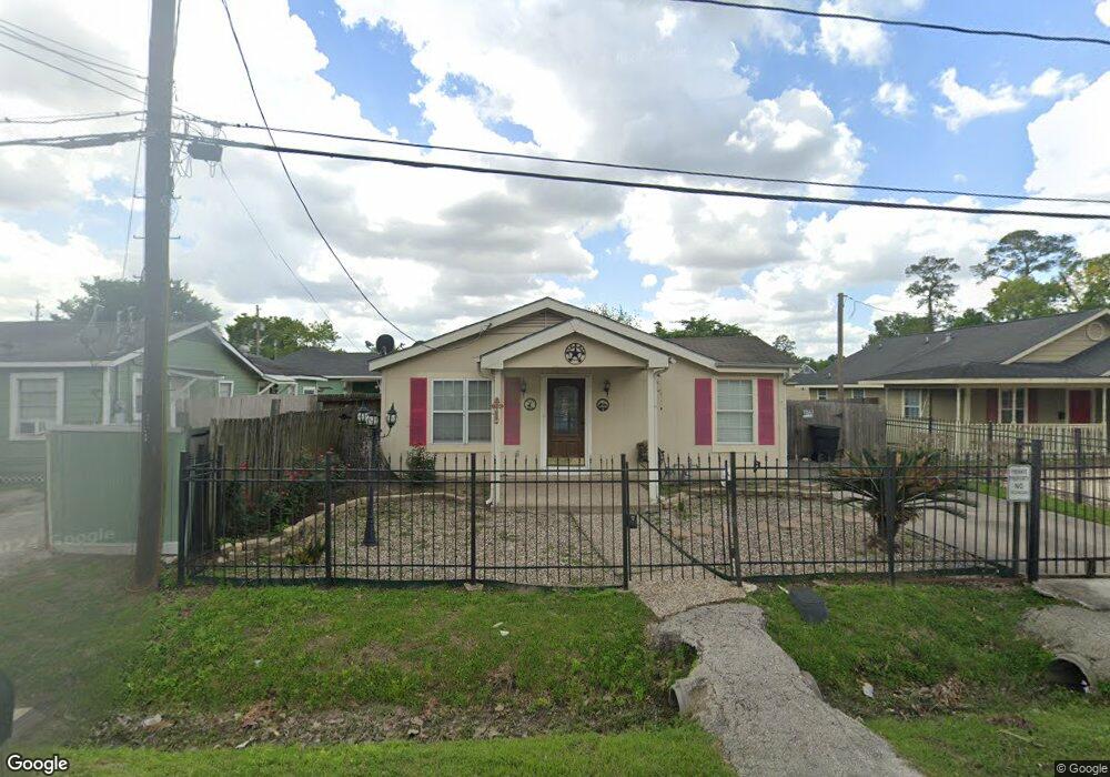
5613 Bersey Ln Houston, TX 77091
Acres Homes NeighborhoodEstimated Value: $197,457 - $281,000
3
Beds
1
Bath
924
Sq Ft
$271/Sq Ft
Est. Value
About This Home
This home is located at 5613 Bersey Ln, Houston, TX 77091 and is currently estimated at $250,114, approximately $270 per square foot. 5613 Bersey Ln is a home located in Harris County with nearby schools including Highland Heights Elementary School, Williams Middle, and Waltrip High School.
Ownership History
Date
Name
Owned For
Owner Type
Purchase Details
Closed on
Aug 31, 2005
Sold by
Johnson A D
Bought by
Johnson Danielle Nicole Thomas
Current Estimated Value
Home Financials for this Owner
Home Financials are based on the most recent Mortgage that was taken out on this home.
Original Mortgage
$13,500
Interest Rate
5.61%
Mortgage Type
Unknown
Purchase Details
Closed on
Jul 15, 2005
Sold by
Robinson Mildred and Robinson Wayne
Bought by
Johnson Danielle N Thomas
Home Financials for this Owner
Home Financials are based on the most recent Mortgage that was taken out on this home.
Original Mortgage
$13,500
Interest Rate
5.61%
Mortgage Type
Unknown
Purchase Details
Closed on
Jul 30, 2001
Sold by
Bigelow Daisey and Houston Ola
Bought by
Robinson Wayne and Robinson Mildred
Home Financials for this Owner
Home Financials are based on the most recent Mortgage that was taken out on this home.
Original Mortgage
$44,000
Interest Rate
7.05%
Create a Home Valuation Report for This Property
The Home Valuation Report is an in-depth analysis detailing your home's value as well as a comparison with similar homes in the area
Home Values in the Area
Average Home Value in this Area
Purchase History
| Date | Buyer | Sale Price | Title Company |
|---|---|---|---|
| Johnson Danielle Nicole Thomas | -- | -- | |
| Johnson Danielle N Thomas | -- | First American Title | |
| Robinson Wayne | -- | -- |
Source: Public Records
Mortgage History
| Date | Status | Borrower | Loan Amount |
|---|---|---|---|
| Previous Owner | Johnson Danielle N Thomas | $13,500 | |
| Previous Owner | Johnson Danielle N Thomas | $76,500 | |
| Previous Owner | Robinson Wayne | $44,000 |
Source: Public Records
Tax History Compared to Growth
Tax History
| Year | Tax Paid | Tax Assessment Tax Assessment Total Assessment is a certain percentage of the fair market value that is determined by local assessors to be the total taxable value of land and additions on the property. | Land | Improvement |
|---|---|---|---|---|
| 2025 | $3,200 | $142,016 | $83,330 | $58,686 |
| 2024 | $3,200 | $152,959 | $83,330 | $69,629 |
| 2023 | $3,200 | $152,959 | $83,330 | $69,629 |
| 2022 | $2,754 | $125,066 | $57,690 | $67,376 |
| 2021 | $2,184 | $93,708 | $38,460 | $55,248 |
| 2020 | $1,937 | $79,995 | $30,448 | $49,547 |
| 2019 | $1,433 | $56,633 | $11,218 | $45,415 |
| 2018 | $1,296 | $51,220 | $11,218 | $40,002 |
| 2017 | $1,295 | $51,220 | $11,218 | $40,002 |
| 2016 | $1,295 | $51,220 | $11,218 | $40,002 |
| 2015 | $1,227 | $50,056 | $11,218 | $38,838 |
| 2014 | $1,227 | $47,750 | $11,218 | $36,532 |
Source: Public Records
Map
Nearby Homes
- 1540 W Tidwell Rd
- Plan C at Commons at West Tidwell
- Plan A at Commons at West Tidwell
- 5723 White Magnolia St
- 1650 W Tidwell Rd
- 1648 W Tidwell Rd
- 1620 Paul Quinn St
- 5733 White Magnolia St
- 406 W Tidwell Rd
- 1218 & 1216 Paul Quinn St
- 1407 Mansfield St
- 880 Paul Quinn St
- 1312 Neiman Ln
- 1306 Neiman Ln
- 1304 Neiman Ln
- 892 Paul Quinn St
- 890 Paul Quinn St
- 1122 Paul Quinn St
- 1830 W Tidwell Rd
- 1824 W Tidwell Rd
- 5609 Bersey Ln
- 5617 Bersey Ln
- 5601 Bersey Ln
- 5605 Bersey Ln
- 5621 Bersey Ln
- 5614 Bersey Ln
- 5610 Bersey Ln
- 5622 Bersey Ln
- 1401 Paul Quinn St
- 1407 Paul Quinn St
- 5626 Bersey Ln
- 5606 Bersey Ln
- 1323 Paul Quinn St
- 1316 W Tidwell Rd
- 1315 Paul Quinn St
- 1548 W Tidwell Rd
- 1552 W Tidwell Rd
- 1422 Paul Quinn St
- 1538 W Tidwell Rd
- 5702 White Magnolia St