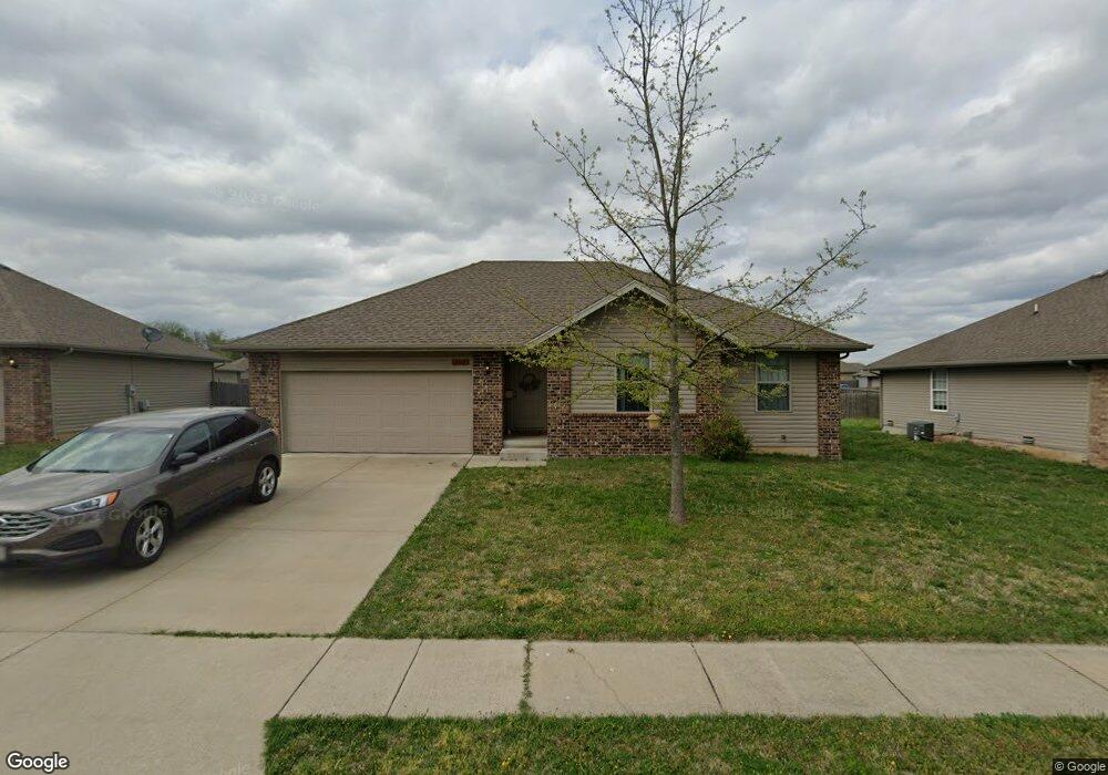
5613 W Longleaf Dr Springfield, MO 65802
Estimated Value: $232,000 - $255,000
3
Beds
2
Baths
1,200
Sq Ft
$200/Sq Ft
Est. Value
About This Home
This home is located at 5613 W Longleaf Dr, Springfield, MO 65802 and is currently estimated at $239,889, approximately $199 per square foot. 5613 W Longleaf Dr is a home located in Greene County with nearby schools including Price Elementary School, Republic Middle School, and Republic High School.
Ownership History
Date
Name
Owned For
Owner Type
Purchase Details
Closed on
Jun 30, 2017
Sold by
Bent Tree Development Llc
Bought by
Cronkhite Homes Llc
Current Estimated Value
Purchase Details
Closed on
Jun 18, 2014
Sold by
Bent Tree Developement Llc
Bought by
Bent Tree Rental Homes Llc
Home Financials for this Owner
Home Financials are based on the most recent Mortgage that was taken out on this home.
Original Mortgage
$91,541
Interest Rate
4.27%
Mortgage Type
Future Advance Clause Open End Mortgage
Create a Home Valuation Report for This Property
The Home Valuation Report is an in-depth analysis detailing your home's value as well as a comparison with similar homes in the area
Home Values in the Area
Average Home Value in this Area
Purchase History
| Date | Buyer | Sale Price | Title Company |
|---|---|---|---|
| Cronkhite Homes Llc | -- | None Available | |
| Bent Tree Rental Homes Llc | -- | None Available |
Source: Public Records
Mortgage History
| Date | Status | Borrower | Loan Amount |
|---|---|---|---|
| Previous Owner | Bent Tree Rental Homes Llc | $91,541 |
Source: Public Records
Tax History
| Year | Tax Paid | Tax Assessment Tax Assessment Total Assessment is a certain percentage of the fair market value that is determined by local assessors to be the total taxable value of land and additions on the property. | Land | Improvement |
|---|---|---|---|---|
| 2025 | $1,927 | $34,730 | $8,550 | $26,180 |
| 2024 | $1,716 | $30,150 | $4,750 | $25,400 |
| 2023 | $1,682 | $30,150 | $4,750 | $25,400 |
| 2022 | $1,476 | $26,220 | $4,750 | $21,470 |
| 2021 | $1,476 | $26,220 | $4,750 | $21,470 |
| 2020 | $1,149 | $22,040 | $4,750 | $17,290 |
| 2019 | $1,145 | $22,040 | $4,750 | $17,290 |
| 2018 | $1,110 | $20,730 | $4,750 | $15,980 |
| 2017 | $1,102 | $20,120 | $4,750 | $15,370 |
| 2016 | $1,079 | $17,500 | $4,750 | $12,750 |
| 2015 | $938 | $17,500 | $4,750 | $12,750 |
| 2014 | $257 | $4,750 | $4,750 | $0 |
Source: Public Records
Map
Nearby Homes
- 5601 W Pecan St
- 5565 W Pine St
- 1343 S Mulberry Ave
- 987 S Natalie Ave
- 5348 Basswood Ct W
- 5355 Basswood Ct W
- 5462 W Lombard St
- 768 S Long Dr
- 795 S Natalie Ave
- 820 S Quade Rd
- 5817 W Alexa Ln
- 5163 W Sunstruck St
- 000 W Independence Dr
- 5004 W Skyler Dr
- 1883 S Farm Road 107
- 6424 W Farm Road 140
- Tbd W Farm Road 148
- 000 W Farm Road 148
- 2015 S Farm Road 107
- 1261 S Erika Ave
- 5605 W Longleaf Dr
- 5621 W Longleaf Dr
- 5618 Sugarpine Dr W
- 5610 Sugarpine Dr W
- 5597 W Longleaf Dr
- 5629 W Longleaf Dr
- 5616 W Longleaf Dr
- 5608 W Longleaf Dr
- 5602 Sugarpine Dr W
- 5624 W Longleaf Dr
- 5626 W Sugar Pine Dr
- 5600 W Longleaf Dr
- 5589 W Longleaf Dr
- 5637 W Longleaf Dr
- 5634 W Sugar Pine Dr
- 5634 Sugarpine Dr W
- 5594 Sugarpine Dr W
- 5607 W Beech St Unit Lot 8
- 5592 W Longleaf Dr
- 5640 W Longleaf Dr
Your Personal Tour Guide
Ask me questions while you tour the home.