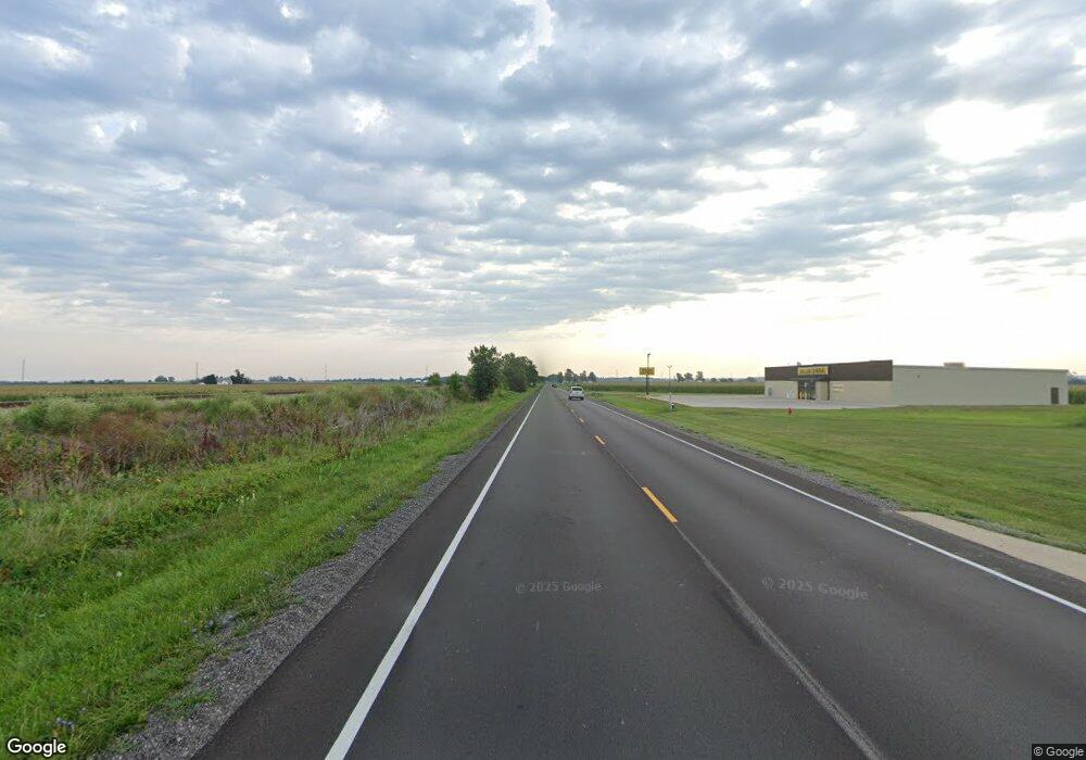
5614 E Route 48 Decatur, IL 62526
Estimated Value: $106,092 - $150,000
2
Beds
1
Bath
1,208
Sq Ft
$108/Sq Ft
Est. Value
About This Home
This home is located at 5614 E Route 48, Decatur, IL 62526 and is currently estimated at $130,523, approximately $108 per square foot. 5614 E Route 48 is a home located in Macon County with nearby schools including Argenta-Oreana Elementary School, Argenta Oreana High School, and Argenta-Oreana Middle School.
Ownership History
Date
Name
Owned For
Owner Type
Purchase Details
Closed on
May 10, 2013
Sold by
Bair Charles H and Bair Corinne B
Bought by
Ball Jeanette L
Current Estimated Value
Purchase Details
Closed on
May 18, 2012
Sold by
Alexander Robert Allen and Alexander Suellen
Bought by
Bair Charles H and Bair Corinne
Home Financials for this Owner
Home Financials are based on the most recent Mortgage that was taken out on this home.
Original Mortgage
$86,850
Interest Rate
3.89%
Mortgage Type
New Conventional
Purchase Details
Closed on
Jan 21, 2003
Purchase Details
Closed on
Jan 1, 1996
Create a Home Valuation Report for This Property
The Home Valuation Report is an in-depth analysis detailing your home's value as well as a comparison with similar homes in the area
Home Values in the Area
Average Home Value in this Area
Purchase History
| Date | Buyer | Sale Price | Title Company |
|---|---|---|---|
| Ball Jeanette L | $9,150,000 | None Available | |
| Bair Charles H | $96,500 | None Available | |
| Bair Charles H | $96,500 | None Available | |
| -- | -- | -- | |
| -- | $47,900 | -- |
Source: Public Records
Mortgage History
| Date | Status | Borrower | Loan Amount |
|---|---|---|---|
| Previous Owner | Bair Charles H | $86,850 |
Source: Public Records
Tax History Compared to Growth
Tax History
| Year | Tax Paid | Tax Assessment Tax Assessment Total Assessment is a certain percentage of the fair market value that is determined by local assessors to be the total taxable value of land and additions on the property. | Land | Improvement |
|---|---|---|---|---|
| 2024 | $1,707 | $35,771 | $4,338 | $31,433 |
| 2023 | $1,121 | $32,433 | $3,933 | $28,500 |
| 2022 | $1,173 | $30,249 | $3,669 | $26,580 |
| 2021 | $1,214 | $28,140 | $3,413 | $24,727 |
| 2020 | $1,228 | $27,012 | $3,276 | $23,736 |
| 2019 | $1,228 | $27,012 | $3,276 | $23,736 |
| 2018 | $1,227 | $27,279 | $3,308 | $23,971 |
| 2017 | $1,233 | $26,836 | $3,254 | $23,582 |
| 2016 | $1,256 | $26,893 | $3,261 | $23,632 |
| 2015 | $1,233 | $26,679 | $3,235 | $23,444 |
| 2014 | $1,192 | $26,679 | $3,235 | $23,444 |
| 2013 | $2,045 | $26,679 | $3,235 | $23,444 |
Source: Public Records
Map
Nearby Homes
- 5656 N Route 48
- 5694 N Route 48
- 5830 N Route 48
- 250 Troy Ln
- 3540 Forest Pkwy
- 20 Whippoorwill Dr
- 5353 E Reas Bridge Rd
- 2221 E Mound Rd
- 6002 N Coulters Mill Rd
- 1585 E North Port Rd
- 4315 Neeley Ave
- 2918 N 22nd St
- 675 S Elwood St
- 8349 Sawyer Rd
- 3443 N Charles St
- 4454 N Prairie View Rd
- 0 Route 51 Unit 6241333
- 45 Larry Dr
- 278 W Brown Ave
- 16 Surrey Ln
- 5614 N Route 48
- 5602 N Route 48
- 5602 E Route 48
- 5636 N Route 48
- 5644 N Route 48
- 5578 N Route 48
- 5578 E Route 48
- 5574 N Route 48
- 5668 E Route 48
- 5668 N Route 48
- 5550 N Route 48
- 5680 N Route 48
- 5538 N Route 48
- 5530 N Route 48
- 5708 N Route 48
- 5510 N Route 48
- 5527 N Route 48
- 5730 N Route 48
- 5502 N Route 48
- 5502 E Route 48
