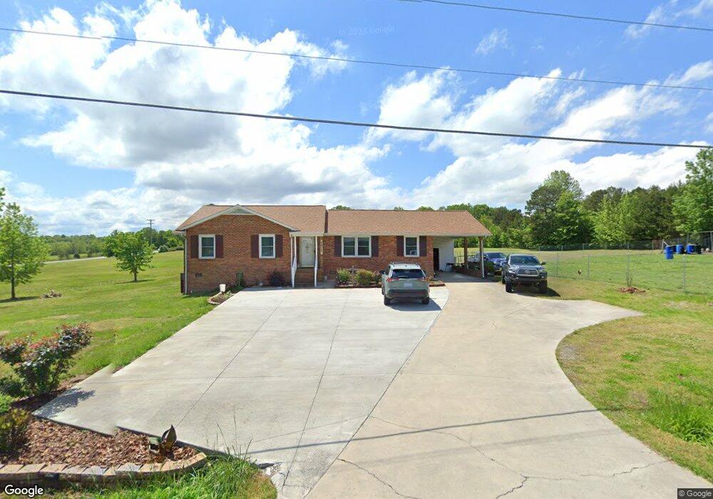
5615 Muddy Creek Rd High Point, NC 27263
Estimated Value: $210,147 - $270,000
--
Bed
2
Baths
1,523
Sq Ft
$164/Sq Ft
Est. Value
About This Home
This home is located at 5615 Muddy Creek Rd, High Point, NC 27263 and is currently estimated at $249,037, approximately $163 per square foot. 5615 Muddy Creek Rd is a home located in Randolph County with nearby schools including John R. Lawrence Elementary School, Wheatmore Middle School, and Trinity High School.
Ownership History
Date
Name
Owned For
Owner Type
Purchase Details
Closed on
Jun 11, 2004
Sold by
Davis Eric Michael
Bought by
Ayllon Martin and Velasquez Felicitas A
Current Estimated Value
Home Financials for this Owner
Home Financials are based on the most recent Mortgage that was taken out on this home.
Original Mortgage
$123,405
Outstanding Balance
$59,806
Interest Rate
5.98%
Mortgage Type
Purchase Money Mortgage
Estimated Equity
$189,231
Create a Home Valuation Report for This Property
The Home Valuation Report is an in-depth analysis detailing your home's value as well as a comparison with similar homes in the area
Home Values in the Area
Average Home Value in this Area
Purchase History
| Date | Buyer | Sale Price | Title Company |
|---|---|---|---|
| Ayllon Martin | $130,000 | -- |
Source: Public Records
Mortgage History
| Date | Status | Borrower | Loan Amount |
|---|---|---|---|
| Open | Ayllon Martin | $123,405 |
Source: Public Records
Tax History Compared to Growth
Tax History
| Year | Tax Paid | Tax Assessment Tax Assessment Total Assessment is a certain percentage of the fair market value that is determined by local assessors to be the total taxable value of land and additions on the property. | Land | Improvement |
|---|---|---|---|---|
| 2025 | $1,342 | $183,770 | $59,400 | $124,370 |
| 2024 | $1,324 | $183,770 | $59,400 | $124,370 |
| 2023 | $1,324 | $183,770 | $59,400 | $124,370 |
| 2022 | $1,127 | $128,780 | $39,520 | $89,260 |
| 2021 | $1,127 | $128,780 | $39,520 | $89,260 |
| 2020 | $1,118 | $128,780 | $39,520 | $89,260 |
| 2019 | $389 | $128,780 | $39,520 | $89,260 |
| 2018 | $1,092 | $121,580 | $33,390 | $88,190 |
| 2016 | $1,063 | $121,577 | $33,390 | $88,187 |
| 2015 | $1,053 | $120,154 | $33,390 | $86,764 |
| 2014 | $1,053 | $120,154 | $33,390 | $86,764 |
Source: Public Records
Map
Nearby Homes
- 5590 Old Cedar Square Rd
- 2994 Stanley Rd Unit 13
- 8434 Us Highway 311
- 0 Hughes Farm Rd Unit 1201373
- 0 Old Cedar Square Rd
- 3368 Old Glenola Rd
- 9116 Us Highway 311
- 9256 Us Highway 311
- 0-B Us Highway 311
- 2505 Banner Whitehead Rd
- 0 Harlow Rd
- 9622 Us Highway 311
- 0 Arbor Dr
- 5988 Weant Rd
- 0 Windemere Cir
- 136 Royal Pines Dr
- 138 Royal Pines Dr
- 4869 Old Edgar Rd
- 3796 Wood Village Dr
- 100 Lindsay Dr
- 6017 Cedar Square Rd
- 5646 Muddy Creek Rd
- 5869 Cedar Square Rd
- 6035 Cedar Square Rd
- 5672 Muddy Creek Rd
- 5841 Cedar Square Rd
- 5686 Muddy Creek Rd
- 5612 Mobile Dr
- 5707 Muddy Creek Rd
- 5719 Muddy Creek Rd
- 5803 Cedar Square Rd
- 5795 Cedar Square Rd
- 5729 Muddy Creek Rd
- 5730 Muddy Creek Rd
- 5747 Muddy Creek Rd
- 5768 Muddy Creek Rd
- 2810 Stanley Rd
- 6128 Cedar Square Rd
- 6149 Cedar Square Rd
- 5821 Muddy Creek Rd